Recent
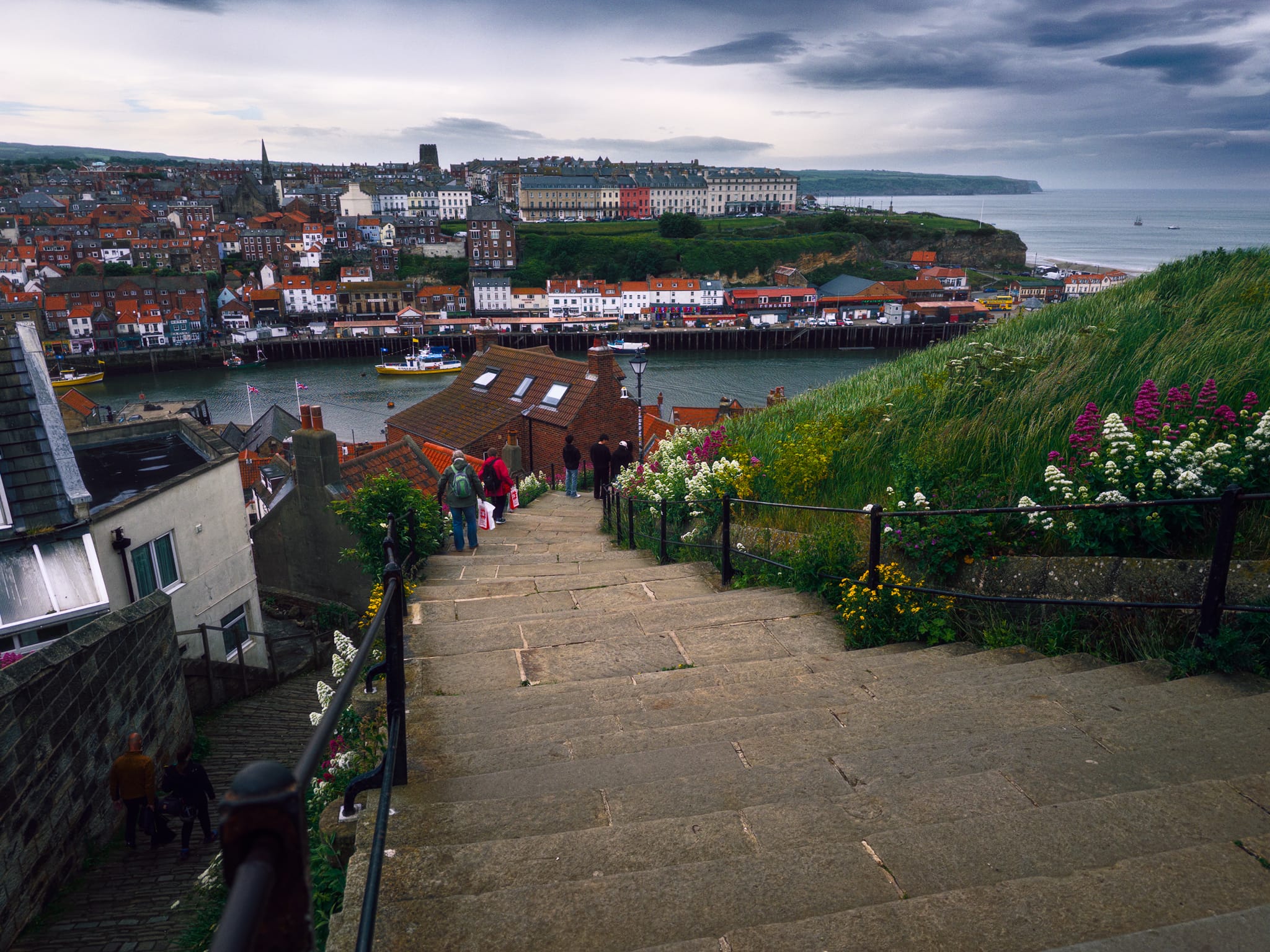
Whitby, North Yorkshire, Summer
·890 words·5 mins
Is a visit to the Yorkshire coast complete without seeing Whitby?
After an almost impossibly perfect and idyllic summer’s day, cloud, wind, and rain arrived to cast the Yorkshire coast in a dark mood.
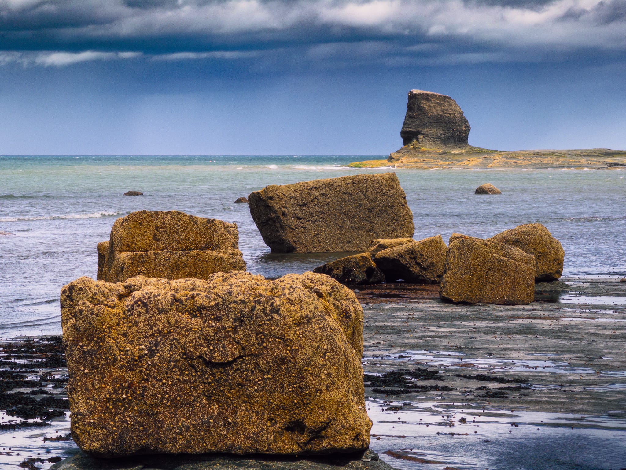
Saltwick Bay, North Yorkshire, Summer
·695 words·4 mins
If you’re a bit of a geology nerd you can’t go wrong with Saltwick Bay.
Just one mile east of the famous town of Whitby, Saltwick Bay is a beautiful sandy bay hemmed in by towering cliffs. On its northern side is Saltwick Nab, a headland separated from the rest of the cliffs that juts out into the North Sea. It was here that Alum was quarried. Alum was mainly used to clean water, because it helps gather together dirt and tiny particles so they can be easily removed. It’s also commonly used in preserving food, especially in pickling, as well as in medicines and beauty products, because it can tighten and tone tissues. At the Bay’s southern end is the distinct and islated sea stack pinnacle of Black Nab near which can be found the wreckage of the Admiral Van Tromp fishing vessel.
Saltburn-by-the-Sea, Redcar & Cleveland, North Yorkshire, Summer
·707 words·4 mins
Oh I do like to be beside the seaside…
In early June the Better Half and I took a well-earned break for a week, heading across the country to hike the coast around the North York Moors. That means places like Whitby, Staithes, Robin Hood’s Bay, the North York Moors National Park…
Watlowes Dry Valley, Yorkshire Dales, Spring
·543 words·3 mins
Summer’s here.
As we headed into the Spring Bank Holiday, a heatwave was approaching the British Isles. Before things got too crazy and blisteringly hot, we took the opportunity for a cooler — but still beautiful — hike in the Dales.
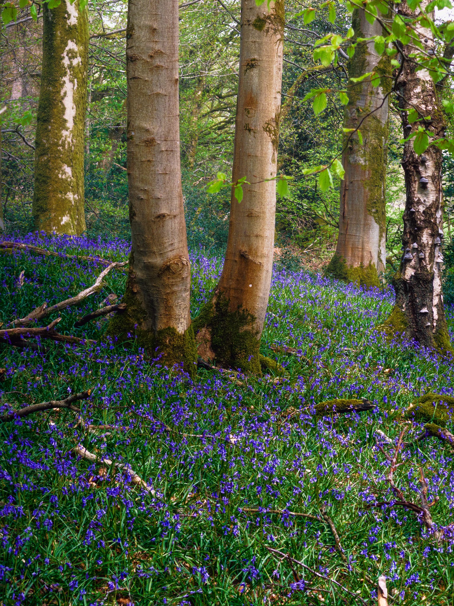
Barkbooth Lot, Lake District, Spring
·370 words·2 mins
Early May means one thing in my head: bluebells.
There’s a few options I know of, and have been quite fortunate to view some extraordinary bluebell displays. However, one place in particular tugs on my desire strings more than others: Barkbooth Lot.
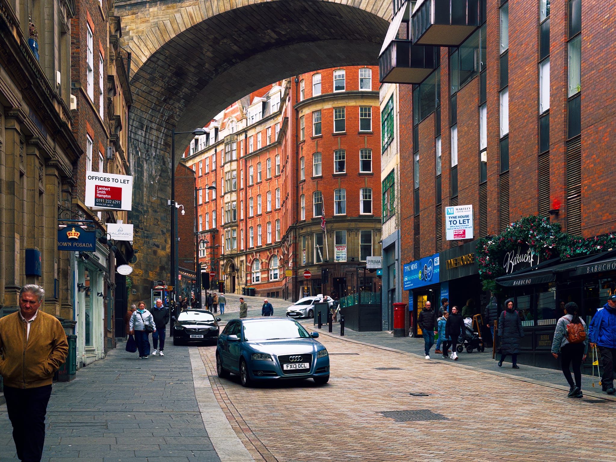
Newcastle-upon-Tyne, Tyne & Wear, Spring
·721 words·4 mins
I have a lot of love for Newcastle.
The last time I visited the city was over a decade ago. Too long.
During our recent stay in Tynemouth we picked a more murkey weather day to take the metro inland for a jaunt around Newcastle city.
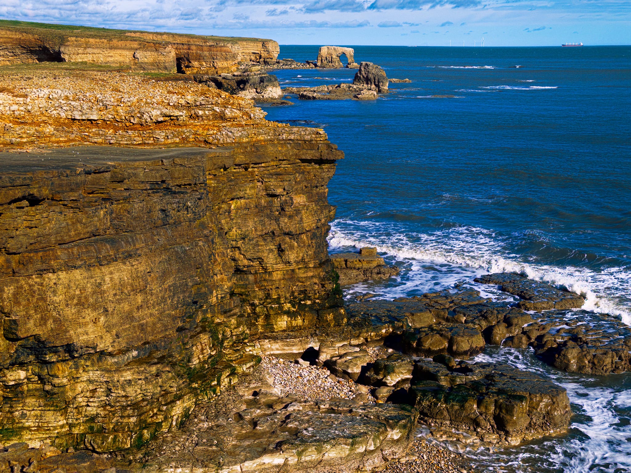
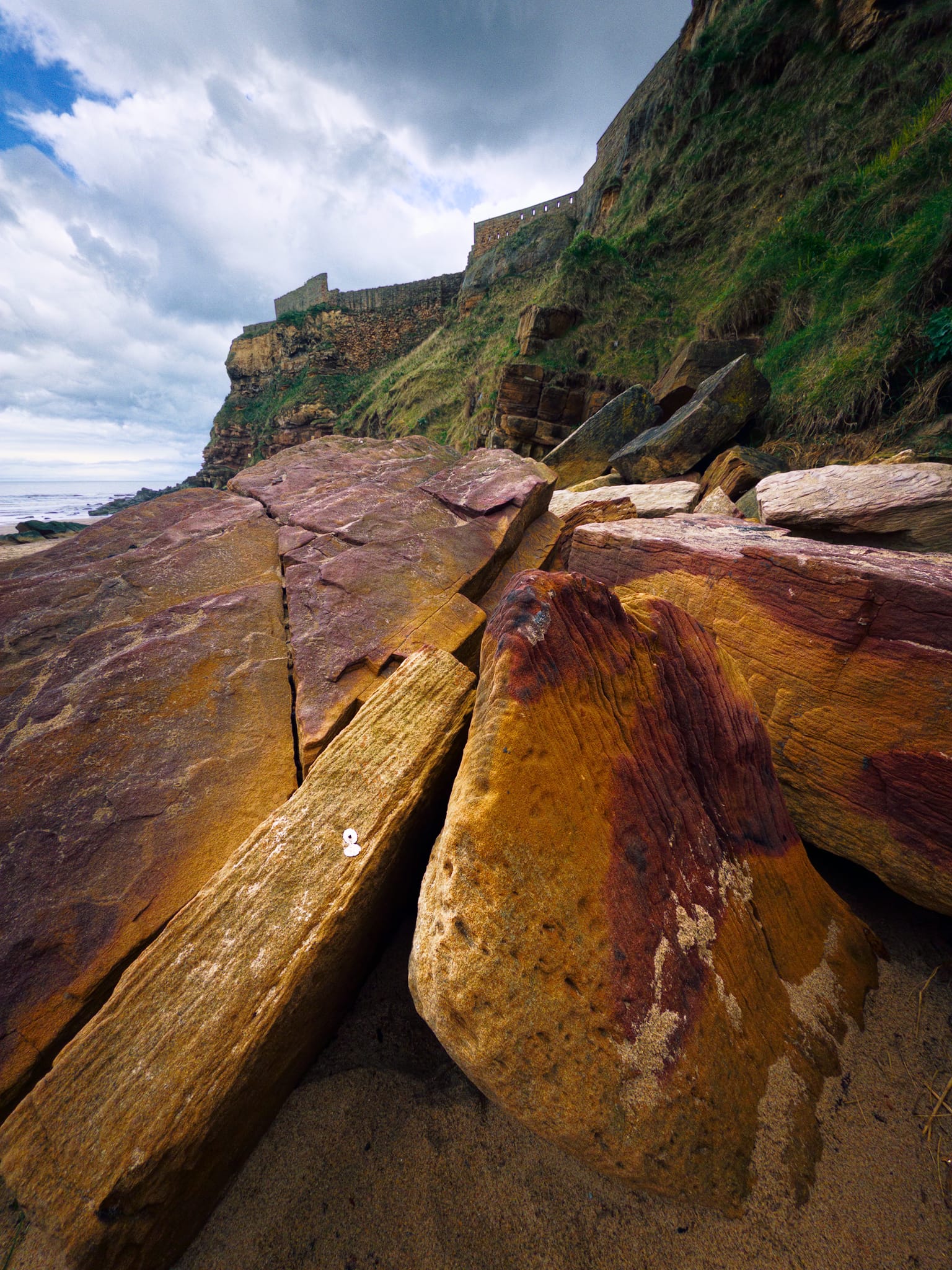
Whitburn, Tyne & Wear, Spring
·757 words·4 mins
Like a mini-Pembrokeshire.
On our final day during our Easter break in Tynemouth, we decided to cross the Tyne south towards a coastline that looked rather interesting (to me) on Google Earth: Whitburn.
Tynemouth, Tyne & Wear, Spring
·805 words·4 mins
An Easter break on the other side of England.
Hearing that Storm Dave was on its way wreak havoc across the northwest, we did the only sensible and drive away from it.
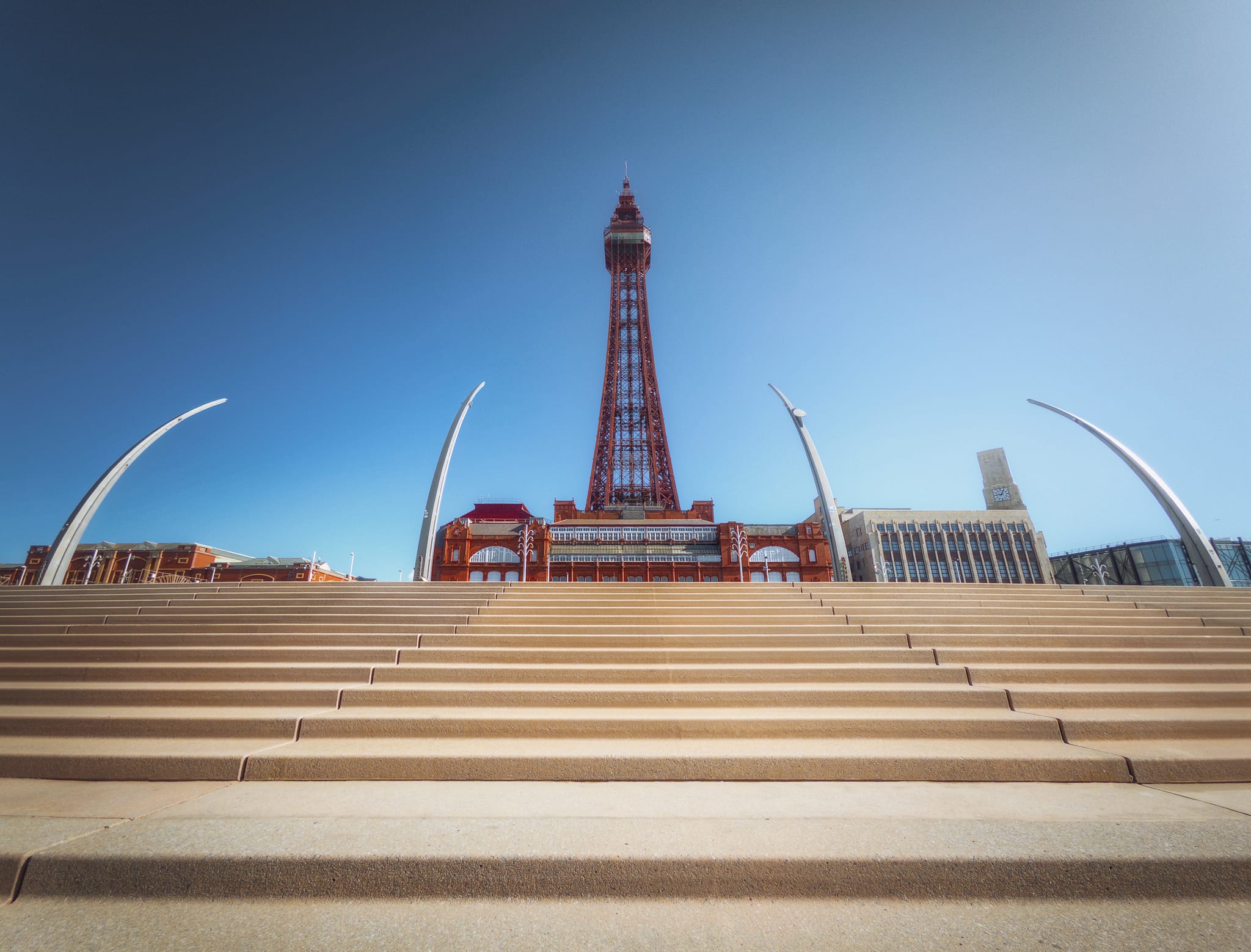
Blackpool, Lancashire, Spring
·739 words·4 mins
Things are starting to feel like spring.
They day ahead was looking clear and sunny, if still cold. So we decided that a visit to Blackpool was in order. Something a little different.
Blackburn, Lancashire, Winter
·581 words·3 mins
Finally, blue sky!
January and February have been wet. Murk, drizzle, mist, frost have been a defining feature of this winter. But with Valentine’s Day opening up clear skies and cold temperatures, it was time to get out.
York, North Yorkshire, Winter
·1310 words·7 mins
It’s been about 12 years since I last went to York.
That’s way too long.
A few days after our snowy hike around Brimham Rocks, Lisabet + extended family and I head east on a crisp clear day to one of England’s oldest cities: York.
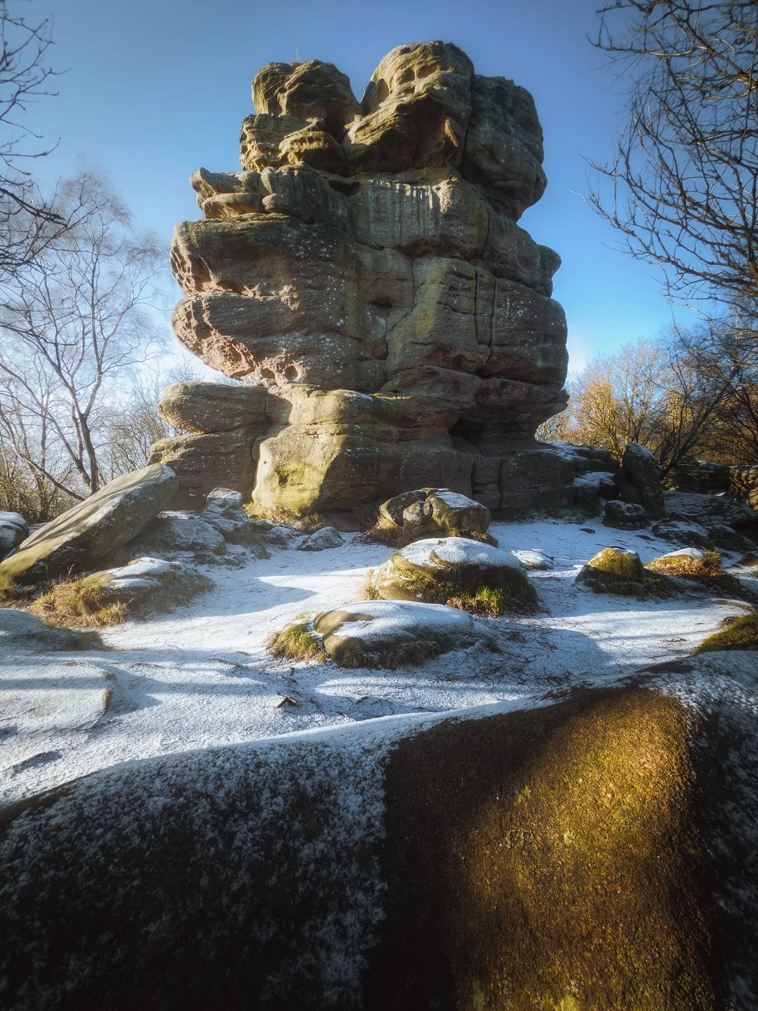
Brimham Rocks, Nidderdale National Landscape, Winter
·466 words·3 mins
A week off after working Christmas and New Year was needed.
With Lisabet’s Aussie family in the UK for a few weeks, we all took a joint week long holiday together. Our “base” was near Summerbridge, between Harrogate and Pateley Bridge, within the Nidderdale National Landscape. This gave us good access to a wide variety of places to explore.
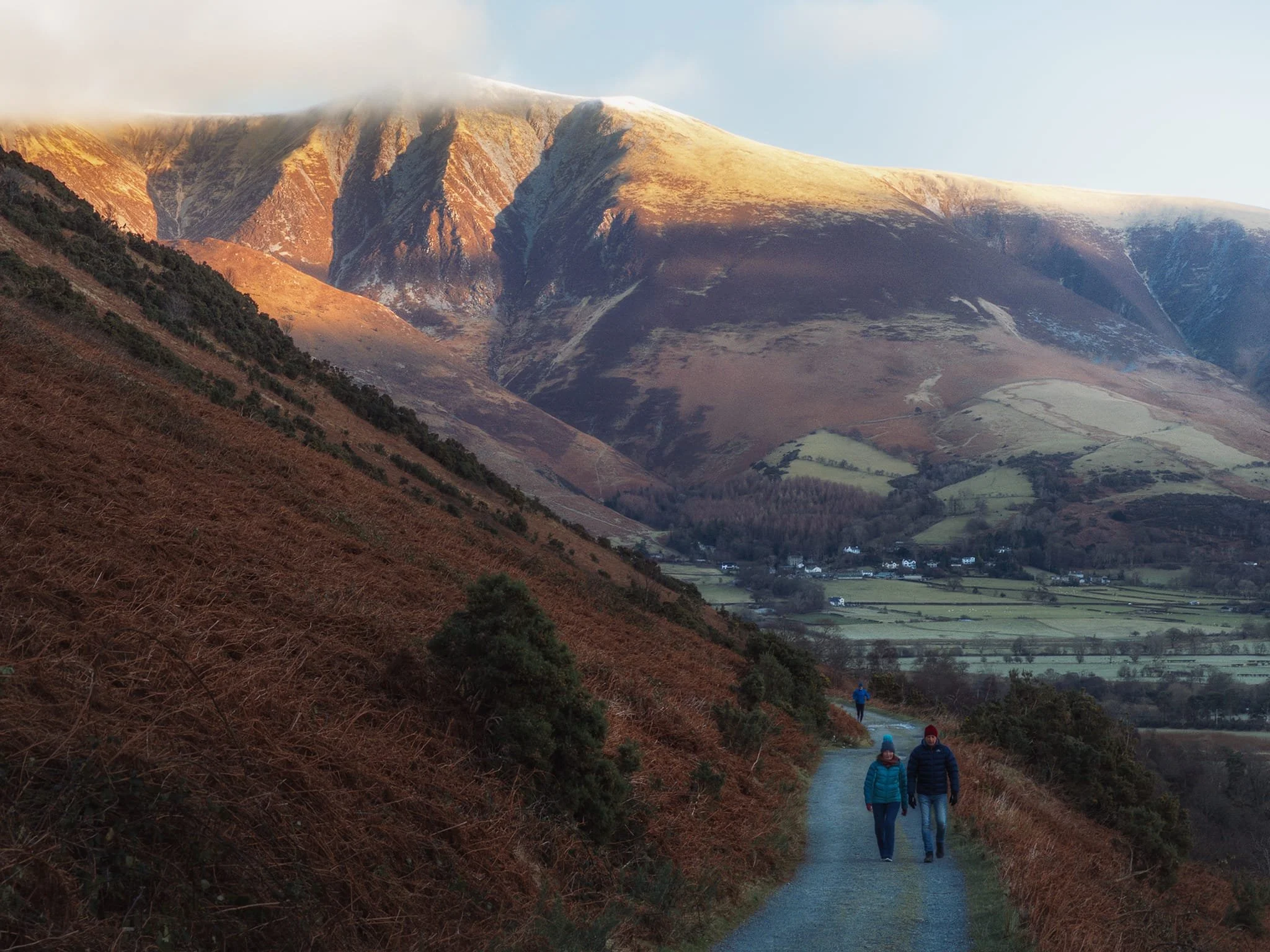
Coledale, Lake District, England
·417 words·2 mins
Time for proper winter scenery.
Happy 2026 everyone! May you have the clarity to focus on what you can control and the composure to let go of what you cannot.
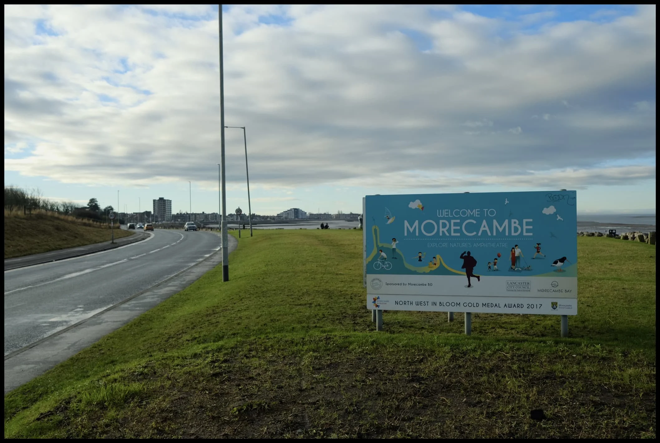
Morecambe, Lancashire, Winter
·326 words·2 mins
December has been very wet.
To quote the UK government website, “In the first 16 days of December, England has already received 80% of the long term average (LTA) rainfall for December.”

Crina Bottom, Yorkshire Dales, Winter
·323 words·2 mins
It’s beginning to look a lot like winter.
Recently we’ve been bombarded with a mix of arctic blasts and torrential downpours. After a Saturday of downpours, Sunday was looking nice and clear.