Like a mini-Pembrokeshire.
On our final day during our Easter break in Tynemouth, we decided to cross the Tyne south towards a coastline that looked rather interesting (to me) on Google Earth: Whitburn.
Well, let’s just say: expectations exceeded.
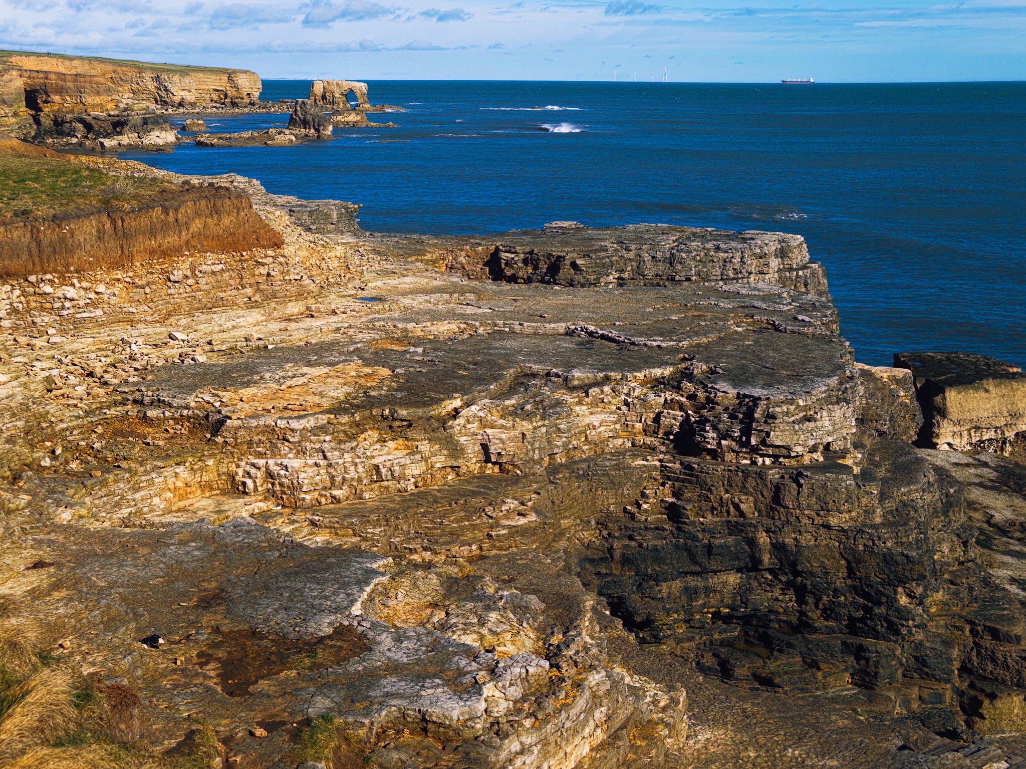
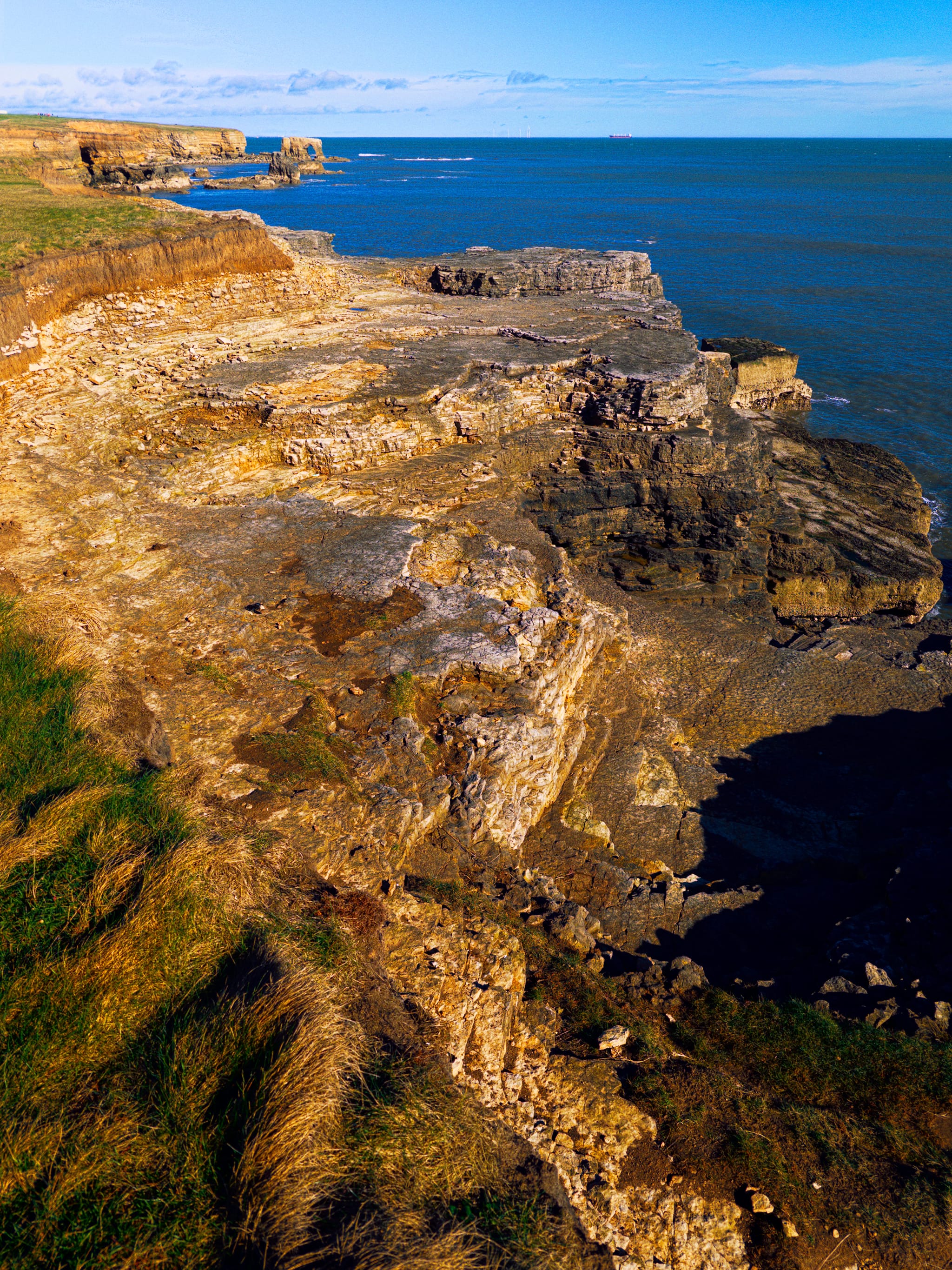
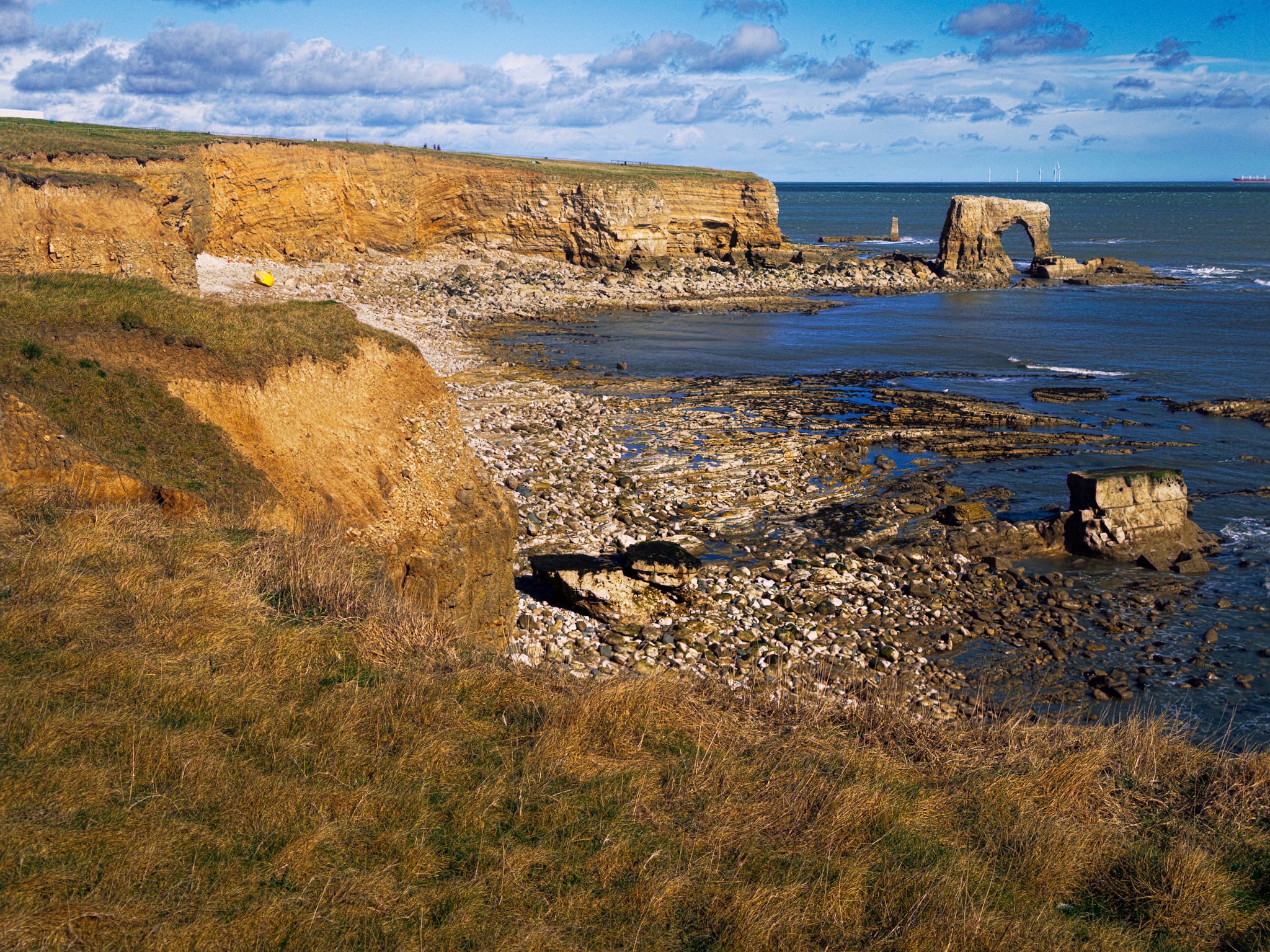
We parked at the unmanned National Trust car park and followed the clear path and signage towards the coastal path. Almost immediately, towards the north are cliffs, sea stacks and even a sea arch! Fun times ahead.
Thankfully, we managed to time conditions well too, as towards the end of the hike the squalls caught up behind us for a nice shower.
All photos taken on my iPhone 17 Pro Max. RAWs developed in Lightroom, then edited and finalised in Photoshop.
Whitburn, Tyne & Wear, Spring © 2026 by Ian Cylkowski is licensed under CC BY-NC-SA 4.0.
The coastal path keeps you away from the cliffs, but if you’re careful and venture closer you’re treated to this view north along the coast. It’s like being back in Pembrokeshire!
The geology underlying this area of Tyne & Wear consists of magnesium limestone. This rock contains a lot of Magnesium Carbonate (MgCO3). This magnesium makes the rock a bit more resistant to weathering and often gives it a yellowish or creamy buff colour compared to the blue-grey of the Dales limestone.
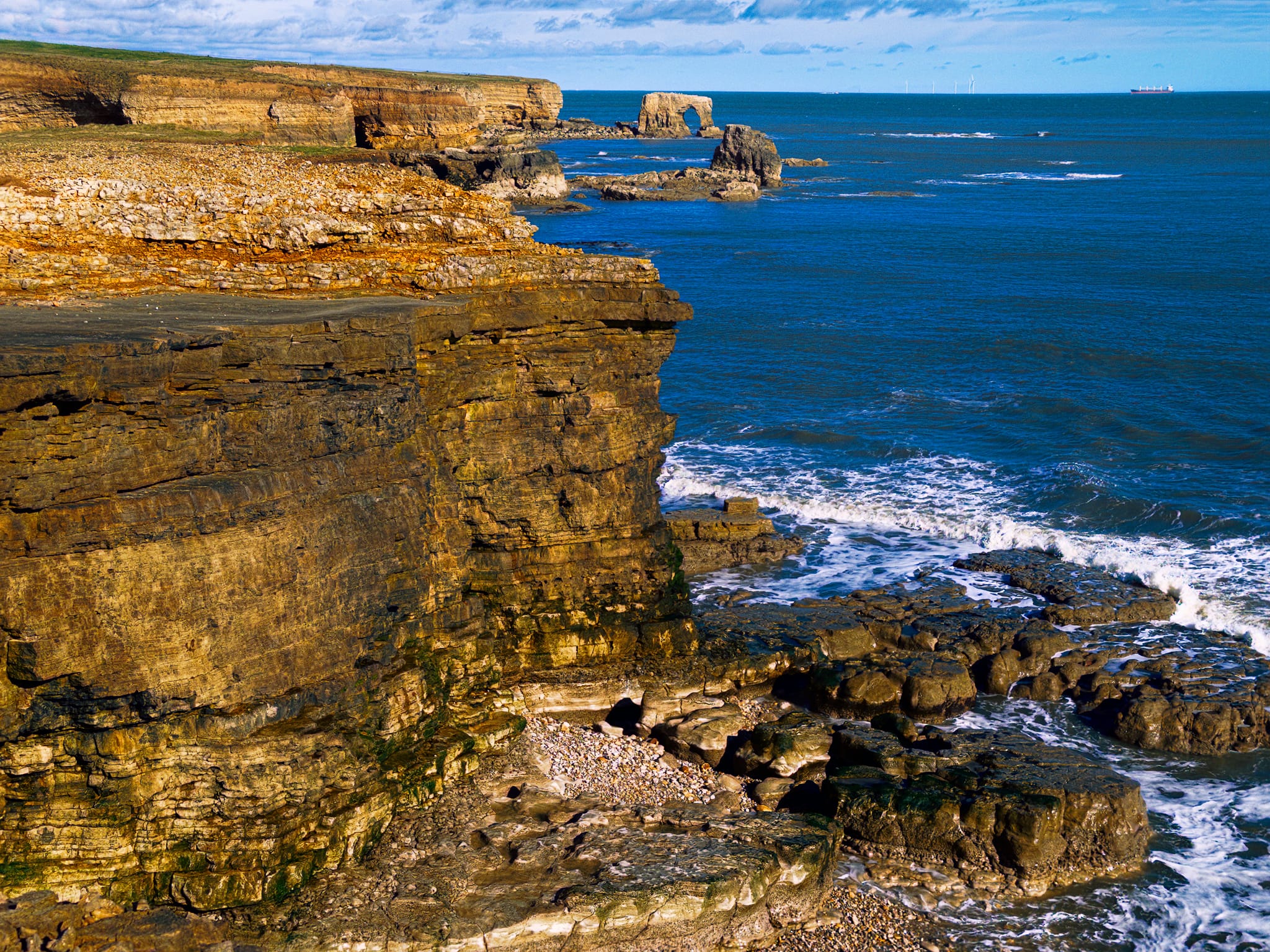
A tighter zoom along the cliffs and what’s that? A sea arch! Amazing. Always a delight to see one of those.
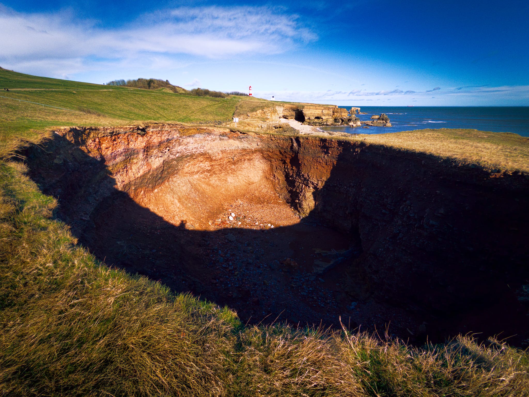
Further north I tentatively edged closer to this massive hole, apparently called Potter’s Hole. It’s a little away from the cliffs, but in time I’m sure this hole will join the sea and form a bay.
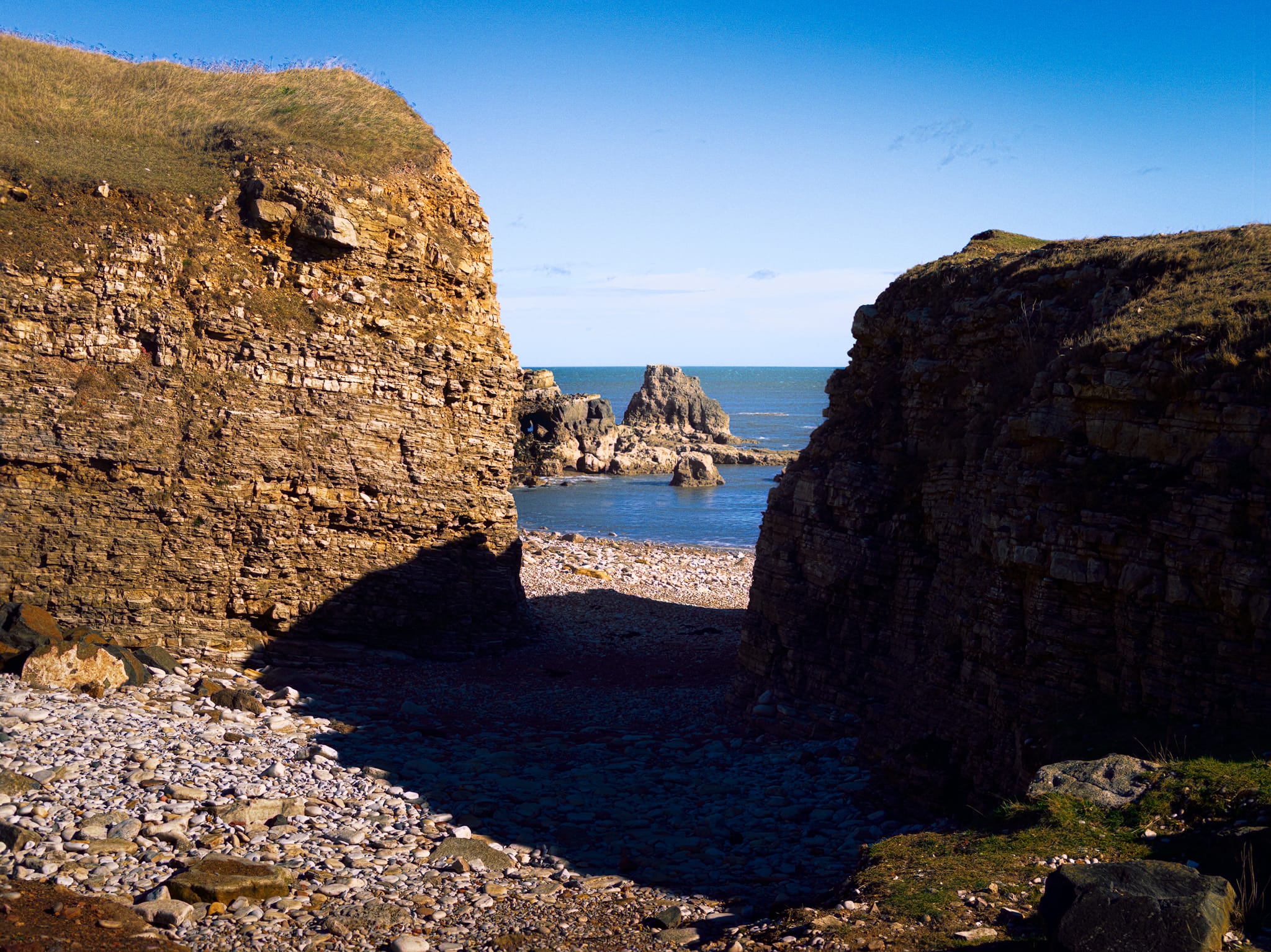
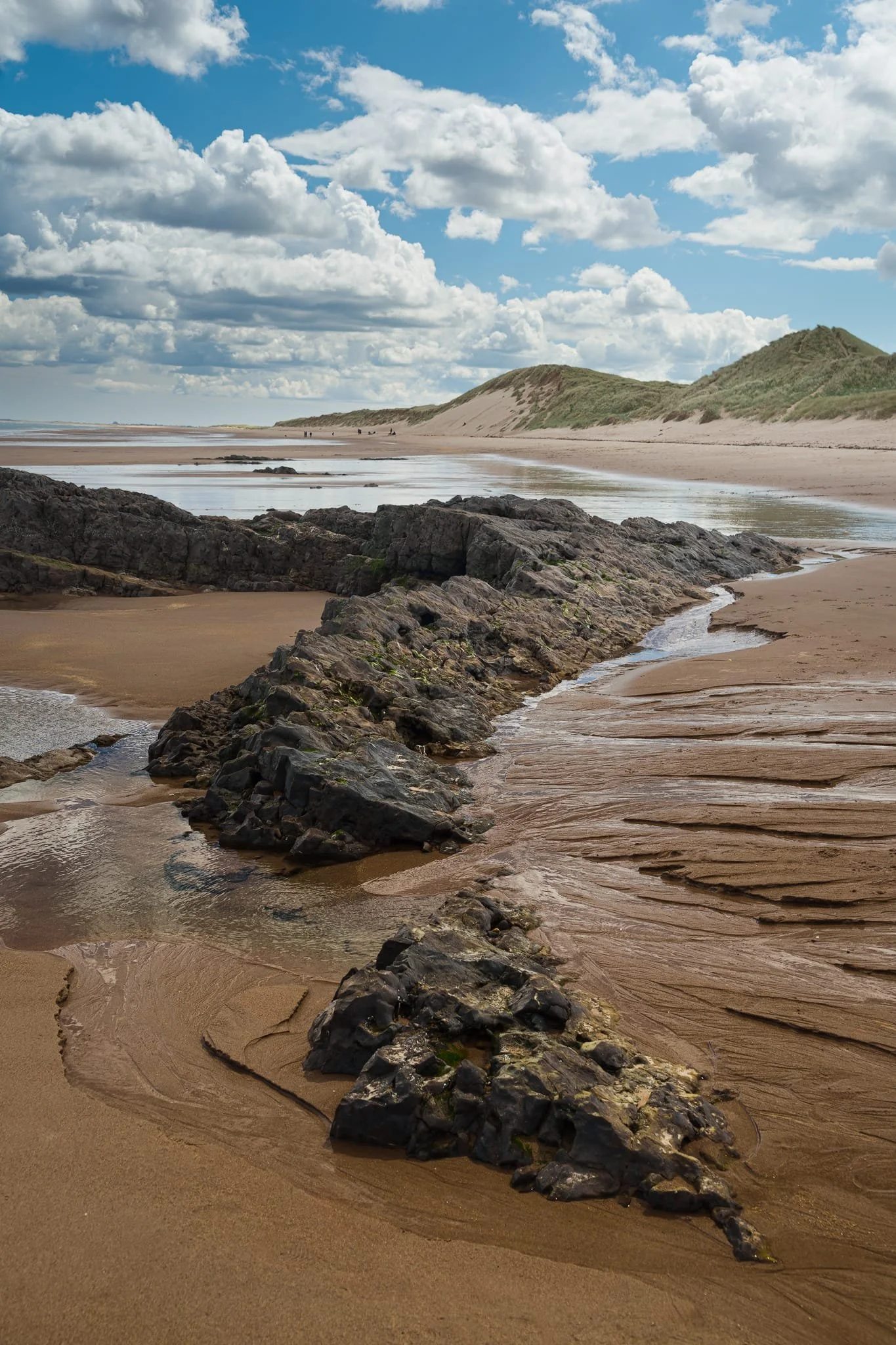
Probably my favourite bit of this whole coastline. The path descends gradually where you can access a pebbly and rocky bay called, either, Byer’s Hole or the Wherry. The maps are not clear. What is clear is that this place is epic.
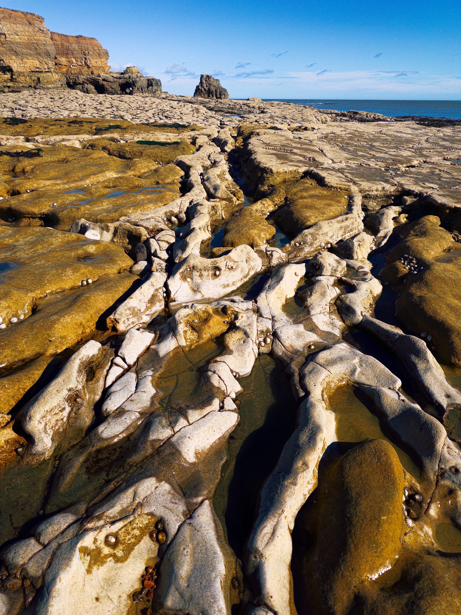
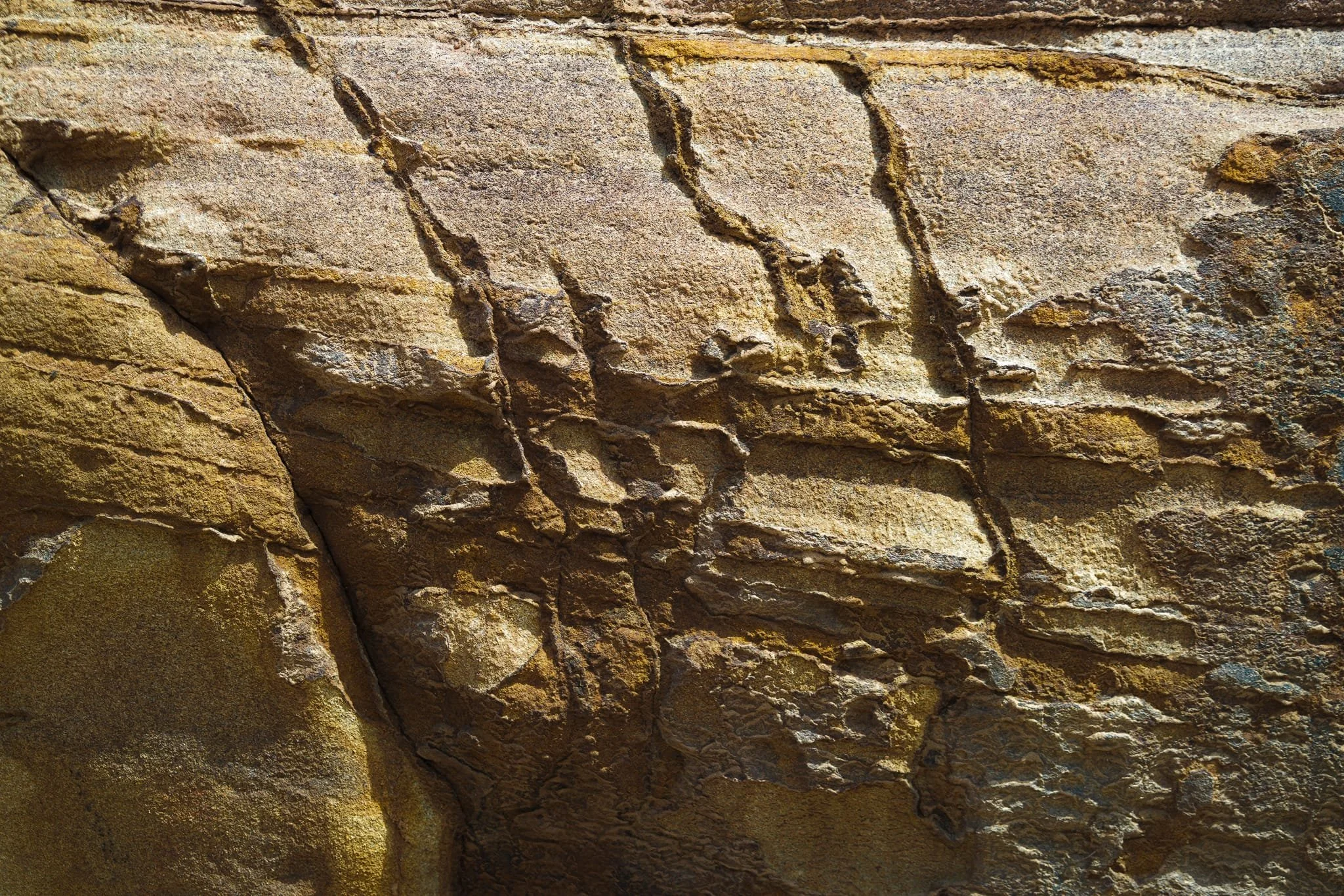
The light-coloured limestone rock formation is from the Permian period, created about 250 to 270 million years ago when the area was covered by a warm, shallow sea. The wavy channels running through the front part of the scene follow natural cracks in the rock, which have been gradually widened over thousands of years by the action of waves. The orange-brown shades come from algae and iron minerals that have rusted on the surface. In the background, the stepped cliffs show layers of ancient seabed sediments that have been revealed through the erosion of the coast over time.
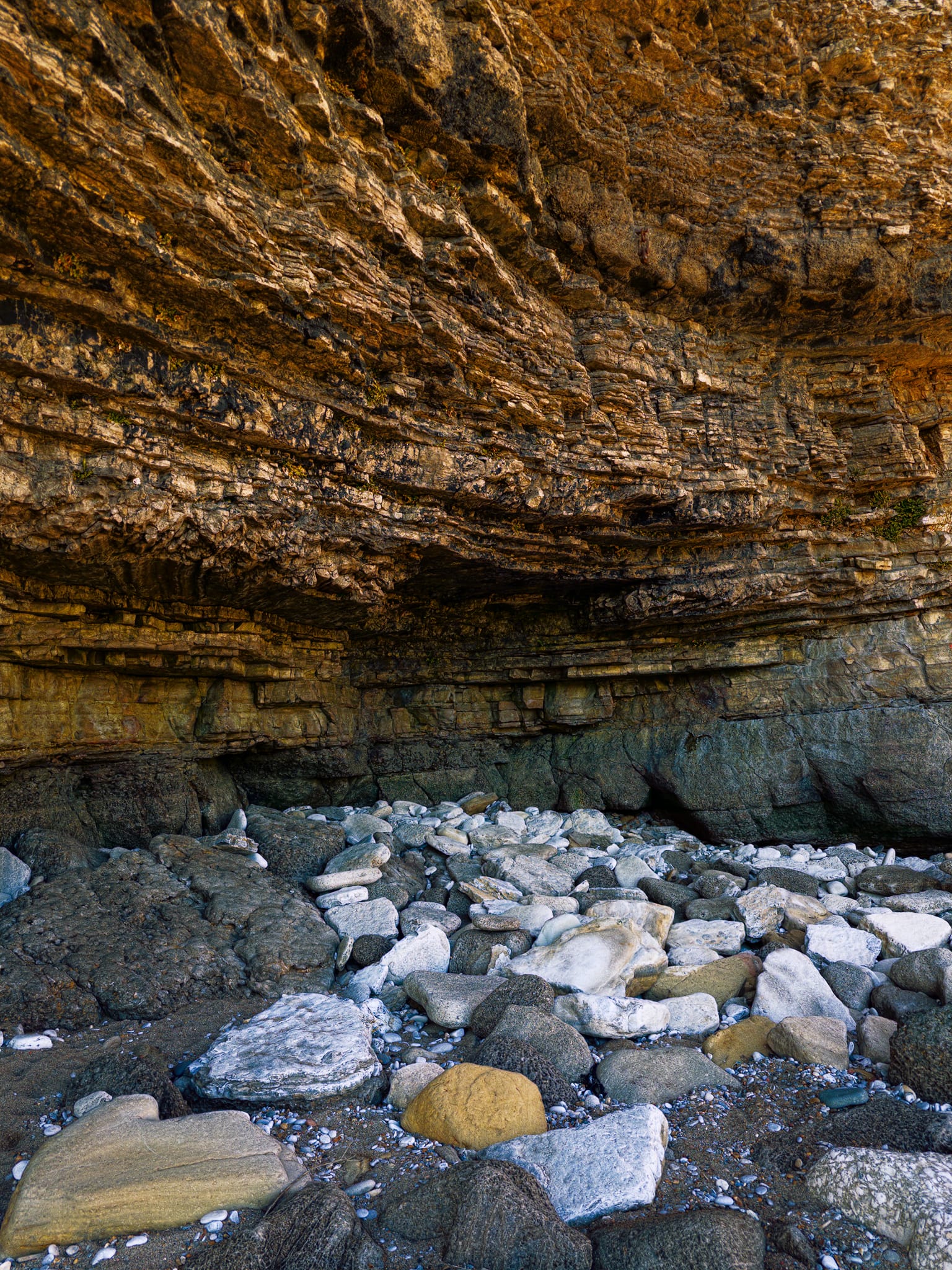
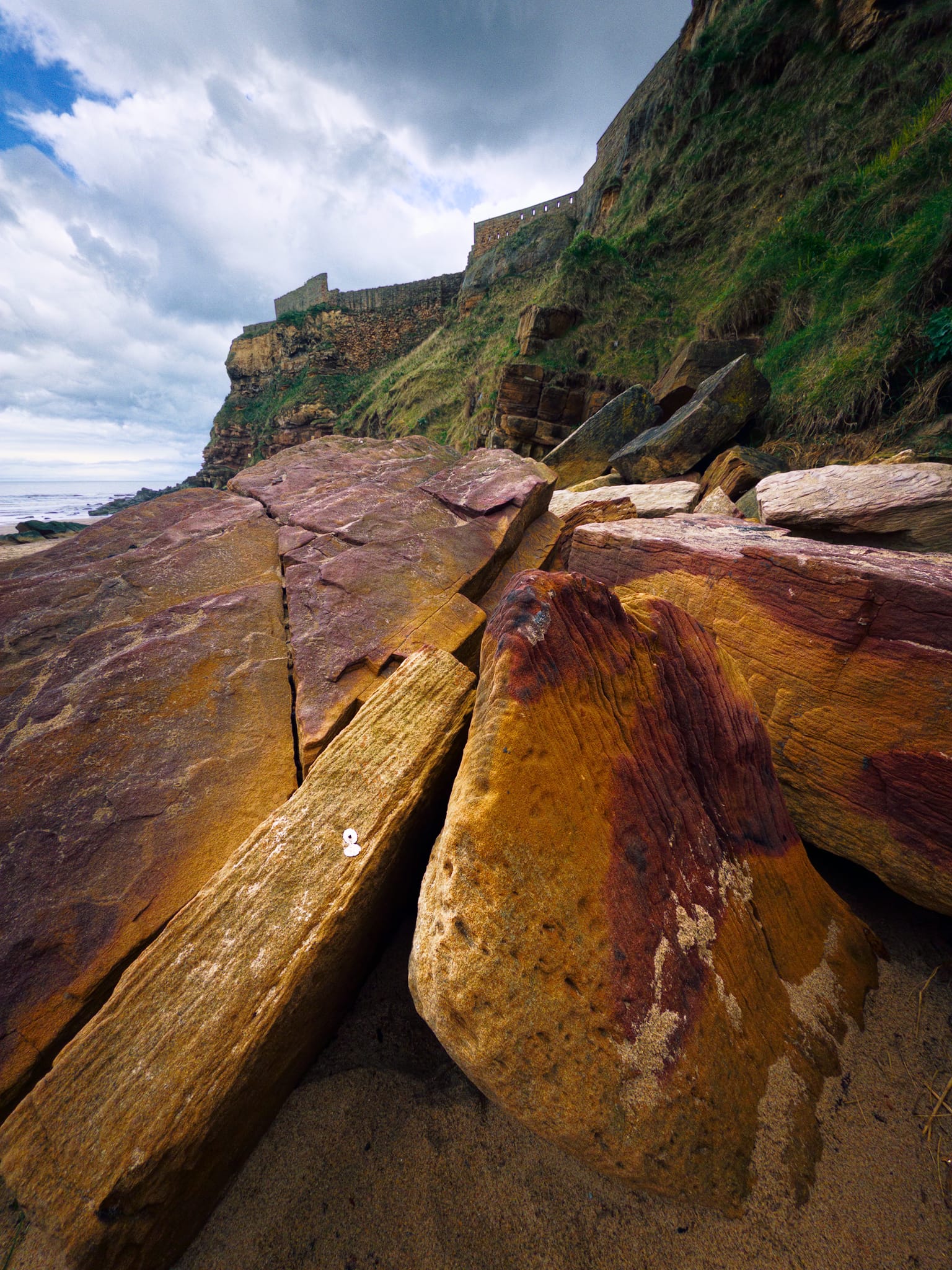
The stunning, layered cliff here is seen in cross-section. Each horizontal band shows a different layer of sediment that was deposited in an ancient, shallow sea. The thinner, finely layered lower beds are followed by thicker, more solid layers above, indicating that the conditions in the water changed over time. Near the base, there’s a prominent overhang, which is a wave-cut notch. Over time, this overhang will likely fall off, and that’s how the boulder beach below was created. The lighter, white stones are fresher pieces of limestone that have recently fallen, while the darker, smoother ones have been shaped and polished by the waves over a longer period.
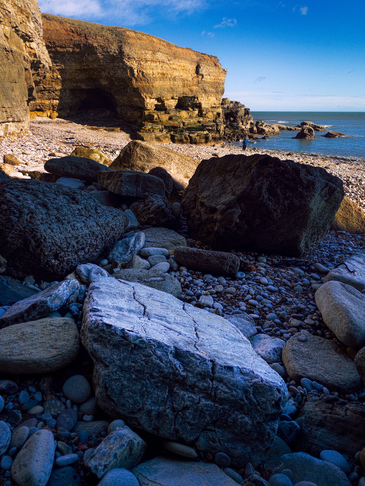
I tucked myself away into the shadow of another inlet, getting close to these fallen boulders and letting the cliffs in the distance provide both colour and luminance contrast. One of my favourite images.
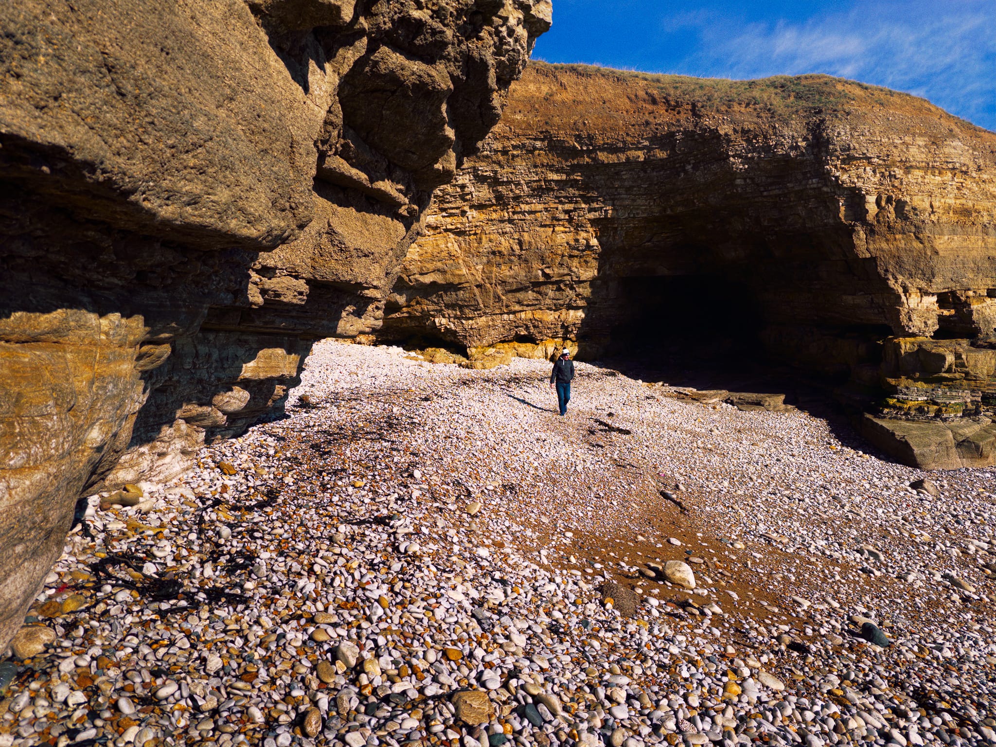
Evidence of the incomprehensible scale of geological time, where the water has carved out this little inlet between the cliffs. Happily, a fellow hiker provides scale.
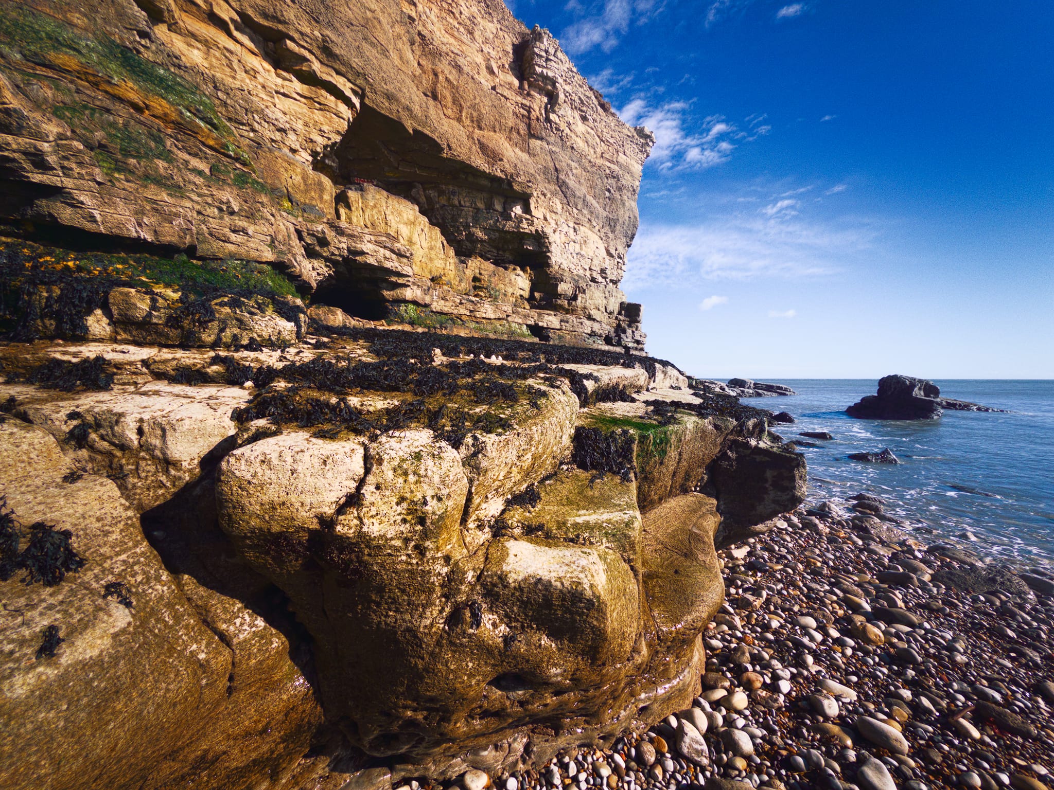
The cliff’s terraced structure features harder Magnesian Limestone beds that resisted erosion longer than adjacent layers. The holes higher up are small caves from wave action exploiting joints over centuries, now well above the current waterline, indicating significant retreat.
Back up above the cliffs, Whitburn’s sea arch comes into view again. All around us and out to sea are the cries of a whole host of birds: purple sandpipers and turnstones from Scandinavia, sanderlings, ringed plovers and redshanks too. And, of course, the ever-present seagull.
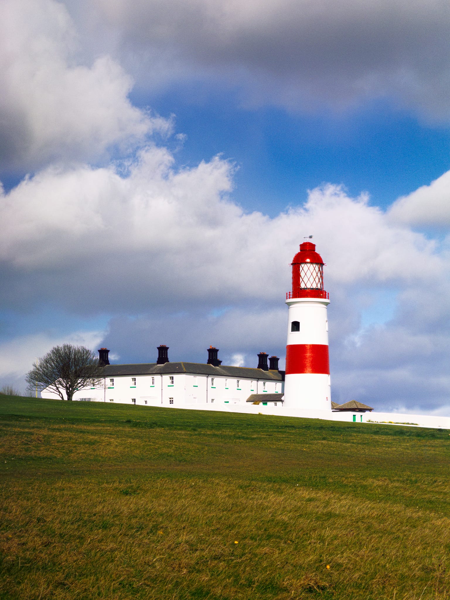
This is Souter Lighthouse as the squall starts to arrive from the west. It was the first lighthouse in the world to be designed and built specifically to use alternating electric current.
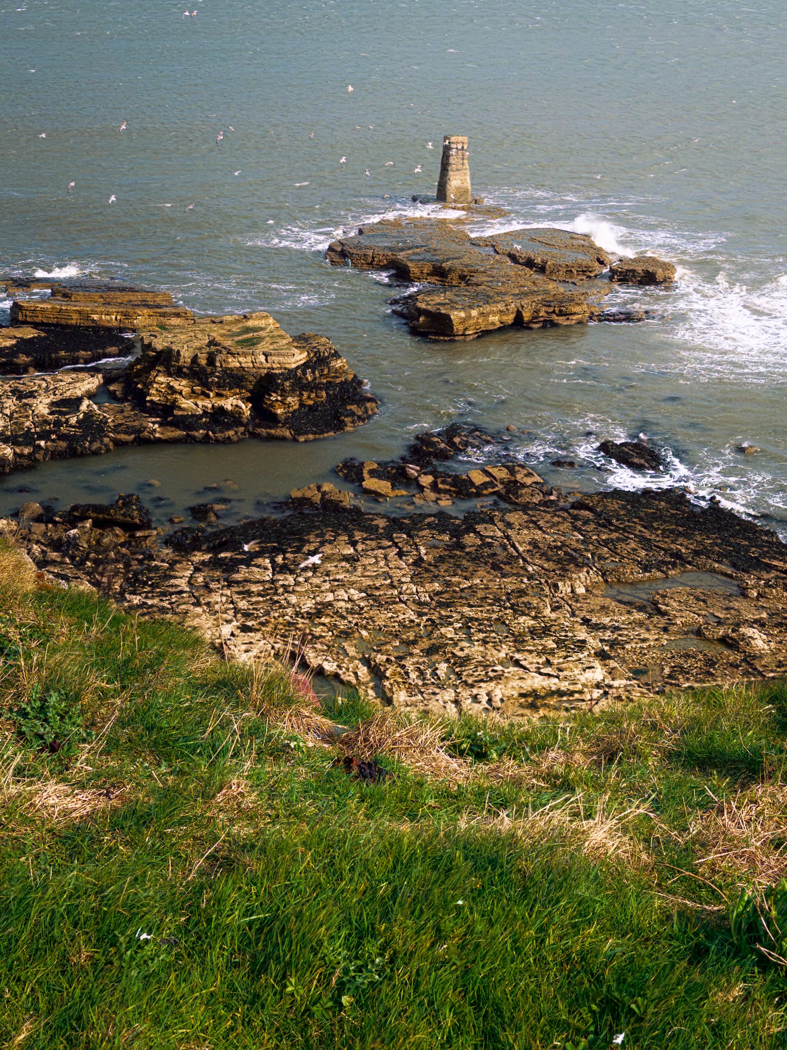
At Lizard Point just before the squall soaked us, I spied this unusually regular formation out into the sea. I can’t see any mention of it on the maps. I couldn’t decide if it was natural and amazingly regular, or human-made and weathered down. Still, made a composition of it.