
Eggerslack Wood & Hampsfell, Cumbria, Autumn
The weekend arrived and it finally stopped raining.
The weekend arrived and it finally stopped raining.
To celebrate, Lisabet and I explored somewhere often overlooked by us and perhaps many others. Heading west from Kendal towards Barrow-in-Furness lies the coastal town of Grange-over-Sands.
It’s a proper bonny little place, with a reputation in Cumbria of being almost exclusively inhabited by pensioners, which is saying something as Cumbria itself has an older demographic than the national average. In fact, Cumbria’s 65+ population is 32% higher than the average in England, whilst the 15–64 demographic is 5% lower than the English average.
Above Grange-over-Sands is a small hill known as Hampsfell. Lisabet and I have never hiked up there before, and we were delighted with what we found! Expansive 360º views, limestone pavements, and a lovely woodland beneath the fell.
All photos taken on my Fujifilm X-T2 using my Vivitar “Series 1” 28–105mm f2.8–3.8 zoom and Laowa 9mm f2.8 prime lenses. RAW files were converted in Capture One for iPad, developed in RNI Films, and finalised in Affinity Photo 2 for iPad.
Eggerslack Wood & Hampsfell, Cumbria, Autumn by Ian Cylkowski is licensed under CC BY-NC-SA 4.0![]()
![]()
![]()
![]()
Near the entrance to Eggerslack Wood, we found a cottage completely surrounded in superb autumn foliage. It’s not much of a composition, but I couldn’t resist shooting it.
Eggerslack Wood reminds me a lot of Serpentine Wood in Kendal, and it’s not surprising. Both are woodland growing from a limestone landscape, with a similar biome.
The last of the year’s autumn foliage in Eggerslack Wood, burning bright on an unseasonably warm November day.
Climbing steeply up and out of Eggerslack Wood, we found ourselves on the slopes of Hampsfell. And a happy find for me: limestone pavements!
A solitary tree rises high from the limestone landscape.
Though nowhere near as extensive or as complete as somewhere like Ingleborough or Malham, the site of these sections of beautiful limestone pavement was truly welcome.
A got incredibly low and close to the limestone pavement in order to record the lines and light towards the tree. The final photo was made up of four f8 shots at different focal lengths, focus stacked together for sharpness throughout the frame.
Higher up the fell, more glacial erratics and tor-like features revealed themselves to me for more tantalising compositions.
Even below the summit, the views across Morecambe Bay were extensive. You can even pick out the flat-topped summit of Ingleborough in the Yorkshire Dales, 30+ miles away.
Climbing up and around the shoulder of Hampsfell, a crystal-clear view of the Coniston Fells in the Lake District made us both gasp.
This structure at the summit of Hampsfell is Hampsfell Hospice. It was constructed in 1846 by the Vicar of Cartmell to provide shelter and relief for weary travellers crossing the fell. It does enjoy extraordinary 360º views.
Limestone glacial erratics, windswept trees and the Lake District fells on a ridiculously warm November day.
The trifecta of tree, boulder, and fells.
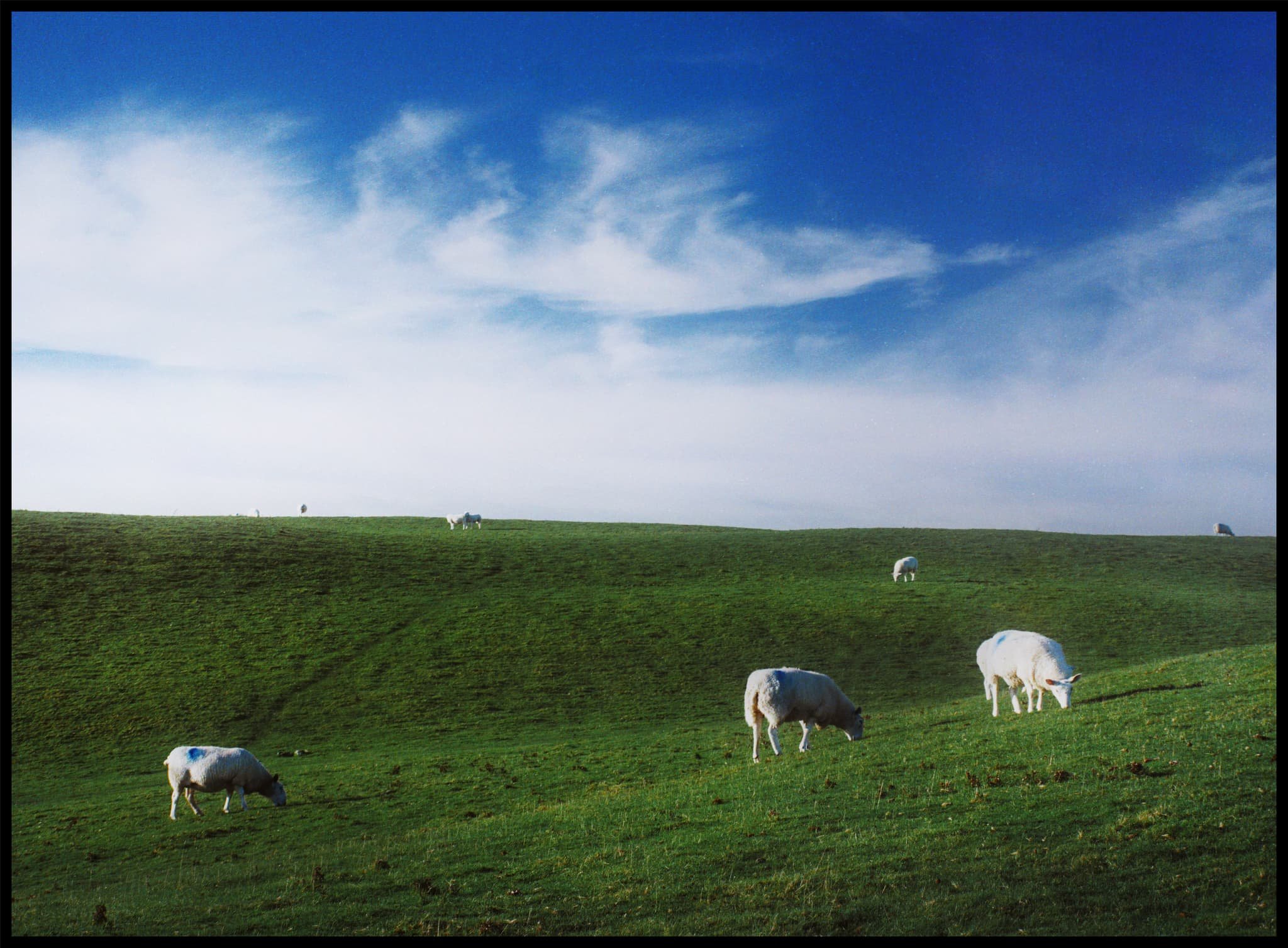
No series of photos in Cumbria is complete without featuring the local sheep.
Did you like these photos?

Miltonrigg Woods, Cumbria, Autumn
Ever since we returned from South Wales, it basically hasn’t stopped raining in North England.
Ever since we returned from South Wales, it basically hasn’t stopped raining in North England.
This has severely limited opportunities to get and about in the local area for some quality hikes and enjoy the season’s autumn colours.
Thankfully, Sunday just gone, conditions were largely dry during a visit to my Dad’s. So, after a wee bit of Googling, we hopped into the car and drove east of Brampton for a lovely hike around Miltonrigg Woods.
Beautiful colours, gorgeous woodland. A good way to see off the last of this year’s autumn colours.
Photos taken on my Fujifilm X-T2 using my Dad’s XF18–55mm f2.8–4 zoom and my own Laowa 9mm f2.8 lens. RAWs converted in Capture One for iPad, developed in RNI Films, and finalised in Affinity Photo for iPad.
Miltonrigg Woods, Cumbria, Autumn by Ian Cylkowski is licensed under CC BY-NC-SA 4.0![]()
![]()
![]()
![]()
Right next to the start of the walk, a beautiful scene illuminated itself before my eyes. Already the autumn colours were looking glorious and the light was just right.
A tigher composition of the illuminated ferns amongst the rusty hues of fallen leaves.
Looking back at the start of the hike. There’s nothing quite like a woodland in autumn.
Three gnarly trees entwine and reach to the skies, sheltering the fiery leaves beneath.
As the sun came out from behind the clouds, I spotted an opportunity for an ultra-wide composition featuring some of the woodland’s gorgeous ferns.
I enjoy the challenge of finding compositions and telling a simple story in an otherwise complicated landscape, such as in the woods.
The afternoon sun pierces through the seemingly endless layers of trees.
Two silver birches with a “skirt” of autumn foliage.
The light was such that you had to stay alert and keep your eyes open, as random parts of the woodland around you would suddenly illuminate and reveal a gorgeous scene to photo.
Another twisting ancient tree in a sea of ferns provides contrast against a backdrop of illuminated silver birch.
Heading back to the car park and a tunnel of light reveals a row of trees amongst a carpet of rusty leaves.
Did you like these photos?

The Elidir Trail Falls, Powys, South Wales, Autumn
Our last full day in South Wales.
Our last full day in South Wales.
We’d previously enjoyed some waterfall action at Cwm Rhaeadr near Llandovery. But that was just one waterfall, even though it was a mighty one.
Deep in the heart of the Brecon Beacons National Park one can find Waterfall Country, home to a myriad of waterfalls. Easily the most popular trail around here is the Four Falls Walk, which we’ve done before way back in 2018. However, word is that this particular trail has become even busier.
Instead, for our last full day, we elected to walk the Elidir Trail. Somewhat less busy but the waterfalls are no less impressive.
We were not disappointed, and beautiful light for woodland and gorge walking aided us for our final day.
All photos shot on my Fujifilm X-T2 using my Vivitar “Series 1” 28–105mm f2.8–3.8 zoom and Laowa 9mm f2.8 prime lenses. RAWs converted in Capture One for iPad, then developed and finalised in Affinity Photo for iPad.
The Elidir Trail Falls, Powys, South Wales, Autumn by Ian Cylkowski is licensed under CC BY-NC-SA 4.0![]()
![]()
![]()
![]()
The Elidir Trail gorge heads upstream where it forks into two distinct sections. The shorter branch is a simple diversion to the viewing point for the main waterfall of the area, called Sgwd Gwladys. After a day or two of rain, the gorge was wet and the atmosphere was moist. Thankfully, that resulted in beautiful soft reflected light in this autumnal scene.
An ultra-wide composition of Sgwd Gwladys, and possible one of the greatest waterfall photos I’ve ever managed to shoot. A dead tree provided nutrition for a whole collection of fungi, serving as my foreground interest with Sgwd Gwladys gracefully rushing over a shelf in the distance.
We gingerly navigated the slippery and mossy boulders to get as close to the falls as possible whilst the light shining down into the gorge was still complementary. Rusty autumn leaves provide colour contrast in the foreground.
Further up the main gorge created by the River Neath (or Afon Nedd), a group of early-20s lads examined a potential swimming and diving spot.
Autumn in a micro scene, as the afternoon sun pierced the clouds above for a particularly strong burst of light.
Here the gorge and river widens up, allowing more autumnal light to pour into the scene on these two cataracts.
Towards the top of the Elidir Trail an almost impossibly perfect autumnal waterfall scene emerges as we clamber down the gorge to gawp at Scŵd Ddwli.
The name of these falls, Scŵd Ddwli, translates roughly to “gushing falls”, which we found to be wholly accurate. Around the edge of the plunge pool, rusty autumnal leaves had gathered making for a lovely composition.
Though we neared the end of the Elidir Trail, and the clouds had gradually covered the gorge, we got a final explosion of light from the late afternoon sun, shooting beams across the falls.
Did you like these photos?

Llansteffan, Carmarthenshire, South Wales, Autumn
Did you know that Wales is home to the most castles per square mile of any country in Europe?
Did you know that Wales is home to the most castles per square mile of any country in Europe?
Certainly during our stay in South Wales we visited our fair share of them, mostly in ruins, such as Dinefwr and Castell Carreg Cennen, and Llandovery castle.
Heading south towards Carmarthen Bay, where the Avon Twyi pours out into the Bristol Channel, one can find the sleepy little village of Llansteffan with yet another magnificent fort perched on a cliff top overlooking the bay. The village’s name means “Llan of St. Stephen”. You’ll find a lot of place names in Wales start with the prefix Llan; it refers to sanctified land occupied by Christian monks or communities, almost always named in honour of a Saint.
After checking out the ruins of Llansteffan Castle, we ambled along the beach below the castle, where I gawped and photographed the local geology.
All photos shot on my Fujifilm X-T2 using my Vivitar “Series 1” 28–105mm f2.8–3.8 zoom and Laowa 9mm f2.8 prime lenses. RAWs converted in Capture One for iPad, then developed and finalised in Affinity Photo for iPad.
Llansteffan, Carmarthenshire, South Wales, Autumn by Ian Cylkowski is licensed under CC BY-NC-SA 4.0![]()
![]()
![]()
![]()
A rather shapely tree that caught my eye on the way up to Llansteffan Castle.
From outside the castle ruins the views overlooking Carmarthen Bay were rather splendid.
The ruins of Llansteffan Castle. It sits on the site of a much older Iron Age fort, showing that Llansteffan has been inhabited for millennia.
The Normans built a castle here in the 12th century. Like a lot of castles here in South Wales it passed hands often between the Welsh and the English. By the 14th century it was described as being in a poor state.
One thing that struck in particular about these ruins were all the wasps. They were everywhere, tucked into various nooks and crannies of the stonework.
We braved the disconcerting hum of wasps all around us to explore this building for a composition whilst the light was particularly sympathetic.
Down on the beach below the castle, things were thankfully a lot more peaceful.
Historical glaciation and millennia of coastal erosion from the sea have exposed millions of years of geology history. Here Llansteffan would’ve been at various times a desert, at the bottom of a sea, and everything in between, with different rocks forming and deposited at various stages. Fascinating.
To quote Natural Resources Wales: “The bedrock geology of this area […] is dominated by Devonian Old Red Sandstone characterised by mudstones, siltstones, sandstones and conglomerates which were deposited in fluvial environments, such as meandering channels and floodplains. The rocks around Llansteffan include important exposures of calcrete (which is a fossil soil indicative of an arid or semi-arid environment). Overlying the Old red Sandstone is a classic sequence of Carboniferous rocks including shallow-marine carbonates (Carboniferous Limestone), shallow-marine and fluvio-deltaic deposits (Millstone Grit), and lacustrine, delta plain sediments and coal (Coal Measures).”
The exposure of Old Red Sandstone is clearer towards Scott’s Bay, where plenty of people were chilling with their pets, nestled into the crags.
I was beguiled by the shapes, forms and colours of the cliff rocks. Imagining the millions of years of this land, and how different the local landscape would’ve looked, makes my head spin!
A tighter composition reveals the joins and seems of various types of rocks as beautiful late afternoon light highlights the textures.
Llansteffan Castle and its dominating position above the village and the surrounding farmland.
Did you enjoy these photos?

Port Eynon, Gower, South Wales, Autumn
Just outside of the Pembrokeshire Coast National Park, one can find other excellent stretches of South Wales coastline.
Just outside of the Pembrokeshire Coast National Park, one can find other excellent stretches of South Wales coastline.
East of Pembrokeshire, Swansea is home to the Gower Peninsula and the Gower AONB (Area of Outstanding Natural Beauty). We had already explored a small section of this area at the start of our holiday at Mumbles. But further along the coastline from Mumbles one can find a stretch of fantastical coastline between Port Eynon and Rhossili.
Whereas the cliffs at Lydstep Head were more vertiginous, at the Gower Peninsula the cliffs are formed from a faulted and folded sequence of Carboniferous rocks. More recent sculpting occurred in the last Ice Age as the Gower lay on the southern margin of the last ice sheet. As a result, the cliffs here feature fantastic shapes of curves and folds smashing into each other at peculiar angles.
All photos taken on my Fujifilm X-T2 using my Vivitar “Series 1” 28–105mm f2.8–3.8 zoom and Laowa 9mm f2.8 prime lenses. RAWs converted in Capture One for iPad, developed and finalised in Affinity Photo for iPad.
Port Eynon, Gower, South Wales, Autumn by Ian Cylkowski is licensed under CC BY-NC-SA 4.0![]()
![]()
![]()
![]()
Port Eynon Bay, with its long sandy beach and tall dunes. Port Eynon is thought to be named after Prince Einion of Deheubarth or an 11th-century Welsh Prince named Eynon. “Eynon” is apparently a fairly common surname in Wales.
West of the beach one can hike up the cliffs to summit Port Eynon Point. My lovely Lisabet pictured here heading straight for the knife-edge tip of Port Eynon Point.
Looking back along the limestone cliff edge from Port Eynon Point towards the summit trig point, the open Overton Mere, and the Gower cliffs beyond.
From Overton Mere, looking back at Port Eynon Point, it’s easier to see the folding of limestone that’s occurred around this stretch of the Gower Coast. Seemingly impossible shapes and lines that are entirely natural.
Below Overton cliff more fantastic shapes are revealed, millions of years of folding, faulting, erosion, and glacial scouring.
On top of Long Hole cliff we navigated a join in the folds of limestone to use as a leading line towards the Common Cliffs, as beautiful late afternoon light highlights their shapes.
Did you enjoy these photos?

Llyn y Fan Fach, Brecon Beacons, South Wales, Autumn
If I had one main personal goal for this fortnight in South Wales we’re enjoying, it’s to get up one of the mountain ranges in the Brecon Beacons National Park.
If I had one main personal goal for this fortnight in South Wales we’re enjoying, it’s to get up one of the mountain ranges in the Brecon Beacons National Park.
There’s a few mountain/hill ranges in the Brecon Beacons National Park, the main two I was interested was either:
The Brecon Beacons, at the heart of the national park, which includes South Wales’ highest peak Pen y Fan (886 metres/2,907 feet)
The Black Mountain, sometimes known as the Carmarthenshire Fans.
On this occasion, we elected to hike up the Black Mountain range above the mountain tarn known as Llyn y Fan Fach.
The day promised to be glorious, with puffy white clouds and strong sun in the crisp autumn air. Though we were disappointed at the sight of Llyn y Fan Fach halfway up the climb (it seems to be in the process of being emptied), the views on the way up to the peaks were absolutely astounding.
All photos taken on my Fujifilm X-T2 using my Vivitar “Series 1” 28–105mm f2.8–3.8 zoom and Laowa 9mm f2.8 prime lenses. RAWs converted in Capture One for iPad, developed and finished in Affinity Photo for iPad.
Llyn y Fan Fach, Brecon Beacons, South Wales, Autumn by Ian Cylkowski is licensed under CC BY-NC-SA 4.0![]()
![]()
![]()
![]()
After exiting a busy car park we started the ascent up the Beacons Way path direct towards the tarn. Looking to the east I nabbed this quick shot of the criss-crossing hills towards Bryn Blaen-Wysg.
About halfway up the path is a small hut where the dam is. Above it are these fish hatcheries which were originally used as filter beds. The rounded hills at the bottom of the path are in stark contrast to the shapes of the Black Mountain, as you’ll see.
As we climb the views get ever more extensive. The last time we visited Llyn y Fan Fach, back in October 2018, there were few people around. This time the car park was full and cars had been dumped on the grass verges along the road leading to the car park. Apparently this area became vastly more popular after being featured in a 2020 TV series “Secrets of Britain”.
From the left, Fan Brycheiniog and Picws Du come into view, with their heavily glaciated and steep northern craggy faces. Morning sun was attempting to break through the clouds above.
Wow, am I right? After seeing the state of Llyn y Fan Fach, we quickly continued our ascent up the Black Mountain. The views looking back to the peaks were too incredible to ignore. The tallest peak, Fan Brycheiniog, is on the left, or strictly speaking its “nose”, Fan Foel. This is followed by Picws Du, Cefn Twrch, and Waun Lefrith.
The hike up the western slopes of the Black Mountain is steep, and the drop down to the tarn is sheer… but I mean, look at those views. The light got more intense, too, as the clouds started to dissipate and reveal the sun.
These peaks are primarily composed of Old Red Sandstone, laid down around 400 million years ago, with bands of Carboniferous Limestone. I wanted to find some of the exposed red sandstone as a contrast to all the grass.
More cracks of ruby red sandstone which I wanted to emphasise with a vertical composition towards the Black Mountain peaks.
My lovely Lisabet, being immensely more brave than I as she stands atop an exposed crag with a 500ft sheer drop beneath her.
This was about as close as I dared go to those crags, with the beautifully curved glaciated wall of Waun Lefrith in the distance.