
The Elidir Trail Falls, Powys, South Wales, Autumn
Our last full day in South Wales.
Our last full day in South Wales.
We’d previously enjoyed some waterfall action at Cwm Rhaeadr near Llandovery. But that was just one waterfall, even though it was a mighty one.
Deep in the heart of the Brecon Beacons National Park one can find Waterfall Country, home to a myriad of waterfalls. Easily the most popular trail around here is the Four Falls Walk, which we’ve done before way back in 2018. However, word is that this particular trail has become even busier.
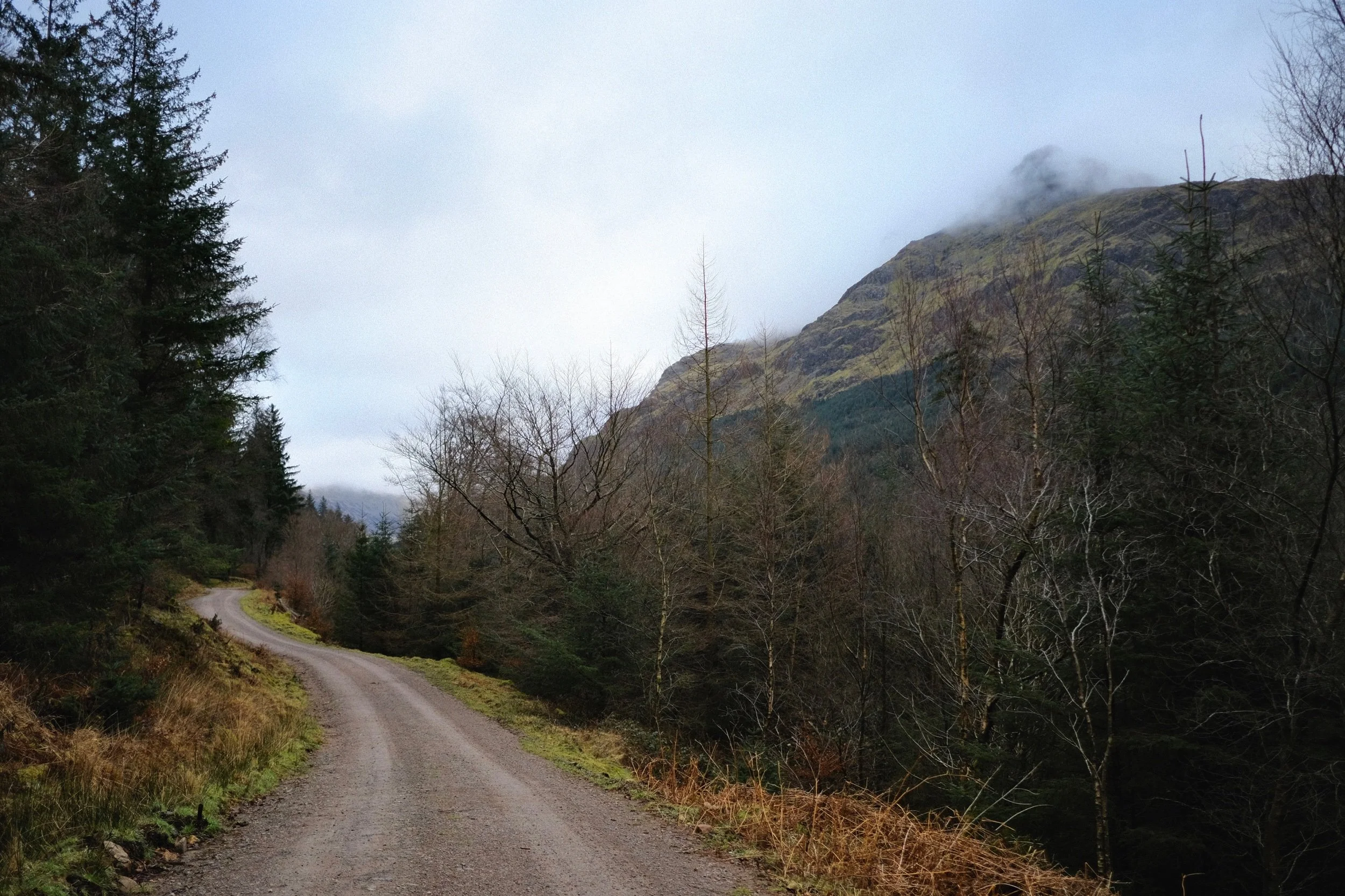
Instead, for our last full day, we elected to walk the Elidir Trail. Somewhat less busy but the waterfalls are no less impressive.
We were not disappointed, and beautiful light for woodland and gorge walking aided us for our final day.
All photos shot on my Fujifilm X-T2 using my Vivitar “Series 1” 28–105mm f2.8–3.8 zoom and Laowa 9mm f2.8 prime lenses. RAWs converted in Capture One for iPad, then developed and finalised in Affinity Photo for iPad.
The Elidir Trail Falls, Powys, South Wales, Autumn by Ian Cylkowski is licensed under CC BY-NC-SA 4.0![]()
![]()
![]()
![]()
The Elidir Trail gorge heads upstream where it forks into two distinct sections. The shorter branch is a simple diversion to the viewing point for the main waterfall of the area, called Sgwd Gwladys. After a day or two of rain, the gorge was wet and the atmosphere was moist. Thankfully, that resulted in beautiful soft reflected light in this autumnal scene.
An ultra-wide composition of Sgwd Gwladys, and possible one of the greatest waterfall photos I’ve ever managed to shoot. A dead tree provided nutrition for a whole collection of fungi, serving as my foreground interest with Sgwd Gwladys gracefully rushing over a shelf in the distance.
We gingerly navigated the slippery and mossy boulders to get as close to the falls as possible whilst the light shining down into the gorge was still complementary. Rusty autumn leaves provide colour contrast in the foreground.
Further up the main gorge created by the River Neath (or Afon Nedd), a group of early-20s lads examined a potential swimming and diving spot.
Autumn in a micro scene, as the afternoon sun pierced the clouds above for a particularly strong burst of light.
Here the gorge and river widens up, allowing more autumnal light to pour into the scene on these two cataracts.
Towards the top of the Elidir Trail an almost impossibly perfect autumnal waterfall scene emerges as we clamber down the gorge to gawp at Scŵd Ddwli.
The name of these falls, Scŵd Ddwli, translates roughly to “gushing falls”, which we found to be wholly accurate. Around the edge of the plunge pool, rusty autumnal leaves had gathered making for a lovely composition.
Though we neared the end of the Elidir Trail, and the clouds had gradually covered the gorge, we got a final explosion of light from the late afternoon sun, shooting beams across the falls.
Did you like these photos?

Hawes Bridge, Kendal, Cumbria, Summer
COVID-19 is in da house.
COVID-19 is in da house.
2 years and 3 months after the initial UK-wide Lockdown announcement, my poor Lisabet has contracted the virus.
She’s being quarantined in the bedroom, door shut, windows open, and donning a mask whenever I need to go in to deliver brews or food.
She’s coping well but the coughing does not sound nice.
As I’m transitioning between jobs at the moment, I actually have a bit of free time before I start at my new position. Thankfully this means I’m able to be useful in the house and help look after her.
Today, Lisabet insisted I make use of this week’s mini-heatwave and head out for a nice waltz in nature. So I did. A good 7-mile circular jaunt from Kendal town centre to a local favourite and back, Hawes Bridge.
All photos taken on my Fujifilm X-T2 using my Vivitar “Series 1” 28–105mm ƒ/2.8–ƒ/3.8 and a Laowa 9mm ƒ/2.8 prime. Images made 90% in-camera using Øyvind Nordhagen’s OWH Daylight Fujifilm recipe, gently finished off in Affinity Photo.
A grey heron (Ardea cinerea) standing in the middle of the River Kent, waiting for lunch. I love when they adopt this more “hunched” stance; sort of makes them look like a grumpy old man in the rain.
Looking back at the heavily overgrown path I was following all the way to Scroggs Wood.
Beyond Scroggs Wood the trail heads through the open fields alongside the River Kent. It’s at this point that pollen from all the grass really starts to wreak havoc with my sinuses.
Like a beautiful bonsai tree, but bigger.
The clear way to the falls at Hawes Bridge.
Above Hawes Bridge falls lots of teeny falls trickle into the river from the fields above.
The gorge around Hawes Bridge is proper lush with flowers and vegetation. And insects. And pollen.
Hawes Bridge falls, looking a lot tamer and smaller with the lack of rain in recent months.
Thousands of years of erosion because of this waterfall have carved overhangs above the river. Be careful near the edge.
Bumble bees happily lapping up the pollen on all the flowers in the gorge. My sinuses and eyeballs were not has happy with all the pollen.
The gorge is lush and verdant, framed nicely underneath Hawes Bridge.
On goes the ultra-wide lens to really feature some of the shapes in the limestone carved by the waterfall.
Through the bridge I zoomed in deeper into the gorge, looking almost jungle-esque.
I hopped on top of Hawes Bridge for some compositions looking down into the deep dark gorge.
The other side of the gorge towards the falls. You can see how the waterfall has carved shelves and ledges.
Spider webs? No. These are probably from ermine moth caterpillars, created as a form of protection. Creepy-looking, eh?
Back out of the gorge, I elected to follow the footpath along the A591 all the way back into Kendal. I knew this route would be windier and keep the bugs away. And help cool me down.
This beautiful cottage at Prizet sits just alongside the A591.
As I near Kendal, this scene reminds me that—in Cumbria—you’re never far away from the countryside.
The ruins of Kendal Castle sitting above Lound Road.
Did you like these photos?
Coldstones Cut & Almscliffe Crag, North Yorkshire, Spring
Yorkshire’s a beautiful county, isn’t it?
Yorkshire's a beautiful county, isn't it?
Living in Kendal as we do, we enjoy closer access to the Yorkshire Dales, an area in North Yorkshire we love dearly. But there's plenty more outside of the Dales.
Pateley Bridge, where we stayed at recently, is situated in the Nidderdale AONB, which lies outside of the Yorkshire Dales National Park. It's a stunning area in its own right. A 10-minute drive west of Pateley Bridge takes you up onto the moorland where can visit the incredible Coldstones Cut construction.
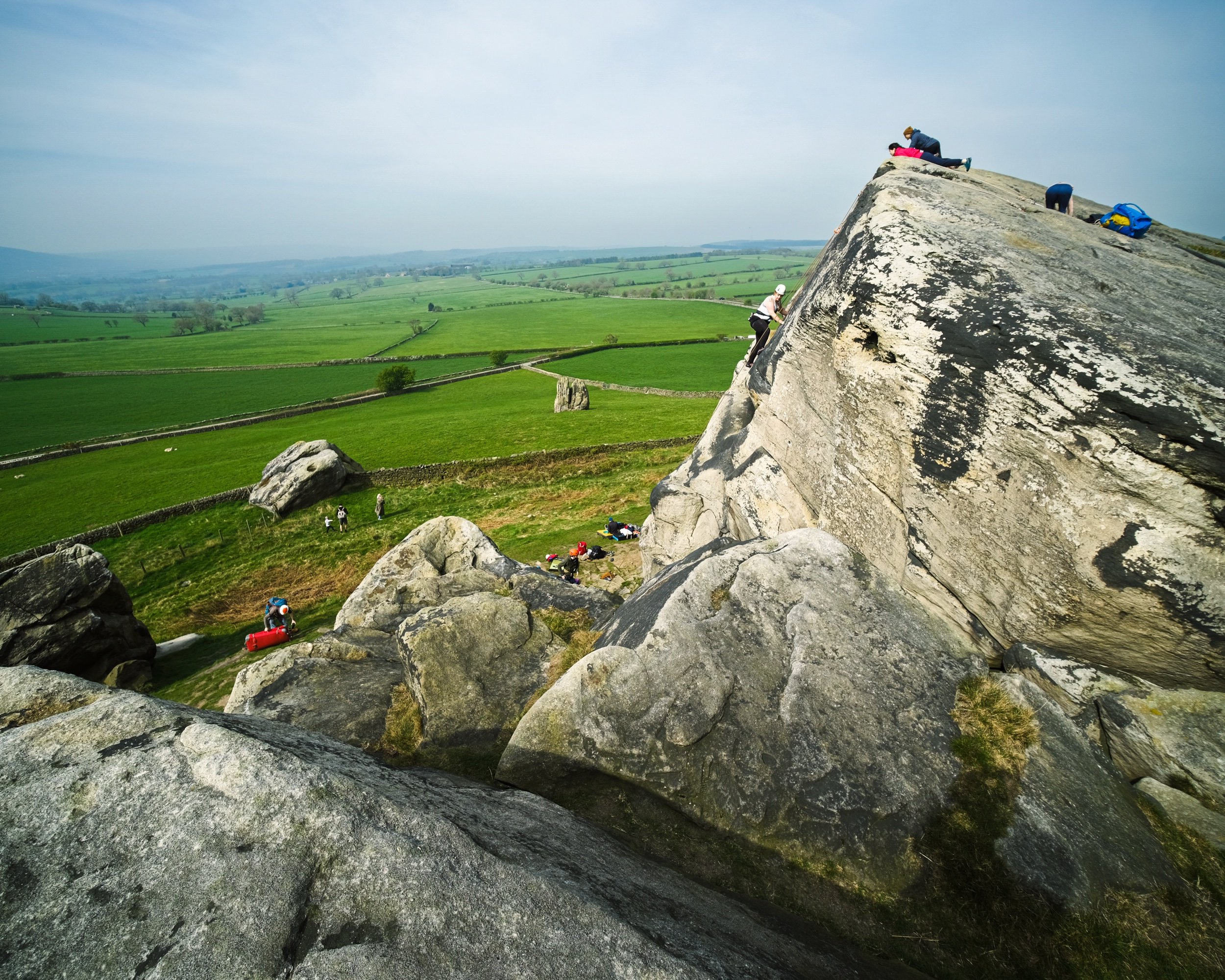
Further south of Pateley Bridge, near North Rigton, one can find the impressive Almscliffe Crag, a cap of millstone crags and rock formations sitting on top of a small hill. It's popular with rock climbers and boulderers, not to mention a walker's paradise.
On this particular occasion, we visited both areas on a beautiful yet hazy spring day.
All photos shot on my Fujifilm X-T2 using my three prime lenses: a Fujinon 23mm f/2.0, a Laowa 9mm f/2.8, and an adapted Pentax SMC 55mm f/2.0. Images made 80% in-camera using the Astia film simulation, then finished off in Lightroom and Affinity Photo.
Coldstones Cut
The entrance to Coldstones Cut, 400m above sea level.
Looking back down the "street" entrance of Coldstones Cut, the sun beaming right at us. Lisabet decided to go full Instagram Mode.
A 5-shot panorama of the view from one of the many view areas at Coldstones Cut. The construction overlooks the imposing Coldstones Quarry, the last remaining quarry in the area that was once dominated by a multitude of limestone quarries. It's estimated the quarry has 15-20 years of productivity left, after which it will be left to green over and return to nature.
Beneath Coldstones Cut and its quarry one can find the ruins of Toft Gate lime kiln. Limestone dug from the hill above was heated by fires in the kiln to produce quicklime for local agriculture through the 19th Century.
Almscliffe Crag
After exploring Coldstones Cut and appreciating the art and views, we ventured south near North Rigton. Here one can enjoy quick access to the imposing Almscliffe Crag.
Though not that busy, and certainly not in Lake District terms, there were still plenty of people milling around the crags. Mostly rock climbers.
Crags and rock formations like these inspire me to whip out my 9mm ultra-wide lens for some unusual and fantastical compositions.
As the crag is made of harder millstone rock, the hill it sits on is isolated from the rest of the land. This helps offer extensive and panoramic views, no matter where on the crags you are.
I appreciated the grit and determination of these rock climbers. I certainly couldn't do it.
Leading lines, curves, and textures ahoy. My happy place.
Lisabet and I clambered around the various nooks and crannies in between the crags, finding interesting views and compositions to photo.
I enjoy getting into precarious situations for those "hard to find" compositions and views.
I shot this primarily for the way the rocks seem to point at the road, which then zigzags off into the distance.
Directly beneath the crag that marks the highest point of the hill.

On the top, the crags have been smoothed out by millennia of erosion from wind and rain.
People cherishing the experience and moment in their own way from the top of Almscliffe Crag.
It's all starting to look beautifully verdant.
A couple and their pooch enjoy the summit views that stretch out for miles and miles.
Trollers Gill & Parcevall Hall, Yorkshire Dales, Spring
Happy belated Easter everyone. Did you have a good 'un?
Happy belated Easter everyone. Did you have a good 'un?
Usually for Cumbria, and the Lake District in particular, Easter signals the first tourism wave of the season. With that in mind, and no obligations to serve, Lisabet and I booked a couple of nights away in a beautiful B&B set in bonny Pateley Bridge, in the Nidderdale Area of Outstanding Natural Beauty.
We took the scenic route to Nidderdale from Cumbria, as we didn't need to check in until the evening. So, first we stopped off at the impossibly pretty Yorkshire Dales village of Burnsall for lunch and some light photography. Afterwards we continued east and stopped off near Grimwith Reservoir for the day's main activity: Trollers Gill.
This place has been on my radar, otherwise known as my Pinterest, for years.
It did not disappoint.
All photos shot on my Fujifilm X-T2 using my three prime lenses: a Fujinon 23mm f/2.0, a Laowa 9mm f/2.8, and an adapted Pentax SMC 55mm f/2.0. Images made 80% in-camera using the Astia film simulation, then finished off in Lightroom and Affinity Photo.
Burnsall
After coffee and a bacon butty near the river, we snapped some shots of Burnsall as we made our merry way back to the car. The 5-arched Burnsall Bridge here is a Grade II listed building, originally constructed in the 17th century with some 19th century improvements.
I'm not sure it's possible to get more Yorkshire than this scene. The Red Lion, built in the 16th century, and recently taken over by Thwaites Brewery.
Like many Yorkshire Dales villages, there's plenty of historical sandy limestone buildings decorated with beautiful greenery, flowers, and the distant hills.
Burnsall Primary School. Originally the old Grammar School founded in 1602 by William Craven of Appletreewick, who later became Lord Mayor of London.
Trollers Gill
After Burnsall, I identified a handy little parking area off the B6265 that would serve as the starting point of our hike to, and up, Trollers Gill. The day was bright and sunny whilst also hazy, lending a wonderful sense of intrigue and distance to photographs. Up on the moorland high above Appletreewick, views extended for miles and miles.
The path down the moorland was easy enough to follow, and soon the characteristic karst limestone landscape of the Yorkshire Dales became apparent.
The main signs pointing to Trollers Gill invite walkers to enter the ravine at the top and scramble their way down. Instead, we elected to take the trail around the western side of Middle Fell. This would eventually lead us to the bottom of Trollers Gill.
The anticipation and excitement builds as we near the bottom of the deep ravine.

At the bottom of Trollerdale, we followed the minor path north to start the climb up Trollers Gill. But first, I simply had to snap this glorious scene.
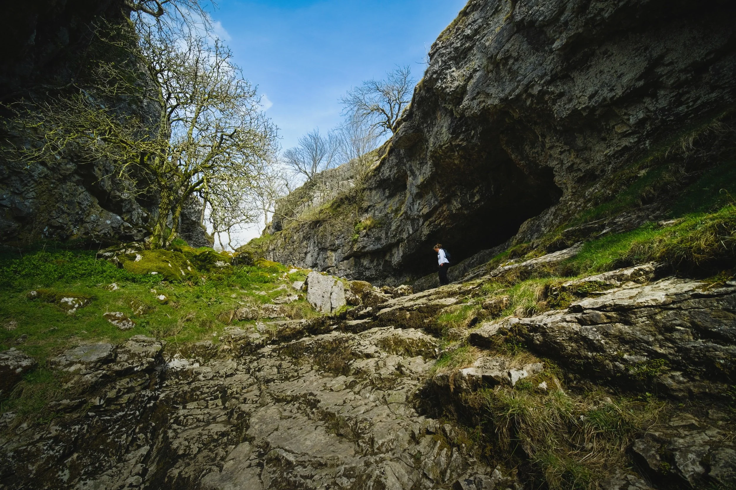
The entrance to Trollers Gill, largely dry for most of the year. Historically this would've been the site of a thunderous ravine with several waterfalls and cascades crashing down the gill. Thousands of years of erosion in a limestone landscape means the beck at the top of the gill now goes underground before entering the ravine, later reemerging at the bottom of Trollerdale.
Looking back at our way into Trollers Gill. Fellow hikers gingerly navigate the way down the ravine. Can you imagine this gorge full of water?
As with many other places in the Yorkshire Dales that features sheer limestone walls, Trollers Gill is a favourite for rock climbers.
Rock climbers assist each other as they ascertain routes up the sheer sides of Trollers Gill.
An ultra wide composition looking up from the bottom of what would've been a powerful waterfall. The meaning of the name "Trollers Gill" comes in two parts. "Gill" is already quite well known and used in Yorkshire and Cumbria, sometimes alternatively spelled as "Ghyll". It means a deep ravine or gully, and is cognate with the word gullet. "Trollers" is split into two: "troll" meaning, well, troll, the mythical beast (not the internet variety), and ears meaning "arse". This gives us "the Troll's arse". You're welcome.
Near the top of Trollers Gill, where the beck mysteriously disappears into the unfathomably twisted caves underneath.
Climbing out the gill and up onto the moorland, we realise that the haze has nearly cleared, giving us a fairly clear shot of Simon's Seat.
The deep drop into Trollers Gill that we had just climbed out of.
The single lane "New Road" that connects with the B6265.
A clear sign that a moorland is particularly and consistently wet: rushes everywhere.
One last look back at the farm track that guided us down into Trollers Gill.
A great discovery! Hanging on a branch near our parking spot was this beautifully preserved sheep's skull, probably a Swaledale. We took it home. Isn't it beautiful?
Parcevall Hall & Gardens
After returning to the car, we realised looking at the map that we were very near Parcevall Hall & Gardens. Fancy a quick visit and a wander? Why not?
Parcevall Hall is a Grade II listed Manor House that includes 24 acres of sculpted and maintained gardens. They were created in 1927 but fell into decline after 1960 following the death of Sir William Milner, 8th Baronet of Nun Appleton. Restoration work commenced in the 1980s.

People can visit and explore the gardens between April and October. It enjoys fabulous views and beautiful displays.
Lisabet and I particularly enjoyed this peaceful statue.
The Gardens, amongst other things, are known for their wonderful view of Trollers Gill, so we followed the route uphill.
Still plenty of daffodils around.
And there it is. Trollers Gill to the right and Middle Fell in the centre, daffodils blooming below. What a fantastic scene.
Cherry Blossom in full bloom at the entrance to the Gardens. What a full and gorgeous day.
Warriners Wood, Lake District, Spring
A brighter weekend means a long Sunday morning above Kendal.
A brighter weekend means a long Sunday morning above Kendal.
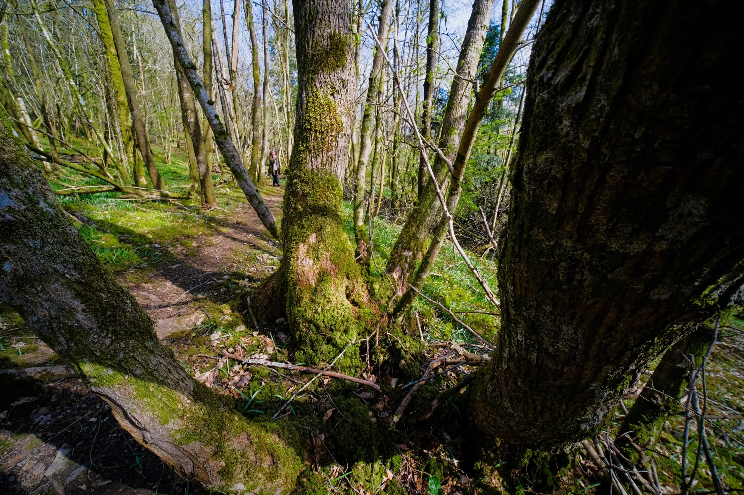
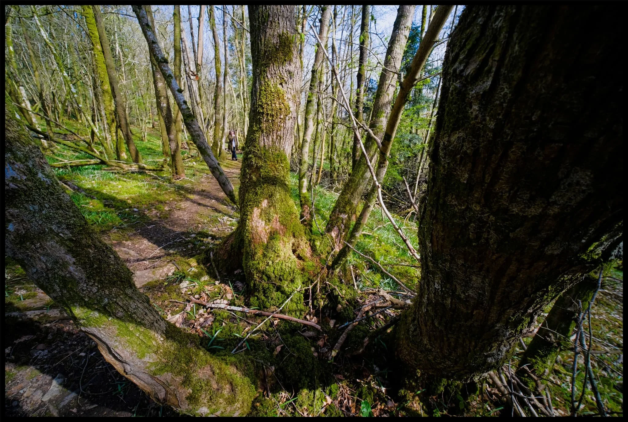
We’ve been to Warriners Wood many times before, after we found it during the winter of 2021. As of spring this year it appears to have survived the 2021/2022 storm season rather well, and some of my favourite trees are still standing strong.
A “Warriner” is an old Scottish/English term for a gamekeeper—that is, someone who’s job is to manage game in a park. I assume this woodland was once part of a gamekeeper’s land. Saying that, Warriner has also since become a fairly popular surname. Who knows?
Even in early April we chanced upon what we think are bluebells. Already. Before the wild garlic has flowered. Crazy.
Photos taken on my Fujifilm X-T2 using my three prime lenses: a Fujinon 23mm f/2.0, a Laowa 9mm f/2.8, and an adapted Pentax SMC 55mm f/2.0. Images made 80% in-camera using the Astia film simulation, finished off in Lightroom and Affinity Photo.
Heading up Brigsteer Road, someone’s now erected an impressive wicker sculpture of a deer (I think?).
Following Brigsteer Road past our usual route up the back of Scout Scar. This farm will be full of lambs now, I imagine.
Warriner’s Wood is up to the left. The sun finally comes out to play.
How lush this will all look when the trees are all in leaf.
As the road starts winding ahead, a small opening in the drystone wall to our left gives us access down the slope to Warriner’s Wood.
Nowt in the way of daffodils in Warriner’s Wood, but the leaves of bluebells are plentiful. This place will host a glorious carpet of them in a month’s time.
My favourite tree in Warriner’s Wood. Or rather, a collection of trees sharing the same root system. I elected to attach my 9mm ultra-wide lens and make a 6-shot vertorama of this tree, from bottom to top. Pretty happy with how it came out!
Lisabet in her element, whilst also beautifully blending in with palette of the scenery.
A trio of trees in this pasture field.
Following the hedgerow back down the slopes of Helsington Laithes, with the Helm serving as a local beacon in the distance.
A Cumbrian pastoral scene.
This gorgeous cottage at the bottom of Helsington Laithes is always worth a photo or two.
I wonder how old it is…
The road back to Kendal, lined with the last of this season’s daffodils.
Ennerdale, Lake District, Winter
Compared to Buttermere’s clear blue skies, Ennerdale could not have been more different.
Compared to Buttermere’s clear blue skies, Ennerdale could not have been more different.
I think the last time we were at Ennerdale was in April 2017. Goodness. That’s coming on to 5 years now. It’s one of my favourite places in the Lake District, with a distinctly unique “vibe” compared to any other area in the National Park.
Ennerdale is a long valley by Lake District standards, measuring around 10-miles long. There are no settlements here, save for the Low Gillerthwaite Field Centre, Ennerdale YHA, and Black Sail Hut right at the head. Ennerdale Water sits at the foot of the dale, offering views all the way down the valley towards some of the Lake District’s biggest peaks: Great Gable, Steeple, and (one of my favourites) Pillar.
In 2003 the major landowners of the valley—United Utilities, the National Trust, and the Forestry Commission—joined forces to create the Rewilding Ennerdale partnership and project. The project’s stated goal is:
“[…]to allow the evolution of Ennerdale as a wild valley for the benefit of people, relying more on natural processes to shape its landscape and ecology.”
Ennerdale does have a massively different feel compared to the rest of the Lake District. It feels more Scottish in a way.
Although on this hike we didn’t see much of the sun, the low clouds did interact with the high fells beautifully, creating gallons of drama for us to photograph.
All photos shot on my Fujifilm X-T2 using my three prime lenses: a Fujinon 23mm f/2.0, a Laowa 9mm f/2.8, and an adapted Pentax SMC 55mm f/2.0. Images made 95% in-camera using Øyvind Nordhagen’s “Modern Negative” Fujifilm recipe.
Following the road from the car park, the views open up and reveal the huge Ennerdale fells tussling with the clouds above.
Across Ennerdale Water, Crag Fell slopes down to an abrupt toe known as Angler Crag, before plunging into the deep lake.
This was the most sun we saw all day. Worth it though. Caw Fell, Haycock, and Scoat Fell fight with the clouds.
A closer view of Angler Crag. It is technically possible to complete a circular hike around Ennerdale Water, but the difficulty is in navigating around this awkward crag.
The cloud cover starts to lift a little bit, with Steeple’s shadow suggesting an appearance.
Lots of trees near the lake shore are covered in thick carpets of moss. Beautifully eldritch.
Beautiful light highlights the reaching arms of this moss-covered tree.
Near the Low Gillerthwaite Field Centre, the forest cover recedes a little and we get out first glimpse of the mighty Pillar. My excitement levels build.
We followed the winding forest track towards Middle Bridge, which cross the River Liza. This would signal our way back down the other side of the valley. Pillar gets closer…
Swirling clouds wrestle with the summit of Pillar.
Like a lot of the Lake District, Storm Arwen took casualties in Ennerdale too.
These trees managed to survive…
…but these two giants didn’t, completely uprooted and tossed aside by the powerful winds of Storm Arwen. Incredible.
Middle Bridge offers beautiful views looking all the way down the rest of Ennerdale.
The River Liza tumbles down the valley here in a series of cascades and falls, each with its own sublime turquoise and azure plunge pools. The water clarity was astonishing.
We crossed the Liza via Middle Bridge, and took the official Liza Trail back towards the foot of Ennerdale. But not without another look back at the crystal clear river and its falls.
Navigating the Liza Trail alongside the river back to the Forest path was tricky, given that several chunks of it had been washed away by Storm Arwen. But views like this from the forest trail made up for it.
Ancient sheep enclosures have long been left to be reclaimed by nature.
Ennerdale Forest, growing taller everywhere.