Keswick–Threlkeld Railway, Lake District, Winter
And now for something completely different.
And now for something completely different.
After yesterday’s thrilling circular hike around the gorgeous and epic Malhamdale, today we embarked on something a little more tourist-friendly and flat: the Keswick–Threlkeld Railway walk.
The 5km walk follows the route of the old Cockermouth, Keswick and Penrith Railway from Keswick to Threlkeld. It was constructed in 1864 with the goal of connecting the town of Cockermouth with the London and North Western Railway (LNWR) West Coast Main Line at Penrith. It closed to passengers and business in the 1960s and 1970s.
Much of the trail was badly damaged or totally destroyed by Storm Desmond in December 2015. Major restoration work was undertaken and the trail was upgraded and reopened in December 2020.
Lisabet and I met met up with me Dad near the start of the trail at Keswick, and followed the route all the way to Threlkeld and back, a good 6.2 miles and 17,000 steps later.
We were blessed with lifting hill fog, resulting in some incredible scenes of clouds whipping around the shoulders of nearby fells Lonscale Fell, Blencathra, and even some of the Helvellyn fells.
This route will definitely be one to revisit in Spring and Summer.
All photos taken on my Fujifilm X-T2 using my three prime lenses: a Fujinon 23mm f/2.0, a Laowa 9mm f/2.8, and an adapted Pentax SMC 55mm f/2.0. Images made in-camera, with no additional editing, using Øyvind Nordhagen‘s Overcast Fujifilm recipe.
The Keswick Hotel, which also seems to come with its own garage. At least, it used to.
The aforementioned Keswick Hotel Garage.

The Keswick–Threlkeld Railway trail starts near Keswick Leisure Centre, alongside the old station. I nabbed a sneaky shot of me Dad.
It wasn’t long before the trail started offering some lovely views along the River Greta towards the fells above Keswick. The main fell pictured here is a favourite of ours, Latrigg.
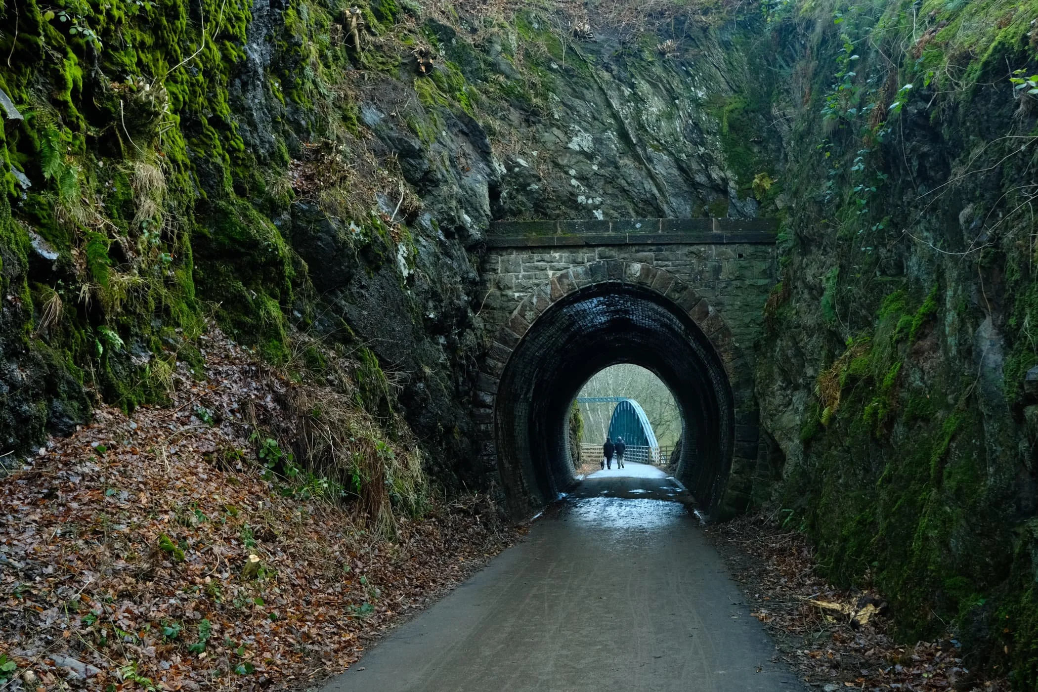
Where possible the Lake District National Park have tried to save and restore as many of the old Victorian bridges and tunnels as possible.
Near the “big” tunnel there’s a little commemorative sculpture, erected to celebrate the National Cycle Route and the Coast to Coast trail.
Into the “big” tunnel we go…
Again, beautifully preserved Victorian engineering, now with the added convenience of modern lighting and smooth, durable tarmac.
On the other side of the tunnel, panoramic views of the River Greta and Latrigg open up.
Despite being in winter, it was lovely to still see some colour about.

One of many of the newer bridges that criss-cross the winding River Greta.
Evidence of Storm Desmond, which scoured the river banks clean. You can still the level that river came up to during the storm. Land slips ahoy.
A nice little holiday village, Low Briery, alongside the River Greta.
The trees now denuded of their leafy vegetation, line the river and serve as a leading line towards Latrigg.
Onwards to the next bridge. There were plenty of other people around enjoying this trail. It was a good job we got started nice and early.
The next bridge to cross the River Greta. The Greta Gorge flattens out at this point, providing “in-bye” land for nearby hill farmers to use for their grazing flocks of sheep.

I wanted to play with lines and angles provided by this bridge, so I snapped on my ultra-wide 9mm lens for some fun compositions.
Not a bad spot for a bit of lunch.
The gorge created of the River Greta flattens out here, opening more perspectives of the Latrigg fells above.
To the north, the clouds were starting to lift from mighty Blencathra.
A solitary tree has survived erosion and storms against all the odds, and stands proudly in the middle of the river.
The excitement levels rise as we catch our first glimpse of Blencathra’s jagged peaks.
Additionally, to the east, the morning hill fog was wrestling with the crags of Clough Head, part of the Helvellyn range.
Beyond Latrigg, the crags of Lonscale, too, were freeing themselves of the morning’s mist.

The shoulder of Lonscale Fell high above the Greta Gorge.
Another relic of Victorian engineering, a small tunnel blasted through the crag leading to Rawsome’s Bridge.
Near Threlkeld, lots of trees were covered in beautiful and vibrant moss as the gorge walls closed in.
The end of the trail. Beyond the A66, Clough Head provides a dramatic backdrop as it tussles with the clearing fog and mist.
Blencathra’s craggy and jagged peaks, now nearly clear of morning mist.
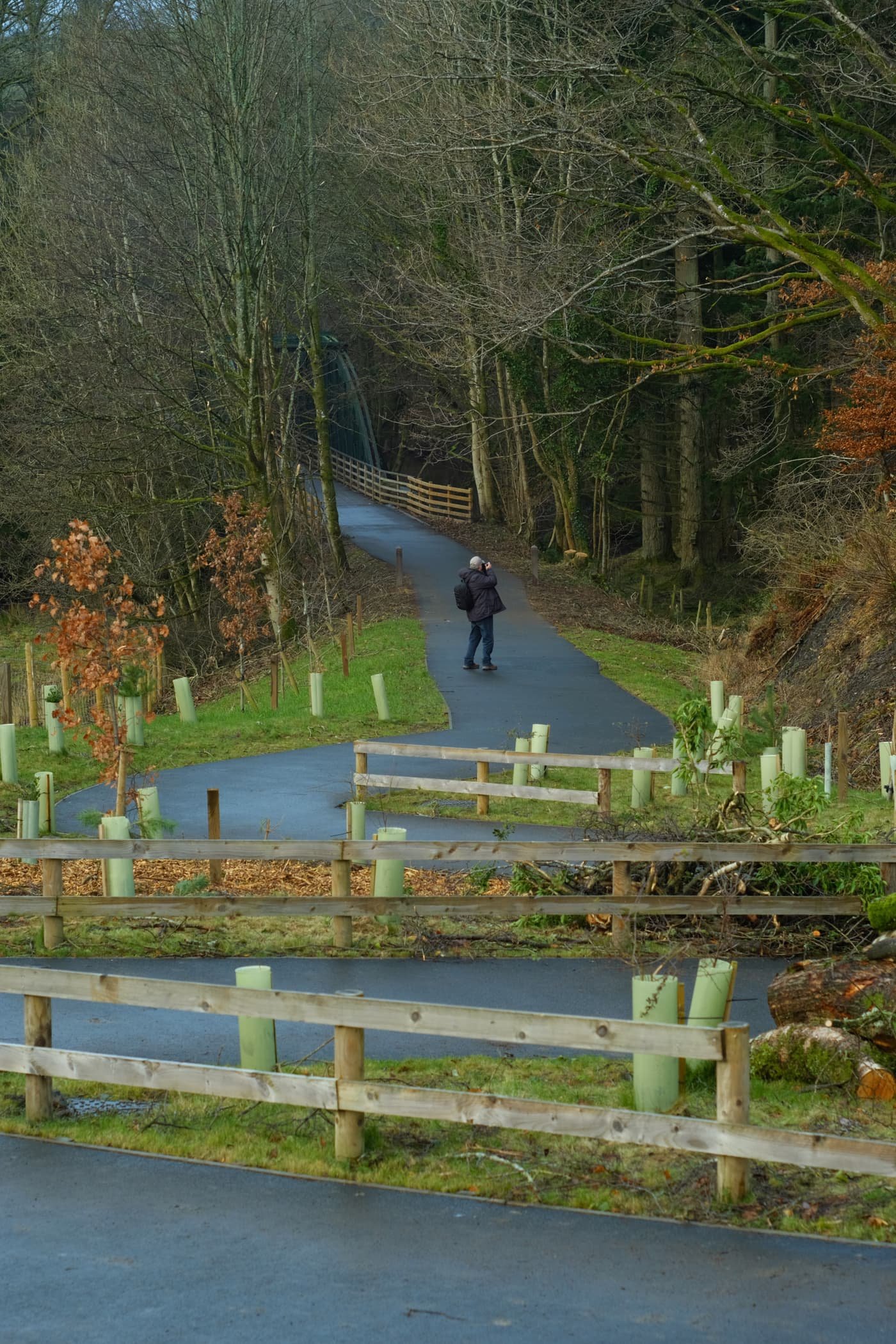
Dad leads the way back to Keswick, happily snapping away.
There’s something wonderfully eldritch about wintery trees covered in moss.
Quite happy with this candid snap of me Dad.
Lonscale Fell again, now apparently losing its battle against the sky.
Blease Fell below Blencathra, and a band of mist clinging to its shoulder.
At around lunchtime, the sun finally broke through the thick cloud cover and illuminated these trees in golden light.
Overall, I can heartily recommend this trail. I look forward to returning in the spring and summer, when there’s more wildlife and flora about.

Latrigg, Lake District, Winter
It’s really starting to feel like winter in the Lake District now.
It’s really starting to feel like winter in the Lake District now.
As the weather improved over the Christmas Break, Lisabet and I decided to embark on a hike up a fell we’ve never done before: Latrigg.
Latrigg is a rather unassuming fell, measuring only 368 m/1,207 ft high. But what it lacks in height or stature it more than makes up for with the views it has to offer.
Technically Latrigg is part of the main Skiddaw massif, the mountain range that looms above Keswick town, disconnected by a depression that drops to 900+ ft. For those with limited mobility it’s possible to reach the summit of Latrigg via a car park near the peak. We decided instead to start in Keswick and hike up the Cumbria Way to the summit.
We certainly weren’t alone and we could easily see why. The day was ice-cold and clear, with gorgeous low winter light filtering through an atmosphere of ice crystals, resulting in shows of 22° halos around the sun and mist lingering around the fells. Skiddaw, Blencathra, and the Derwentwater fells also had plenty of snow on their peaks, adding to the sense of awe.
I hope these photos convey the beauty we experienced on this hike.
All photos shot on my Fujifilm X-T2 using both my Samyang 35mm f/1.2 and Laowa 9mm f/2.8 lenses. A variety of Fuji’s film profiles were utilised in the RAW developing.
As we ascended up the steep section of the Cumbria Way, the views looking back west and southwest grew more impossible to resist photographing. The sun was too weak to burn away the morning’s temperature inversion, leaving floating tufts of mist to meander around the fells.
As we broke off the Cumbria Way to take the path up towards the Latrigg summit, and patch of mist floated our way and obscured views back towards Skiddaw (931 m/3,054 ft). I quickly nabbed this 35mm composition of what turned out to be a fleeting moment.
We joined, at a distance, other groups of people near the summit of Latrigg, admiring the views and the incredible light show. The halo around the sun is known as a 22° Halo, caused by sunlight refracting through millions of hexagonal ice crystals in the atmosphere. The lake in the distance is Derwentwater.
From the summit of Latrigg, looking back towards the Derwentwater and Whinlatter fells as another patch of mist slowly creeps up the shoulders of the fell.
Plenty of dogs were enjoying the sights and smells of the fell too.
Away from the sun we continued on the summit track back down Latrigg’s eastern shoulder, affording us wonderful views of a snow-clad Blencathra (868 m/2,848 ft). More mist streamed in to partially obscure the views of the mighty fell.
Following, at a distance, other hikers back down the Cumbria Way, with extraordinary views towards the Whinlatter and Lorton fells.