Lowther Estate, Cumbria, Autumn
Autumn’s definitely here. You know what’s also here? The Great British Changeable Weather.
Autumn’s definitely here. You know what’s also here? The Great British Changeable Weather.
I took an educated guess at the weather today and decided our best bet for good light and conditions would be East Lake District/Cumbria during mid-morning/early afternoon. So! We ventured to the Lowther Castle and its Estate, for a healthy jaunt from the castle grounds to Askham Fell and back round.
Driving to Lowther was… interesting. It involves taking the A6 up and over Shap Fell, whereupon we were greeted with a thickness of fog that a Live Music Stage FX Producer would be proud of. Once we arrived at Lowther, the cloud base was starting to lift and the sun made various attempts to breakthrough.
Thankfully, as we hiked up Askham Fell, and back down through Helton, the cloud cover truly lifted and we enjoyed glorious autumnal scenes.
All photos taken on my Fujifilm X-T2 using my Samyang 35mm f/1.2 lens. If you’re wondering why the right hand side of my photos appears constantly out of focus, it’s because I think there’s a broken element in my lens. Damn.
Images developed using RNI Films’ Kodachrome film profile.
The ruins of Lowther Castle, a popular destination for many families. The fog was gone but we were still waiting for the cloud base to lift.
The way to the Lowther Castle Courtyard. Not our destination for the day, though maybe after the hike.
I implore visitors to explore the ruins of Lowther Castle. It’s epic.
Down into the woods we go. Autumn colours are really starting to pop in Cumbria.
One of many abandoned entrances into the various private areas of the Lowther Estate.
Look at them beautiful colours.
The path pops out of the woodland beneath Lowther Castle, and follows alongside the River Lowther. The cloud cover finally starts to break up.
Sunlight breaks through and picks out the tiny village of Helton above the River Lowther.
One of my favourite parts of this hike is when you come off the road to Whale and up the “lonnin” (lane) alongside Millkeld Sike towards Helton.
We would’ve like to have spotted more fungi, but we did see what I think is known as “Chicken of the Woods” or—more properly—Laetiporus sulphureus.
My lovely Lisabet, capturing the beautiful that was developing through the lane.
Our way to Helton…
Sloe! Otherwise known as Blackthorn, and more properly Prunus spinosa. Good for making Gin with.
We follow the minor road, south of Helton, which will eventually lead us to the bridleway up onto Askham Fell.
Our goal: Askham Fell, with its fellside traced with dry stone walls.
There were quite a lot of Kendal Rough Fell sheep around the area, which I was happy to see. You tend find more Swaledale around here.
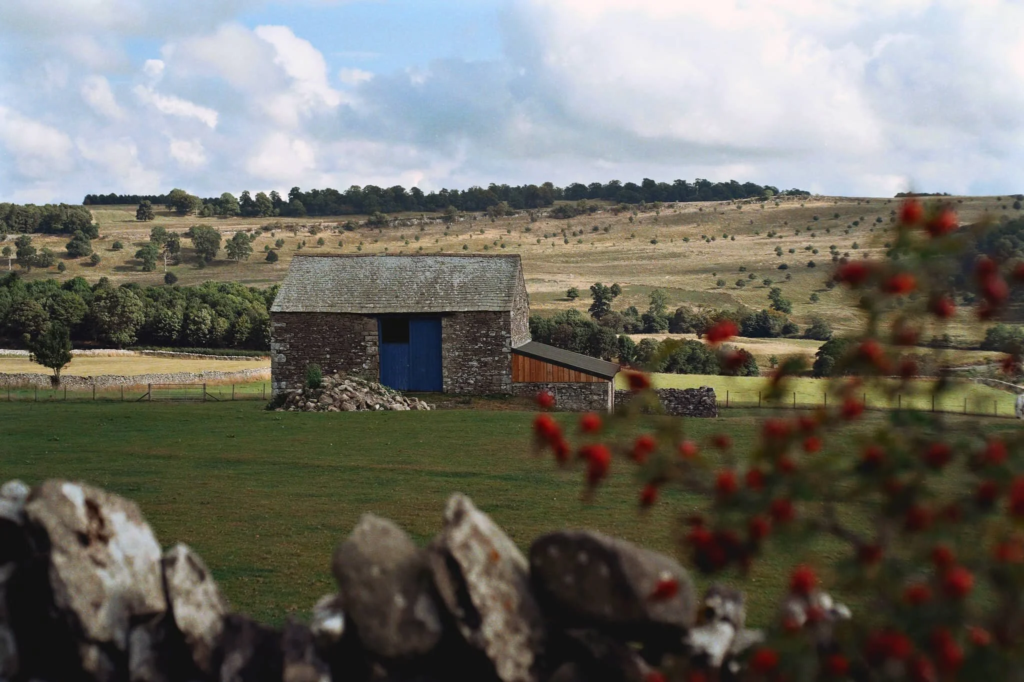
On the way up the bridleway toward Askham Fell, we stop to admire this dilapidated barn.
We paused on our way up the bridleway to admire the light and views towards Burtree Scar.
Near the flat top of Askham Fell, there were a fair few hay bales dotted around the fell side, which I didn’t expect.
Another Kendal Rough Fell yow, chilling as we made our towards Helton.
An impossibly pretty farmhouse, with many of its original features still intact.
Helton has some proper bonny cottages.
Didn’t spot any red squirrels, unfortunately.
This row of cottages in Helton enjoy some crackin’ views across the valley to Burtree Scar and the Ullswater Fells.
By this point in the day, the sky was really starting to clear up. Another barn gave me a lovely subject for this composition.
Into the woods near Gillriggs Cover as we make our way towards Askham and ultimately back to Lowther Castle.
The track took us past St. Peter’s church in Askham. Some of its windows and gravestones have seen better days.
A very low and dry River Lowther, shot as we crossed Askham Bridge to head back up the woods to Lowther Castle.
Just a nice scene and soft light as we hiked up the steep route through Lowther Castle woods.
Walla Crag, Lake District, Autumn
Autumn has arrived.
Autumn has arrived.
The “life” from all the verdant vegetation is starting to wane, the ferns are turning rust-hued, and the leaves are beginning to drop. Autumn’s here, and I cannot wait for those autumnal colours.
Whilst we wait, we decided today on a venture up a relatively small fell that we’ve never tried before: Walla Crag (379 m/1,243 ft).
At “only” 379 m tall it’s definitely one of the smaller fells, especially when compared to some of the giants in the area such as Skiddaw (931 m/3,054 ft) and Blencathra (868 m/2,848 ft). Nevertheless, what it lacks in height it makes up for in the jaw-dropping views it offers from its summit.
All photos shot on my Fujifilm X-T2 using my three prime lenses: a Samyang 35mm f/1.2, a Laowa 9mm f/2.8, and an adapted Pentax SMC 55mm f/2.0. Developed using RNI Films’ Kodak Ektar 100 profile.
Not far along the trail and already the views really open up. A couple enjoy a picnic in the sun with the backdrop of the Helvellyn fells behind them.
A row of Roman trees, Sorbus aucuparia, filled with their fruit frame the trail looking back to Blencathra in the distance.
The trail starts rising, offering up views looking back towards the likes of Lonscale Fell (715 m/2,346 ft).
By now the full profile of Skiddaw, its fells, and the smooth profile of Latrigg are fully exposed. It’s turning out to be a crackin’ day.
Plenty of other fell walkers were making their way up and down the trail. To the left in the distance is the magnificent slopes and peaks of Blencathra.
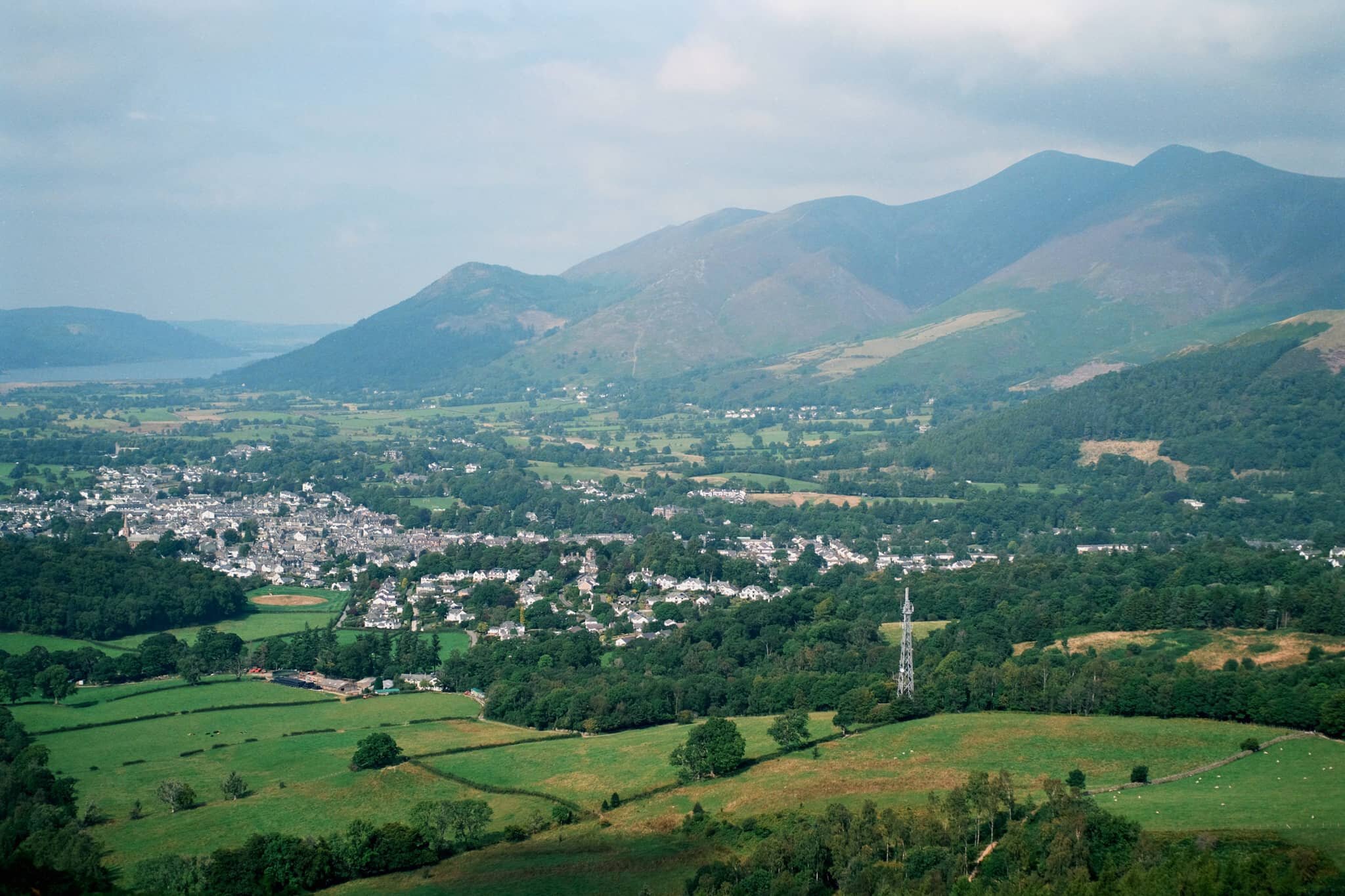
Skiddaw’s multi-peak shape looms of the bonny town of Keswick.
On our way up, the views towards the Derwentwater Fells, too, soon open up and our sense of anticipation grows.
Rowan trees and their vivid berries frame the Derwentwater fells on a somewhat hazy day.
Another lovely aspect to Walla Crag’s environment is the sheer abundance of pink heather everywhere.
The water level at Derwentwater is ridiculously low. New gravelly islands are reappearing and existing ones are gaining new shores.
It soon becomes apparent how much of a drop there is from Walla Crag’s northwestern face.
As more sun comes out, I spot another framing opportunity full of colour.
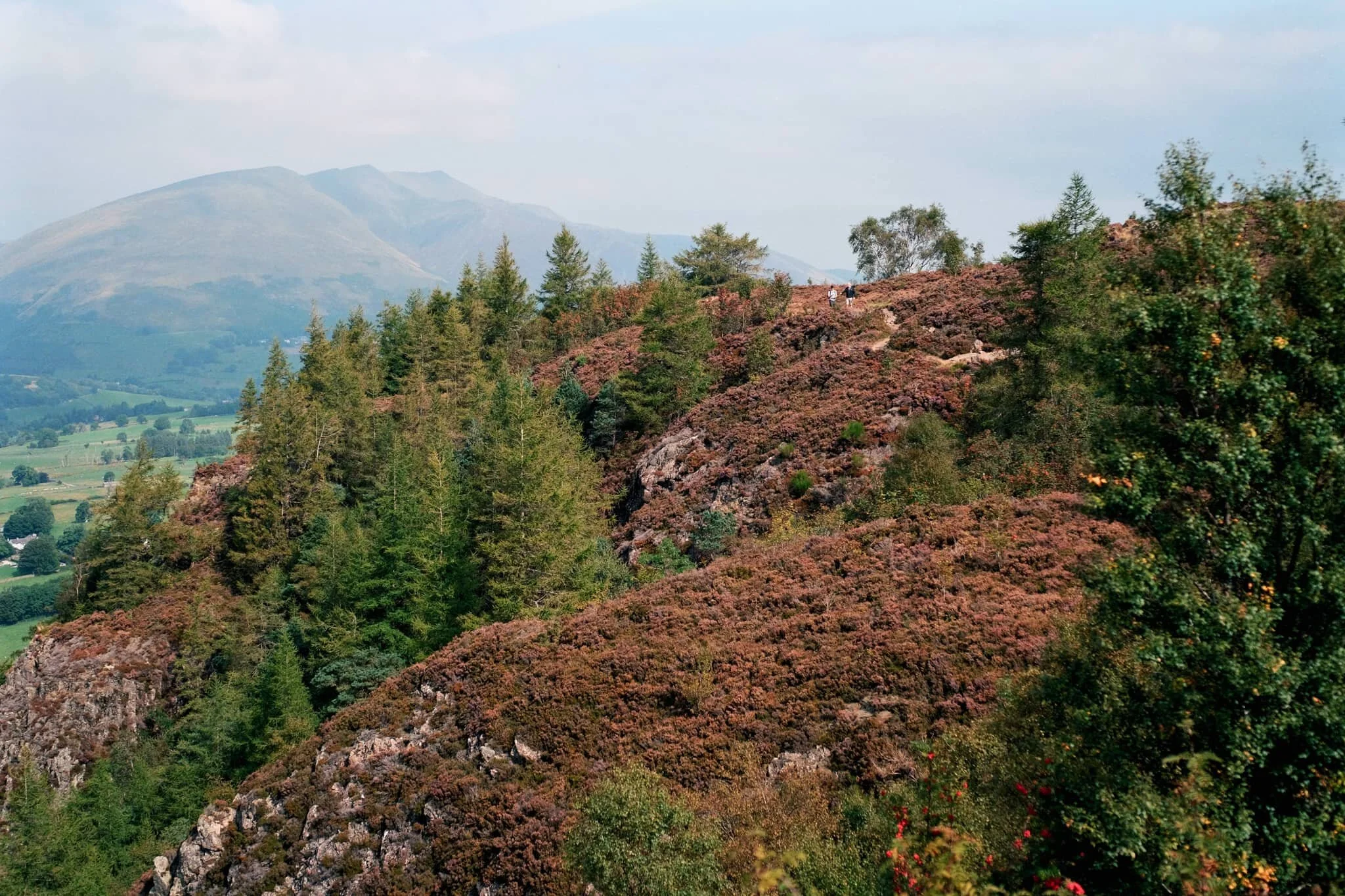
Looking back at the cliff-edge trail we followed. The amount of heather around Walla Crag is ludicrous.
Like, so much heather…
Aaaand… summit! Plenty of other folk enjoying the views from Walla Crag summit too. We stop for a quick bite and some water, taking the panorama in.
My ultra-wide 9mm lens was able to take in the vast panorama available from the summit of Walla Crag. One of the best views in the whole of the Lake District.
With my 55mm attached, it was time to pick out some smaller scenes amongst the vast panorama. The hazy conditions allowed for a wonderful layering affect with Derwentwater Fells.
Mighty Skiddaw looming above Keswick.
After taking everything in, it was time to follow the trail back down from the summit towards the main path off Walla Crag, with heather still in abundance.
Looking across the moorland and ferns, deep into the Jaws of Borrowdale.
Fellow hikers branch off from the path to take in the views towards the Helvellyn range, and Clough Head (726 m/2,382 ft) in particular.
Seemingly endless layers of fells in Borrowdale.
On the way back down off the fell, I spot this tree and arrange it underneath the peaks of Blencathra.
Magnificent Blencathra, demanding our constant attention as we climb off the shoulders of Walla Crag.
This is Armillaria mellea, or honey fungus. Apparently highly revered for its edible qualities, though a lot of UK species react with alcohol badly in people’s bodies causing nausea and vomiting. It’s generally best to parboil these mushrooms, and not consume alcohol for a day before and after eating them.
Follow other hikers along the trail back down to the car. The haze appears to lift somewhat around the Helvellyn fells.
The Helvellyn range above, with High Rigg and Low Rigg below.
Another fantastic day.
Howgills, Yorkshire Dales, Summer
It was time to come back to the Howgills.
It was time to come back to the Howgills.
Back in April this year, 2021, Lisabet and I made our first hike up onto the Howgills, summiting Winder (473 m/1,552 ft), the fell that directly overlooks the beautiful Yorkshire Dales town of Sedbergh. It wasn’t hard, during that hike, to gawp at the next fell along the ridge from Winder, namely Arant Haw at 605 m. We vowed to return and tackle Arant Haw.
Today was that day.
The forecast was for clear skies and pushing 20°C, but when we arrived at Sedbergh for around 9am it was relatively chilly and cloudy. As we began our ascent up the Dales High Way up into the Howgills—and the views opened up—it became apparent that the cloud base still hadn’t quite cleared the fell tops. This resulted in amazing light and weather conditions, significantly slowing down our hiking progress (but all for good reason).
After a proper good pull, we managed to summit Arant Haw as well as add on the smaller fell of Crook on the way back down.
What a crackin’ day.
All photos shot on my Fujifilm X-T2 using two of my prime lenses: a Samyang 35mm f/1.2 and a Laowa 9mm f/2.8. Developed with RNI Films’ Kodak Portra 160 profile.
The way marker indicates the Dales High Way, the main trail that takes you up into the Howgills from Sedbergh. The fell on the left is Crook.
This was the kind of light show we were subject to on our way up the Howgills. The cloud base was clinging to the top of the Garsdale and Dent fells, and as the sun was rising they were swirling as they burning off.
Shapely Winder from the Dales High Way. Not our destination for the day.
A fell runner and her anxious dog passed us on their way across Settlebeck Gill and up Crook.
Plenty of lambs and young sheep around the Howgills, warily watching us we disturbed their grazing.
It wasn’t long before we spotted more people heading up the trail behind us. We weren’t in a rush. The light and views were too good to miss.
The view looking up Settlebeck Gill. That little hill in the distance with the trail running over it? That’s our destination: Arant Haw.
Looking down Settlebeck Gill, the light and views just get better and better.
The small Frostrow Fells catching the morning light, whilst the Dent fells recede in shadow. Astounding.
The steep folds of Settlebeck Gill, leading down to Sedbergh and the Barbondale fells beyond.
After reaching the plateau above Settlebeck Gill, our destination becomes immediately obvious: Arant Haw.
Looking back to Winder, morning light scanned across the fells and I waited for it to reach the summit of Winder before snapping this composition.
The view north from the summit of Arant Haw. Good heavens.
The views north from Arant Haw take in a succession of Howgills peaks and valleys, felltops such as Calders (674 m/2,211 ft), Bram Rigg Top (672 m/2,205 ft), The Calf (676 m/2,218 ft, highest point of the Howgills), and White Fell (636 m/2,086 ft). The clouds clung to the felltops as the day brightened
Looking down the gill of Swarth Greaves Beck eastwards. Views for miles and miles.
Just astounding.
The western spur that juts out from Arant Haw gives you an indication of the steepness of the fell’s western face.
Zooming in more, I love this arrangement of horizontal and diagonal lines created by the fells and gills.
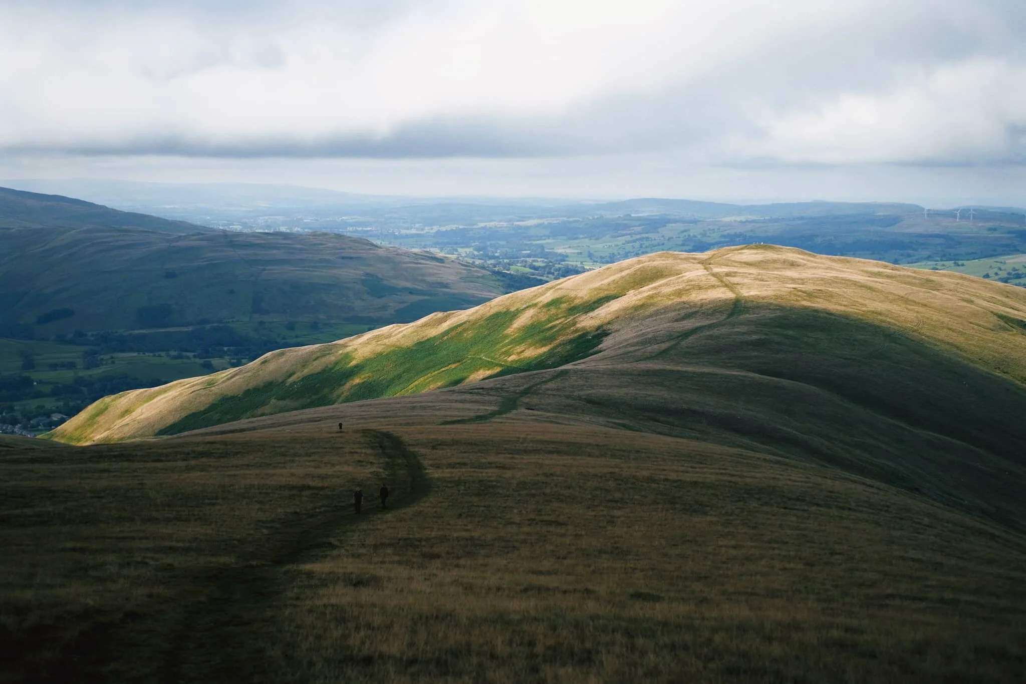
Time to head down Arant Haw. The conditions looking back to Winder and Sedbergh were starting to brighten up significantly.
The little knobbly fell to the right is our next destination: Crook. There’s not any “official” path to the fell, but that’s no major bother anyway. The Howgills is all Open Access Land.
Swaledale and Rough Fell sheep enjoy the views towards Garsdale as much as we do, it seems.
Even though Crook is only 450 m high or so, the views from its summit are no less impressive.
From Crook it was even possible to make out the back of Wild Boar Fell in Mallerstang, looking northeast.
Looking back up to Arant Haw from around Crook summit, the light getting brighter and brighter.
It was time to come off the Howgills, Lisabet leading the way ahead. We decided on the Soolbank route off Crook, heading down into Settlebeck Gill.
Once we were alongside the banks of Settlebeck Gill, it was simple enough to follow the gill all the down until you could cross and rejoin the Dales High Way back into Sedbergh.
Settlebeck Gill is an impressive sight. The little people hiking the Dales High Way give an indication of scale.
The way back down into Sedbergh, the fells now free of clouds.
North Pennines Waterfalls, County Durham, Summer
Woohoo for a week off! With the Lake District as rammed as it is at the moment, let’s go somewhere a l’al bit different.
Woohoo for a week off! With the Lake District as rammed as it is at the moment, let’s go somewhere and l’al bit different.
The North Pennines AONB (Area of Outstanding Natural Beauty) is a favourite of ours but remains relatively untouched by us. We’ve explored arguably the jewel of the North Pennines, High Cup Nick, many times. But another absolutely stunning part of the area is the three main waterfalls: High Force, Low Force, and Cauldron Snout.
Long-time followers of this blog may remember our last excursion to High Force and Low Force, last year. The two waterfalls are a geology student’s dream and truly spectacular. But the third waterfall, Cauldron Snout, is often missed out on compared to the other two. That’s because it’s many miles further up the River Tees, near Cow Green Reservoir. Like High Force and Low Force, Cauldron Snout is the result of the outflow of Cow Green Reservoir passing over the whin sill; a layer of prehistoric super-hard dolerite volcanic rock that has left pillars and columns. The waterfall has eroded the softer rock around, leaving the harder columns of whin sill standing.
Cauldron Snout “only” drops about 60 m, all in all, but does so steeply down 180 m of the gorge, making it one of the longest waterfalls in England. The last time we visited it was many years ago in between Christmas and New Year, and a lot of the rock around the waterfall was covered in ice, making it a treacherous task to navigate. This time, we managed to scramble all the down alongside the waterfall. It was immense.
All photos shot on my Fujifilm X-T2 using my three prime lenses: a Samyang 35mm f/1.2, a Laowa 9mm f/2.8, and an adapted Pentax SMC 55mm f/2.0. Images developed using one of RNI Film’s Kodachrome profiles, finished in Affinity Photo.
Low Force is probably the easiest of the three to access, being less than a kilometre’s walk from the Bowlees Visitor Centre. Regardless, it’s an impressive sight and sound.
My lovely Lisabet, already on the case and getting some compositions in.
I clambered around the columns and cliffs of whin sill to get to the northern bank of the Tees for this view of the main falls of Low Force. The morning’s light was wonderful and I didn’t want to miss out.
The twin falls of Low Force. Not necessarily all that tall, but powerful and loud.
The conditions and light were beautiful. Not too harsh. Autumn’s definitely on the way.
One gentleman decided that a dip in the waterfall was in order.
Fair play to him.
The Pennine Way heads along this footbridge, which crosses the River Tees below. It’s an old ‘un, too, so all the signage requests people cross it one at a time.
The lower aspect of Low Force shot from the southern banks of the Tees after we crossed the bridge.
After I spotted this young lass climbing the statues, I think she looked rather… sheepish?
A tighter composition of the main falls of Low Force, trying to convey the sheer power of these waterfalls. The redness in the water comes from all the peat the river carries from the high moorlands of the North Pennines.
Looking back at the northern bank of the River Tees, with more people finding their now to the waterfalls. Best get a move on.
Lisabet doing her best to capture all the splendour around her.
Love all the signs of autumn starting to appear.
Looking forward to all the rusty colours of autumnal ferns.
After trekking the Pennine Way along the southern side of the River Tees, we crossed another old footbridge and took these steep steps up towards the road. A visit to High Force beckoned us.
The woodland above the Tees is still lush.
After paying our entrance fee (£2 per adult, very reasonable), we followed the path through the woodlands of the Raby Estate. Already, we could hear the booming sound of the giant waterfall, High Force.
The first glimpse of High Force and the gorge it’s created. The excitement builds…
And there she is, plunging 70 ft off a cliff into the deep pool below. What a sight.
We scrambled down to the boulder field left behind by the receding waterfall, each of us seeking our own photographic compositions of the waterfall.
Of course, mine predominately featured all the wonderful shapes of the boulders.
After thousands and thousands of years, as the waterfall carves its way back up the River Tees, it’s left behind boulder with fascinating shapes and textures.
Plenty of other folk were clambering around the boulders for better views of the awesome High Force.
Nature makes you feel closer.
Due to the COVID-19 Pandemic, the High Force trail is a one-way system now, so we hiked up the steep steps out of the gorge and navigated through the Raby Estate woods back to the car. My lovely Lisabet, looking as stunning as ever.
Upper Teesdale has a similar “feel” to a Yorkshire Dales valley, to me.
After a break for lunch, we drove a few miles west and parked at Cow Green Reservoir, seeking out Cauldron Snout. Along the way, views across the reservoir can be had of Meldon Hill (767 m/2,517 ft).
We crossed the dam for views over the reservoir and below to the Tees. Clouds of midges were out in full force.
Looking down onto the Tees from the top of the dam. You can just make out to the left the top of Cauldron Snout before it crashes down into the valley.
Cow Green Reservoir was constructed in the late 1960s to supply the industries of Teeside with a constant supply of water.
The reservoir essentially acts as a river regulator, ensuring the River Tees is always flowing with water even during dry conditions.
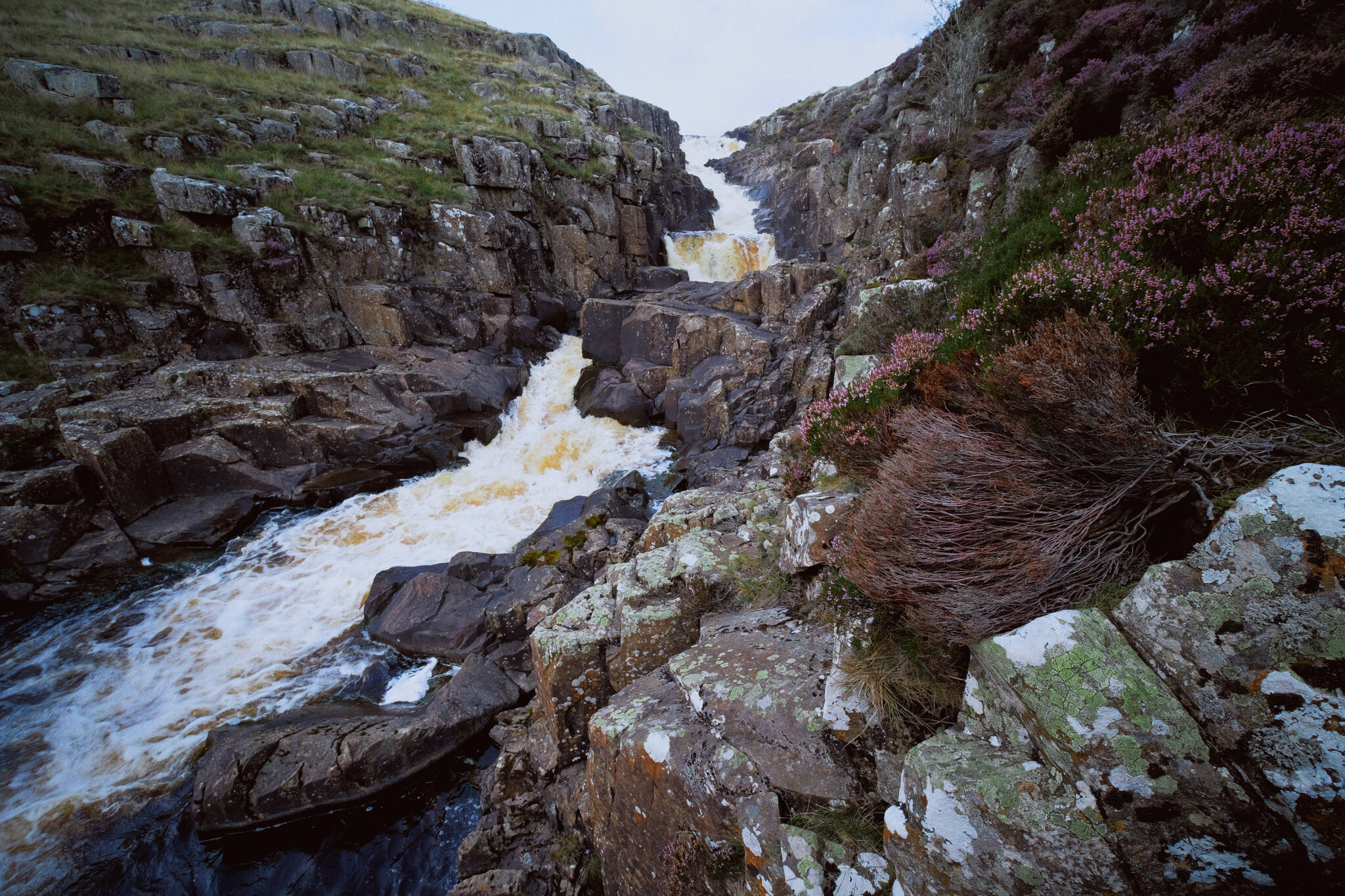
And here’s the top of Cauldron Snout. The Pennine Way is to left, but it isn’t really a “path” as such as navigating and scrambling down the side of the gorge created by the waterfall.
But doing so enables you to get right next to the falls for cracking views like this. A man perched at the top of the falls helps provide a sense of scale.
With the heather in bloom, they provided wonderful pops of colour around the waterfall.
Scrambling down the gorge was exhilarating, and definitely something that would not have been possible for my condition 5-years ago.
As the gorge sheltered us from the wind, this provided the necessary moist and still conditions for clouds of midges to form everywhere. They duly took advantage and started ravaging our bare flesh.
Near the bottom of Cauldron Snout now, and we can start to understand the scale of these falls.
The bottom of Cauldron Snout, which climaxes with this beautiful fanned curtain of a waterfall.
Colwith Force, Summer, Lake District
After two successive weekends of rain, it was time to seek a waterfall or two.
After two successive weekends of rain, it was time to seek a waterfall or two.
Getting outside for some solid hiking has been difficult given the changeable conditions we’ve experienced in August. Thankfully, the week ahead is looking promising, which is fortuitous because I have a week off.
Lisabet and I got up and out early to avoid the crowds, taking on a good 10,000 steps to visit both Skelwith Force and Colwith Force. Both waterfalls are not large but after prolonged rainfall they are powerful.
All photos shot on my Fujifilm X-T2 using two of my prime lenses: a Samyang 35mm f/1.2, and a Laowa 9mm f/2.8. Developed using RNI Films’ Kodak E100G film profile.
Getting as close as I dare to Skelwith Force. After rainfall the roaring thunder from these falls is near deafening.
Lisabet was braver than me, and clambered down the crags to the small footbridge for a different view. The spray from the falls leant a delicious mood to the scene.
We crossed the river and double-backed onto the Cumbria Way, stopping near Park House and Park Farm for some glorious views towards the Langdale Pikes as the cloud started to clear from the fells.
Gorgeous Herdwick ewes, fleeces clipped short after a hot summer and their smit marks reapplied.
Near Low Park we spot a good clump of Impatiens glandulifera, or Himalayan Balsam. It is considered a highly invasive species.
This year’s Herdwick tup lamb, just starting to grow its horns.
One of my favourite trees in the Skelwith/Colwith area. Truly gnarly, with the clouds burning up from the fells.
What a scene.
The way down to the River Brathay, with Wetherlam fighting with the clouds above.
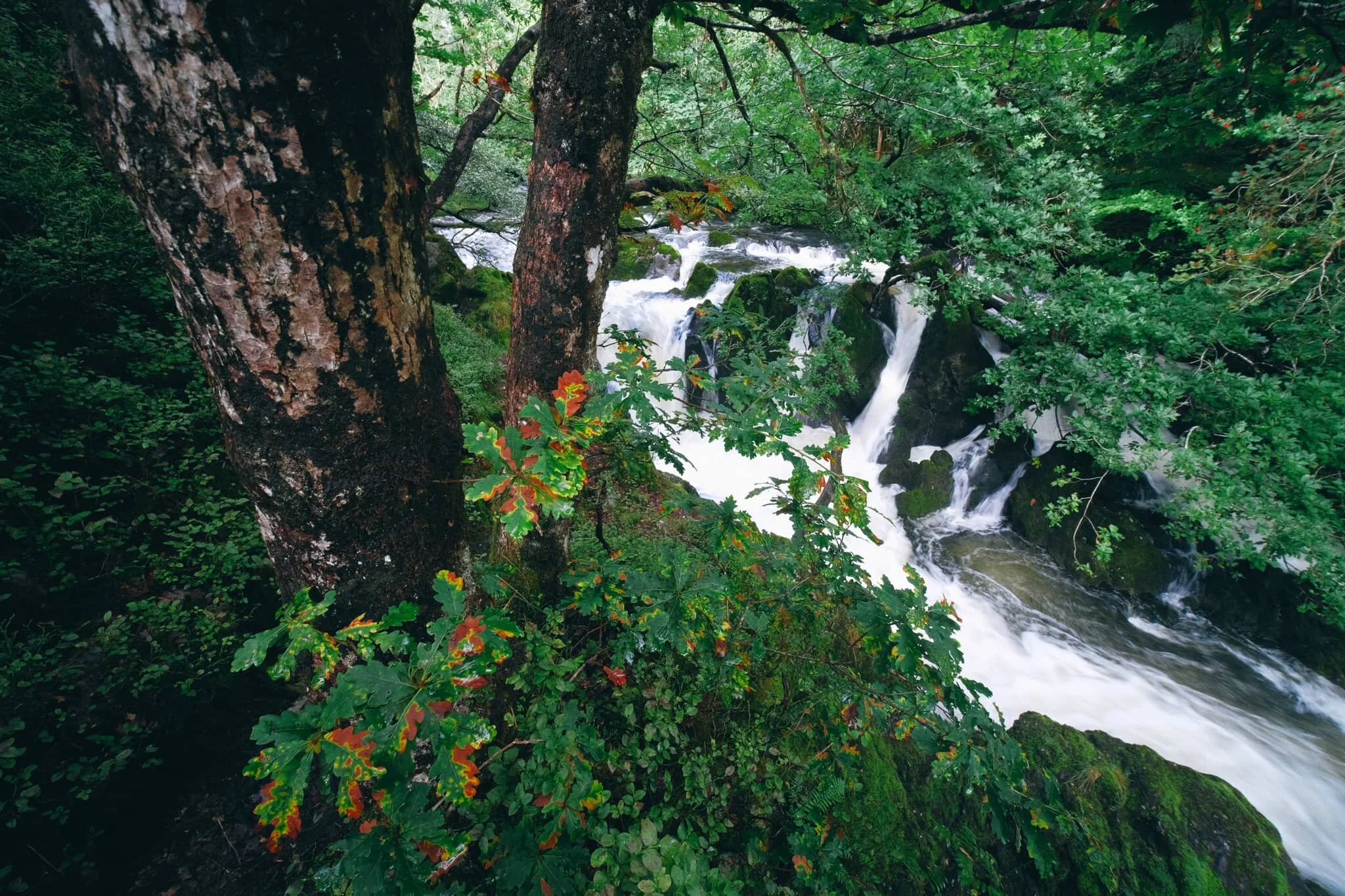
Heading to Colwith Force. Already we can here the bassy roar of the twin spouts…
And there she is, looking absolutely incredible after all the rainfall we’ve had.
We climbed the pitched path to get to the upper part of the falls, teetering near the top of the main falls.
I plugged my 9mm ultra wide onto the camera to try and capture the scene from above the main falls.
It’s always an exciting time when the foliage starts to turn towards those wonderful autumn hues.
One final look at the upper falls before we climb higher through the woods.
Sometimes you just have to take a picture of a pretty tree.
After popping out of the top of the woods you’re greeted with the craggy top of Great How. Additionally, the sun decided to show its face.
We decided to to explore a little extra and took the path towards Stang End, snapping High Park Farm along the way with Lingmoor Fell above.
By this time of the day, many more people were on the paths enjoying the weather and scenes.
To cap the day off, we were greeted by a vocal chicken navigating its way on top of a dry stone wall. As you do.
Hodge Close Quarry, Lake District, Summer
Time for something a little different.
Time for something a little bit different.
The Lake District is obviously world famous for its natural splendour; the lakes, fells, tarn, waterfalls, and everything in between. But beneath the surface of this picture of paradise lies thousands of years of man-made work.
Mining has been a feature in the Lake District landscape for hundreds of years. Copper, graphite, lead, slate… you name it, it’s probably been found and mined for. One of the bigger historical industries in Lakeland was slate mining; I say “historical”, slate mining still occurs at Honister Pass, inside Fleetwith Pike.
Slate was mined extensively in and around the Coniston area, too, particularly in the 19th century when Lake District slate was in demand for “roofing Britain”. Three miles north of beautiful Coniston, one can find one of the biggest leftover workings of slate mining in the whole of the Lake District: Hodge Close Quarry.
Lisabet and I have been meaning to find and explore Hodge Close Quarry for quite some time now. Lisabet’s been before, but many moons ago. I, on the other hand, have only ever had Google Images and Pinterest to go on. We parked up in lay-by just north of Yew Tree Tarn and follow the easy trail northwest, clearly signposted for Hodge Close Quarry. Along the way, one can enjoy frankly spectacular views of the Langdale Pikes and Central Fells of the Lake District. This was an aspect of the hike I had no idea of!
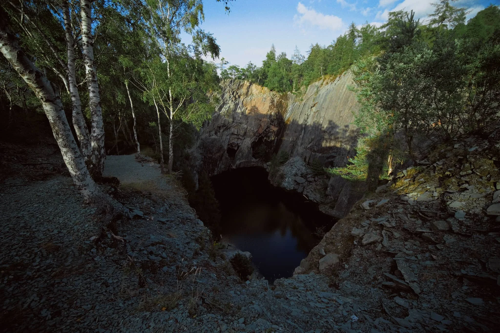
Arriving at Hodge Close Quarry, and taking careful note of all the warning signs, we were greeted by a cavernous scar in the earth; sheer walls dropping 150 ft into a dark pool, itself a depth of around 150 ft. What a wonder; and what work man has performed!
We spent a good couple of hours around the quarry, shooting compositions in the gorgeous evening light. And there was no hardship in retracing our steps back to the car, as the light just better and better.
One of the most beautiful evening walks in the Lake District I’ve had for a while.
All photos shot on my Fujifilm X-T2 using my three prime lenses: a Samyang 35mm f/1.2, a Laowa 9mm f/2.8, and an adapted Pentax SMC 55mm f/2.0. Images made 75% in-camera, with RNI Film’s Kodachrome film profile applied afterwards.
The way up to Hodge Close Quarry, via a bridleway known as Smithy Brow. Probably literally named.
I couldn’t tell you what this piece of farming tech is called, but it certainly looked long abandoned.
The first of many delightful scenes available from Smithy Brow. Taking in Lingmoor Fell (469 m/1,539 ft), Pike of Blisco (705 m/2,313 ft), and Bowfell (902 m/2,959 ft).
The view looking towards the northeast, taking in Seat Sandal (736 m/2,415 ft) and Dollywaggon Pike (858 m/2,815 ft).
That wonderful towards the northwest once again, shot near one of the disused farm barns alongside Smithy Brow.
Freshly clipped (sheared) Swaledale sheep, enjoying the grassy offerings around High Oxen Fell.
The area between High Oxen Fell Farm and Hodge Close Quarry is densely wooded and filled with ferns.
Just a lovely scene involving the Lake District’s famous dry stone walls and a knobbly coppice.
Nearing the quarry, we pass through a load of holiday cottages that enjoy spectacular views of the Coniston fells. They were probably all mining buildings once.
The first sight you see of Hodge Close Quarry. Quite the drop, eh? 150 ft down to the dark pool below. A young couple perched on top of the crag gives you a sense of scale.
Thankfully, with my 9mm ultra-wide lens at hand, I was able to capture immense compositions that could feature both the dark pool and the sheer walls of the quarry, all at once.
We scanned along this western edge of the quarry, shooting along the way as the light gradually faded along the top of the crags.
It’s easy to feel weak in the knees when capturing the sheer drop down…
We skirted around the southern and eastern edges of the quarry, nabbing compositions of the chasm with the Langdale fells in the distance.
This is the view the aforementioned young couple would’ve enjoyed.
We joined the Holme Fell trail northwards, looking to reconnect with the Smithy Brow bridleway back to the car. Lush carpets of fern everywhere gives a real “jungle” vibe to this scene.
The setting sun was providing beautiful deep tones of orange when peaking through the canopy and hitting the trees.
Peeping through the head-height ferns for this composition of Black Crag.
My lovely Lisabet, always the perfect accompaniment to any hike.
High Oxen Fell Farm, now property of the National Trust courtesy of Beatrix Potter. Probably built in the 1600s.
The nice thing about retracing the route back was enjoying the views in reverse with even better light.
Low Oxen Fell and Great How, with the gentle sunset light pulling out the contours of the landscape.
What a scene! What light!
Basking in the golden glow.
Layers and layers.