
Walla Crag, Lake District, Summer
A 4am start.
A 4am start.
The UK is on the cusp of a record-breaking heatwave, kicking in Sunday evening/Monday morning. Even before the real heatwave arrived, Sunday’s temperatures up here in Cumbria were looking to peak at around 26°C. Not only that, summer in the Lake District is easily its busiest time. So what to do?
Wake up before the sun rises and get to our destination before everyone else.
We decided on revisiting the small Walla Crag above Derwentwater, a new favourite after our first venture in autumn last year. Upon leaving the house we were greeted with something we didn’t expect before a heatwave, but probably should’ve anyway.
Rain.
We pulled up at the parking spot, and thankfully it only took 15 minutes or so for the rain to cease. By about 6:40am we started the walk up to Walla Crag.
Although the rain had cleared, it was still completely overcast even as temperatures quickly rose. The sun was not able to break through. So although light conditions were not the best, the views were still utterly magnificent.
All photos taken on my Fujifilm X-T2 using my Vivitar “Series 1” 28–105mm f2.8–f3.8 zoom lens. Shot using the Classic Chrome film simulation, developed in Capture One for iPad, cleaned up in Affinity Photo for iPad.
Walla Crag, Lake District, Summer by Ian Cylkowski is licensed under CC BY-NC-SA 4.0![]()
![]()
![]()
![]()
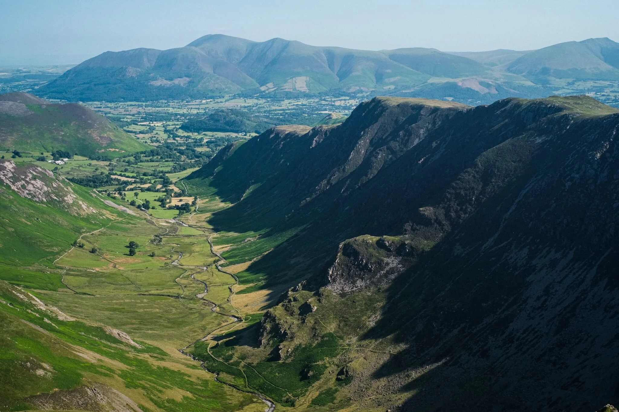
Across the fields from the Walla Crag path, Low Rigg looks diminutive against the imposing crag face of Clough Head, part of the Helvellyn range.
As we began the steep ascent up to Walla Crag, the views looking back opened up quickly. Here, Blencathra’s beautiful shape is unmistakeable.
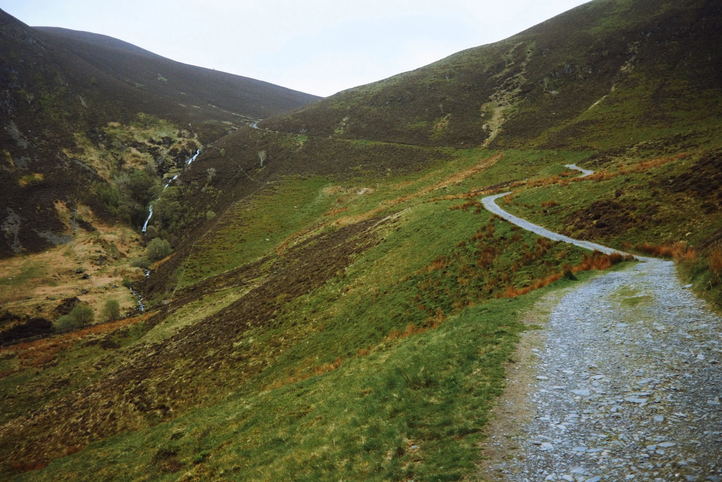
The way up to Walla Crag, a short and sharp ascent.
Once up on the more level part of the fell, a small gate through the drystone wall allows you to take the more exploratory route to Walla Crag’s summit. Near the crag’s cliff edge, clear panoramas can be enjoyed across Derwentwater to the Grisedale fells.
Back along the cliff edge towards Blencathra, already there is some heather starting to appear. Give it another month or so for it to be in full resplendent bloom.
The smooth multi-peaked profile of Skiddaw, England’s 6th highest peak.
Walla Crag’s cliff face is lush, chock-full of fern, trees, heather, and loads of other flora. Lisabet discovered a small bilberry bush, and helped herself to a couple of the tart berries.
The summit of Walla Crag! Looking back north towards Skiddaw, a dominant presence on the Keswick skyline.
Derwentwater looks dry, with a couple of new islands becoming exposed as the water level drops.
One final composition from the summit, this time featuring Blencathra’s curved forms.
Walking towards the Jaws of Borrowdale.
Probably my favourite composition of the day. The drystone wall keeps livestock out of the Walla Crag area, allowing flora to flourish. In the distance is Derwentwater’s southern tip with the Borrowdale fells high above.
The other side of the same wall, featuring more of the Catbells ridge.
On the way back down the fell, I couldn’t resist revisiting this composition.
Pretty happy with how this shot of a family of fell ponies came out.
Did you like these photos?
Dash Falls, Lake District, Spring
Here’s another place I’ve been meaning to explore for ages.
Here's another place I've been meaning to explore for ages.
The Northern Fells of the Lake District are dominated by two champions: Skiddaw and Blencathra, the 6th and 18th highest mountains in England respectively. These fells make up a wall of peaks at the southern end of the Northern Fells, looming directly over Keswick and Threlkeld.
There are, however, numerous fells and valleys behind Skiddaw and Blencathra, and by comparison these fells see little footfall. On the western side of the Northern Fells, nestled in between the Uldale fells and the Back o' Skidda is the Dash Valley. At the head of this valley drops a rather spectacular waterfall, Dash Falls, also sometimes called Whitewater Dash waterfall. Rather than being one single drop, these falls take the form of a series of steep cascades from the head of Dash valley to the valley floor.
Though the day was relatively overcast, the scenes were no less epic. Happily, there were also plenty of Herdwicks about!
All photos taken on my Fujifilm X-T2 using my three prime lenses: a Fujinon 23mm f/2.0, a Laowa 9mm f/2.8, and an adapted Pentax SMC 55mm f/2.0. Images developed using RNI Films' Kodachrome film profile.
The first part of the walk involves navigating through livestock pasture to reach Peter Houses Farm and joining the Cumbria Way. Already, scenes were looking incredible.
Herdwicks! With their lambs, perhaps only a couple of weeks old.
A true Lake District scene: Herdwicks and the fells.
Our first sight of Dash Falls. From this point on the Cumbria Way is properly paved and easy to follow all the way to the falls.
Looking back at the way we came. On the right is Binsey, an isolated little hill that nevertheless enjoys fantastic views.
A marker stone indicates the bridleway ahead towards Dash Falls. Beyond the falls you can carry on over via the Cumbria Way towards Skiddaw House, a hostel in the middle of Skiddaw Forest.
The path gets steeper and the falls get closer.
Near the top of the path you can enjoy the view straight down the falls. It might be possible to clamber down and get right alongside them, but I wouldn't dare.
With my ultra-wide lens on, I was able to capture this expansive scene of the Dash valley from the top of Dash Falls.
On the way back down, after a spot of lunch and rest, I kept the 9mm lens on to snap some expansive views of the valley from the top.
Looking straight down Dash Valley. There's loads of heather about, so this will be a great place to return to in late summer.
A 6-shot vertorama with my 55mm lens of Dead Crags, which looms above the southern side of Dash Valley.
One last look back, a zoomed in composition of Dash Falls as it cascades down the sheer face of Dash Valley's head.
A quizzical cow scopes us out as we near the start of our walk at Bassenthwaite village.
Dodd, Lake District, Winter
Thankfully a dry, if bitingly cold, weather system has descended on the British Isles.
Thankfully a dry, if bitingly cold, weather system has descended on the British Isles.
On the Saturday, Kendal was engulfed in a soupy-think mist. It almost seemed to muffle the world in a pillow. In actuality, a temperature inversion sat on top of a lot of Lake District valleys, including Kendal. Conditions above the inversion were clear, sunny, and bright.
So, for the Sunday, we decided to head to the Northern Lakes for a hike up Dodd, part of the Skiddaw range. Local weather reports indicated that a temperature inversion would continue to cling to the fells below 450 m or so, but otherwise the day would be sparkling clear above. Dodd measures 502m above sea level.
In the end, the temperature inversion wasn’t quite as extensive around the Northern Lakes, mostly sitting on top of Derwentwater. Nevertheless, conditions were glorious, the Lake District was quiet, and hiking Dodd is always a good exercise.
All photos shot on my Fujifilm X-T2 using my three prime lenses: a Fujinon 23mm f/2.0, a Laowa 9mm f/2.8, and an adapted Pentax SMC 55mm f/2.0. Images were bracketed handheld, merged and blended in Affinity Photo, then finalised in Snapseed.
The Old Sawmill Tearoom, at the car park below Dodd. A beautifully quaint and cosy place.
Hiking up Dodd is simple enough. Just the follow the green signposted trail. As we did we rose above the leftover mist in the woods, and the sun pierced through the woodland.
Most of Skiddaw, like a lot of Lakeland fells, lacks significant tree cover. Dodd’s an exception, and its dense woodland is managed by the Forestry Commission.
Couldn’t resist snapping a composition of this Sleepy Hollow-esque tree, seemingly pointing the way up through the woodland.
As we started to emerge above Dodd Forest, more of the fell’s rough and craggy summit becomes apparent.
One of many incredible views you can enjoy around the summit of Dodd. Above the woods and the temperature inversion, a clear sight towards the Helvellyn range reveals itself.
It’s hard to keep up the hiking momentum when panoramic views like this constantly vie for your attention.
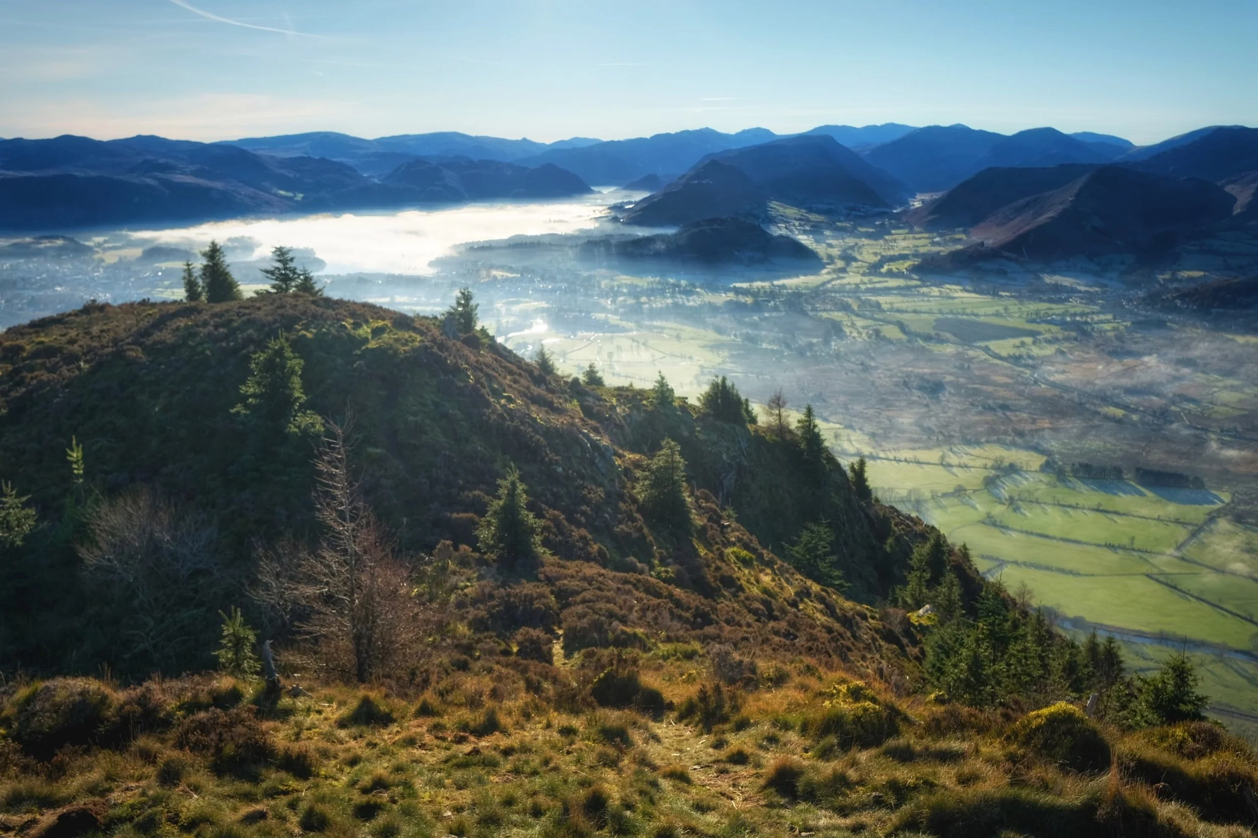
Nearing the summit of Dodd. To the left a temperature inversion clings to the surface of Derwentwater, creating a lake-sized mirror reflecting the morning sun. To the right are the Newland fells; tiny tufts of fog cling to dales below.
From the summit of Dodd. Bassenthwaite Lake was impossibly still, and the atmosphere was clear that you could see all the way across to the Cumbrian coast and beyond to Galloway in Southwestern Scotland.
We rested on the summit for coffee and fruit, but I had to snap another composition looking back to the magnificent shapes of the Helvellyn range.

With my 55mm attached I tried for some focused compositions of some of the nearby fells from Dodd summit. The wooded fell here is Barf (yes, that’s right).
The shapely peak pictured above the dale here is Grisedale Pike.
As we started to descend, more compositions offered themselves to me. Immediately above is the southern face of Carl Side with Little Man behind it.
The way back down Dodd’s southern aspect is quite steep, but no less beautiful.
As we near the bottom, Ullock Pike glows in the midday wintersun.
Despite being in winter, Skill Beck was surprisingly lush and verdant.
The remnants of Storm Arwen’s destruction made for some nice ultra-wide compositions.
There’s a lot of lush fern to be found alongside Skill Becks many mini waterfalls.
Another casualty of Storm Arwen, now left where it fell to provide life and nourishment for all denizens of the forest.
Walla Crag, Lake District, Autumn
Autumn has arrived.
Autumn has arrived.
The “life” from all the verdant vegetation is starting to wane, the ferns are turning rust-hued, and the leaves are beginning to drop. Autumn’s here, and I cannot wait for those autumnal colours.
Whilst we wait, we decided today on a venture up a relatively small fell that we’ve never tried before: Walla Crag (379 m/1,243 ft).
At “only” 379 m tall it’s definitely one of the smaller fells, especially when compared to some of the giants in the area such as Skiddaw (931 m/3,054 ft) and Blencathra (868 m/2,848 ft). Nevertheless, what it lacks in height it makes up for in the jaw-dropping views it offers from its summit.
All photos shot on my Fujifilm X-T2 using my three prime lenses: a Samyang 35mm f/1.2, a Laowa 9mm f/2.8, and an adapted Pentax SMC 55mm f/2.0. Developed using RNI Films’ Kodak Ektar 100 profile.
Not far along the trail and already the views really open up. A couple enjoy a picnic in the sun with the backdrop of the Helvellyn fells behind them.
A row of Roman trees, Sorbus aucuparia, filled with their fruit frame the trail looking back to Blencathra in the distance.
The trail starts rising, offering up views looking back towards the likes of Lonscale Fell (715 m/2,346 ft).
By now the full profile of Skiddaw, its fells, and the smooth profile of Latrigg are fully exposed. It’s turning out to be a crackin’ day.
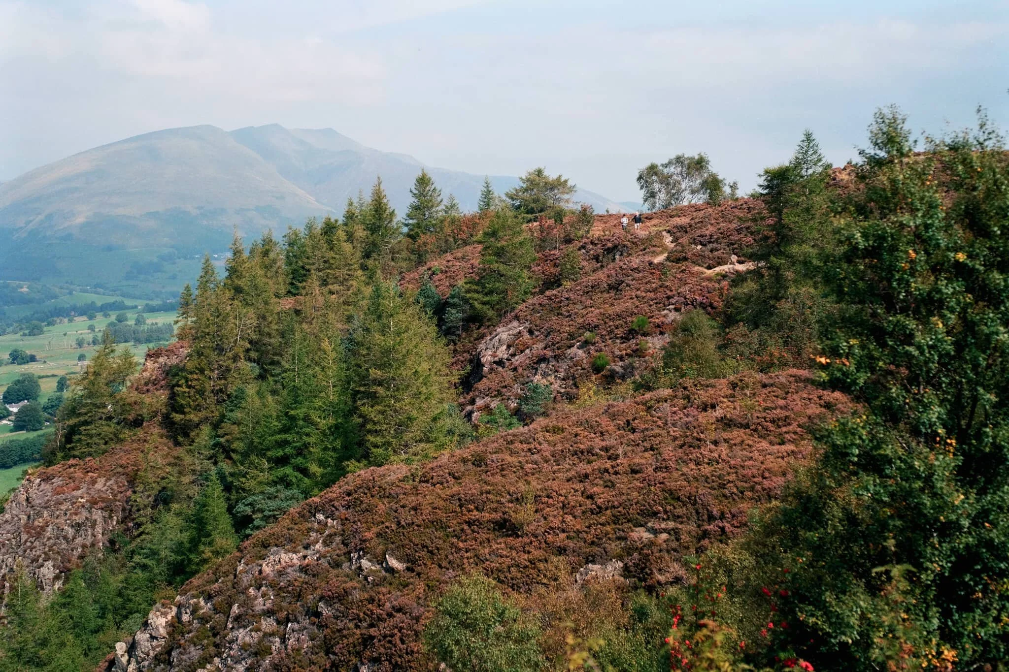
Plenty of other fell walkers were making their way up and down the trail. To the left in the distance is the magnificent slopes and peaks of Blencathra.
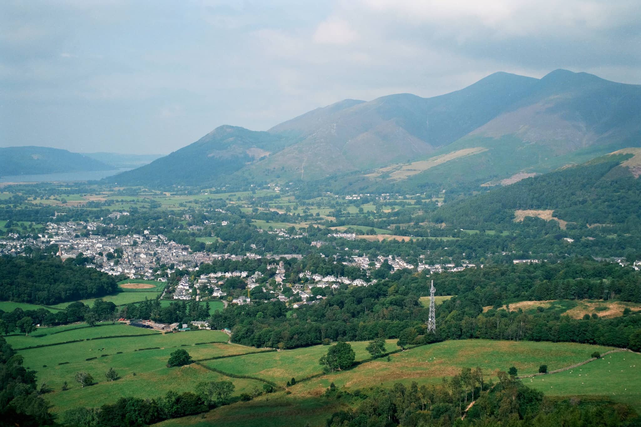
Skiddaw’s multi-peak shape looms of the bonny town of Keswick.
On our way up, the views towards the Derwentwater Fells, too, soon open up and our sense of anticipation grows.
Rowan trees and their vivid berries frame the Derwentwater fells on a somewhat hazy day.
Another lovely aspect to Walla Crag’s environment is the sheer abundance of pink heather everywhere.
The water level at Derwentwater is ridiculously low. New gravelly islands are reappearing and existing ones are gaining new shores.
It soon becomes apparent how much of a drop there is from Walla Crag’s northwestern face.
As more sun comes out, I spot another framing opportunity full of colour.
Looking back at the cliff-edge trail we followed. The amount of heather around Walla Crag is ludicrous.
Like, so much heather…
Aaaand… summit! Plenty of other folk enjoying the views from Walla Crag summit too. We stop for a quick bite and some water, taking the panorama in.
My ultra-wide 9mm lens was able to take in the vast panorama available from the summit of Walla Crag. One of the best views in the whole of the Lake District.
With my 55mm attached, it was time to pick out some smaller scenes amongst the vast panorama. The hazy conditions allowed for a wonderful layering affect with Derwentwater Fells.
Mighty Skiddaw looming above Keswick.
After taking everything in, it was time to follow the trail back down from the summit towards the main path off Walla Crag, with heather still in abundance.
Looking across the moorland and ferns, deep into the Jaws of Borrowdale.
Fellow hikers branch off from the path to take in the views towards the Helvellyn range, and Clough Head (726 m/2,382 ft) in particular.
Seemingly endless layers of fells in Borrowdale.
On the way back down off the fell, I spot this tree and arrange it underneath the peaks of Blencathra.
Magnificent Blencathra, demanding our constant attention as we climb off the shoulders of Walla Crag.
This is Armillaria mellea, or honey fungus. Apparently highly revered for its edible qualities, though a lot of UK species react with alcohol badly in people’s bodies causing nausea and vomiting. It’s generally best to parboil these mushrooms, and not consume alcohol for a day before and after eating them.
Follow other hikers along the trail back down to the car. The haze appears to lift somewhat around the Helvellyn fells.
The Helvellyn range above, with High Rigg and Low Rigg below.
Another fantastic day.
The Newlands Round, Lake District, Summer
The Great British Summer Heatwave has arrived.
The British Summer Heatwave has arrived.
In the week leading up to yesterday, Saturday 17th July, I had been planning a fell walk with my friend, Kate. She has more experience fell walking than I do, so we agreed to try a fell walk incorporating a view I’ve been after for years: Dale Head.
As the week progressed, it became apparent that a heatwave would arrive over the British Isles on the day of our walk. So we agreed to get up super early, drive to the location, and start the hike before temperatures became unbearable.
That was exactly the right decision.
Parking up at Honister Slate Mines, we started the steep ascent up the shoulder of Dale Head (753 m/2,470 ft) in comfortable temperatures of 15–16°C and a lovely breeze. By the time we had reached the final fell of the round, Robinson (737 m/2,418 ft), temperatures had risen into the mid-20s and the sun was strong. We had planned it well.
Kate turned out to be the perfect fell walking partner. Relaxed, sensible, and well-provisioned.
Here’s to more fell walking!
All photos taken on my Fujifilm X-T2 using two of my prime lenses: a Samyang 35mm f/1.2 and a Laowa 9mm f/2.8 lens. Images made 80% in-camera using a customised Classic Chrome film simulation, with minor corrections and edits afterwards in Lightroom and Affinity Photo.
The ascent up the shoulder of Dale Head from the Honister Slate Mine quickly opens these incredible views towards Buttermere and the Lorton Vale. Fleetwith Pike (648 m/2,126 ft) on the left was looking magnificent.
Looking back down the path we had taken, now the southern fells were becoming visible. Featuring Base Brown, Grey Knotts, and Green Gable.
At this height, the northern face of Kirk Fell (802 m/2,631 ft) was coming into view.
Aaaannddd… summit! The top of Dale Head, featuring its massive cairn and, more importantly, the ridiculous view if offers all the down the Newlands Valley towards the Skiddaw mountains. 8-years in waiting, and I loved every second.
Though the southern shoulder of Dale Head is steep, it is relatively smooth. By contrast, the fell’s northern face drops 400 m or so in less than a kilometre via Dale Head Crags. This enables this huge open view towards the High Spy and Maiden Moor ridge on the right, and the shoulder of Hindscarth on the left.
Probably my favourite shot of the day. The High Spy and Maiden Moor ridge, with its western flanks dropping sheer to the valley floor in a series of crags. In the distance, the Skiddaw range. Incredible.
Time to rest and refuel, which Kate and I were more than happy to do.
From Dale Head, there are unparalleled views towards the northern face of Fleetwith Pike and even, in the distance, mighty Pillar (892 m/2,927 ft).
West of Dale Head summit it’s easy enough to follow Hindscarth Edge to the next fell, drinking in the views all the way. Here is a clear shot of Buttermere and the massive High Stile range of fells above it.
The view back east shows the sheer craggy drop of its northern face as well as the crags of High Spy. In the distance is the Helvellyn range.
The way forward. Our next goal was to follow Hindscarth Edge and branch off to the right in order to summit Hindscarth itself.
Another view of Fleetwith Pike’s norther face and mighty Pillar in the centre. To the right is High Crag, part of the High Stile range.
Just below Hindscarth Crags I move towards the edge to nab this composition of the High Spy/Maiden Moor ridge with the Skiddaw and Blencathra ranges in the distance. Closer to me, a Swaledale lamb chews the cud and chills.
As we ascend Hindscarth, different views open up eastward. Below is Far Tongue Gill, to the right is Dale Head Crags, and left is Miners Crag and Red Crag of the High Spy/Maiden Moor ridge. In the distance, the Helvellyn range.
And another summit! This time, Hindscarth (727 m/2,385 ft), which offers a wonderful view down to the Newlands Valley floor and the Skiddaw range beyond.
Looking back at the High Stile range, I primarily took this shot for the British Isles-shaped cloud above the fells. You see it?
Being more west than when we started out, the High Spy/Maiden Moor ridge opens up and we can see Catbells (451 m/1,480 ft) as well. In the distance is the beautiful Blencathra fells.
A vertical composition from Hindscarth, looking down the trail to Scope End and the Skiddaw range in the distance. Just incredible views, no matter where you look.
High Spy, Maiden Moor, Catbells with beautiful Blencathra far away.
Kate happily resting by the wind shelter on Hindscarth. Across the valley is our next target, Robinson.
The way to the next fell, Robinson, involves returning back to the Hindscarth Edge trail and carrying onto the Littledale Edge trail towards Robinson. Before we did, I had to capture this panorama of fells from the Hindscarth summit.
Looking back at the Hindscarth Edge trail. Hard to believe we had walked all that way.
The Honister Pass, the top of which marked the start of our hike. We’ve made it quite far. In the distance is Glaramara (783 m/2,569 ft).
Nearing the top of Robinson. The small isolated fell of Rannerdale Knotts comes into view, followed by Crummock Water and Mellbreak above it. We can now see beyond the Lake District out to the Irish Sea.
And the third and final summit! Robinson was definitely the hardest to climb. The top is relatively flat but its sides a rather steep, with paths made largely of loose scree. By the time we reached Robinson, it was midday and temperatures were really starting to climb. I went scurrying around the summit with my ultra-wide lens to shot some of the interesting rock formations.
Utilising our previous route as a leading line towards the fells and featuring this wonderful craggy formation.
Fascinating geology. This is apparently an “olistostrome of disrupted, sheared and folded mudstone, siltstone and sandstone”. I also liked in this composition our the pile of rocks on the right mirrored the shape of the Skiddaw range to the left.
After the rather precipitous climb down Robinson’s northeastern flank to Buttermere Moss, I look back to shoot this profile of Robinson. More as a reminder of what we’d achieved.
What a wonderful day.
Dodd Woods, Lake District, Spring
After an unusually dry and cold April 2021, the rain has returned.
After an unusually dry and cold April 2021, the rain has returned.
This Bank Holiday Lisabet and I planned on a long hike through the Mallerstang valley in the Yorkshire Dales, a favourite of ours. However, reading all the weather radars and forecasts indicated a lot of rain was on its way through South Lakes and the Yorkshire Dales. By contrast, the northern Lake District looked pretty good. So we changed plans and embarked on a hike up Dodd (502 m/1,647 ft), a small fell that came highly recommended by a friend of mine.
Dodd is part of the Skiddaw range, a massive bulk of fells to the north of Keswick, which tops out at Skiddaw itself at 931 m/3,054 ft asl. Most of the fell is covered in trees as it’s owned by the Forestry Commission but the summit is bald, allowing for extensive views towards either Derwentwater and the Newland Fells or Bassenthwaite Lake and out towards the Solway Firth.
Despite changeable conditions, the car park was extremely busy and we were lucky to get parked where we did. Thankfully there is plenty of signage around Dodd Woods and we simply followed Dodd Summit Trail, snapping happily along the way. There is a lot to be said for roaming around dense woods and the quality of light you get, not to mention the incredulous views you get from around the summit of Dodd.
All photos taken on my Fujifilm X-T2 using two of my prime lenses: a Samyang 35mm f/1.2 and an adapted Pentax SMC 55mm f/2.0. Developed using RNI’s Kodachrome film profiles.
The clarity of light was superb.
Lots of families wandering around Dodd Woods, enjoying the scenery and crisp sun.
I had to line up a composition involving this unusual tree, which had formed a sort of natural arch over the footpath.
Skill Beck, like a lot of rivers in the Lake District at the moment, was very dry and barely a trickle, as it tumbled through the woods.
I love the soft transitions of light and shadow you get in the woods.
We continue upwards, following the Dodd Summit Trail.
About three quarters of the way through the hike, the tree cover starts to open up, letting in more light. I quickly snapped this photo of my lovely Lisabet as she entered a zone of open light.
Underneath Dodd summit I spotted this wonderful crag marked with flecks of vivid orange and red. I wonder if there’s iron ore in the rock around here?
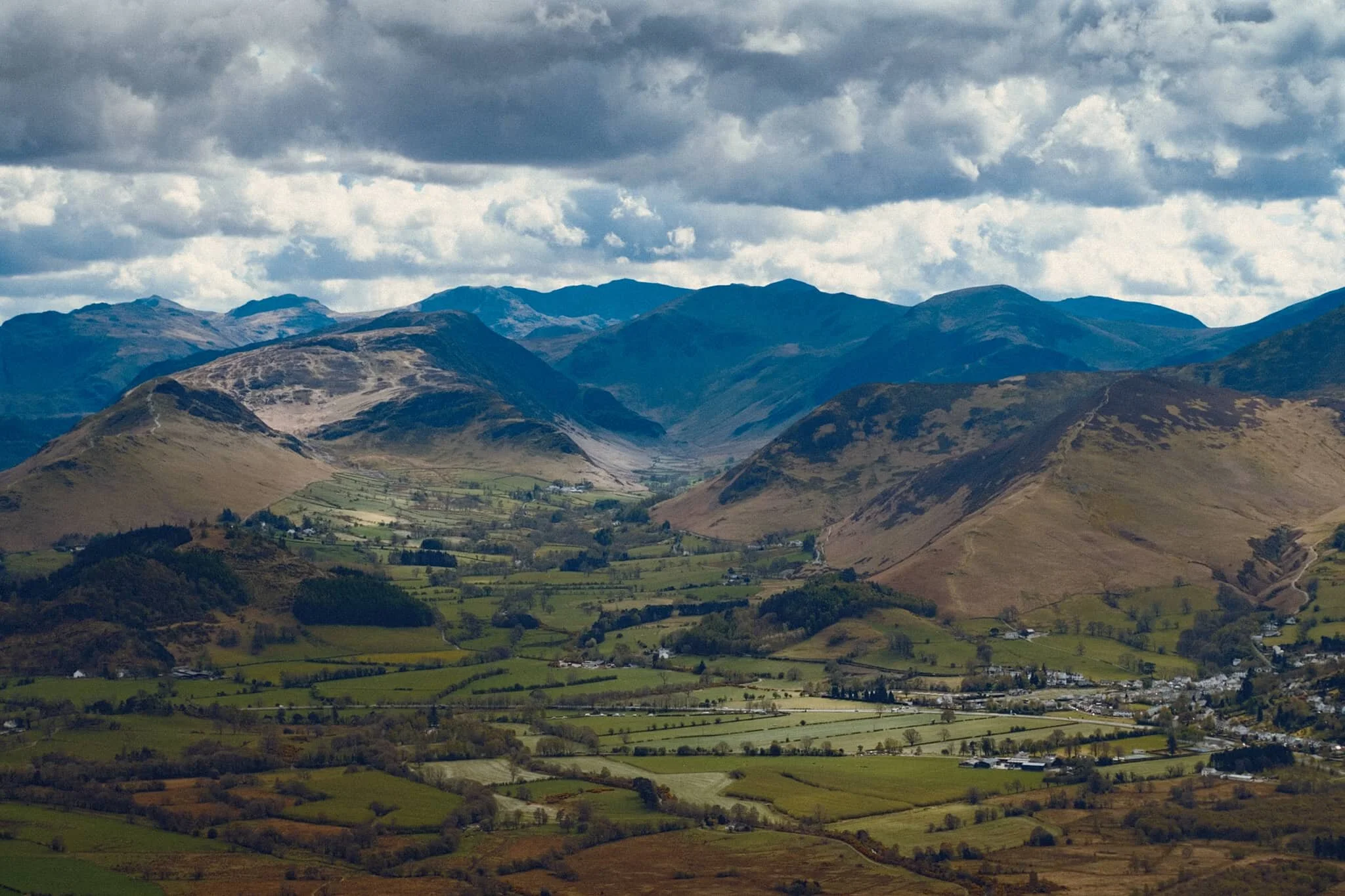
Our first glimpse of the views that Dodd offers. And we weren’t even at the top yet! Absolutely immaculate. Showing Derwentwater and its fells, with the bonny town of Keswick to left.
The Newland Valley and its fells, with the Dodd Summit exit trail below.
Again with that soft woodland light…
I have to remind myself, when I’ve got my head down hiking up a fell, to always look back. Had I not done so, I would’ve missed this! The view all the way back towards the Helvellyn range, and you can even clearly see the Helvellyn (950 m/3,118 ft) summit itself, catching some highlighting!
Bassenthwaite Lake framed by two trees; famously cited as the only “lake” in the Lake District (that is, the only lake with the word “lake” in its name). The atmosphere was so clear you could also make out the Solway Firth and the Galloway mountains in Scotland.
And we reach the summit. Some of the best views of the Northern Lake District I’ve ever seen.
The Lorton Fells and Grisedale Pike. Little hovering spots of light scan across the land.
My lovely Lisabet at the summit, getting those views.
I popped on my 55mm lens to zoom in further and pick out specific scenes from the vast panorama available from the summit of Dodd. The Newland valley and fells, in particular, were looking absolutely splendid.
Lord’s Seat (552 m/1,811 ft) from across Bassenthwaite Lake.
Honestly, I could’ve taken thousands of shots from the summit of Dodd…
Grisedale Pike (791 m/2,595 ft) catching some lovely light above the Whinlatter Forest.
Following the narrow trail back down the slopes of Dodd
As we climb down the wooded fell slopes, the landscape changed from craggy to mossy and grassy.
Lovely light catching the trees and footpath.
Heading our way back down to the car, soft afternoon light blooming through the woods. I liked the tree on the right, looks like a tuning fork.