
Kingsdale, Yorkshire Dales, Autumn
Flexibility can lead to great things.
Flexibility can lead to great things.
We started a promising Saturday morning with a plan to hike up the highest peak in the Yorkshire Dales: Whernside (736 m/2,415 ft).
It would definitely be the highest peak we’ve ever ascended but we were planning to “cheat” a little bit. Below Whernside’s western flank is a valley called Kingsdale. There’s a road that runs from the south, near Ingleton, through and over Kingsdale before dropping back down into Dentdale. This road enjoys a few large passing places, one of which is near the summit of the road at 468 m a.s.l. In theory, we could park at the passing place and hike the minor trail up Whernside’s western flank to reach the summit, with only 300 m of actual ascent needed.
We didn’t go for it in the end. Parking in passing places is generally a no-no, and the trail and landscape around Whernside’s western flank looked rather boggy.
Instead, we drove back down to the valley bottom of Kingsdale and stopped at an actual parking place. Here we elected for a hike up Kingsdale’s magnificent limestone fellside to locate the magnificent Cheese Press Stones.
It turned out to be a great idea on a beautiful day.
All photos shot on my Sony α7ii using my Sony FE 28–70mm f3.5–5.6 OSS zoom lens. RAWs developed in Lightroom using RNI Films’ Kodachrome film profiles, finalised in Photoshop.
Kingsdale, Yorkshire Dales, Autumn by Ian Cylkowski is licensed under CC BY-NC-SA 4.0![]()
![]()
![]()
![]()
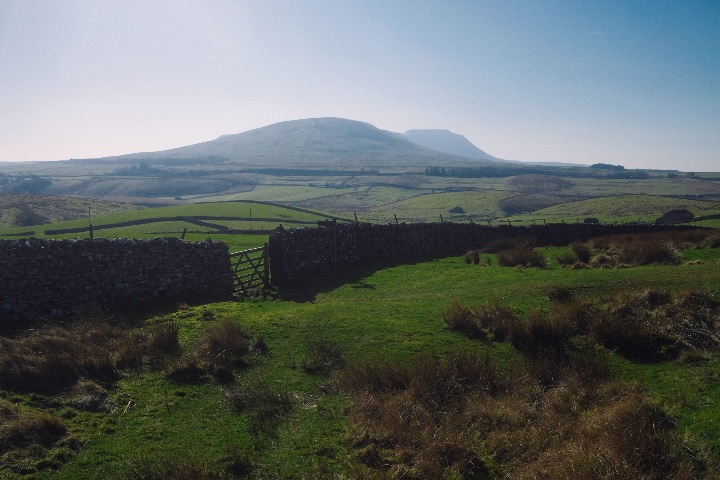
Straight away from our little parking bay, the views across to Twistleton Scar and Ingleborough were magnificent. They were only going to get better.
The road north through Kingsdale, with the valley’s fantastic scar looming directly above. The main scar above the road is known as Keld Head Scar. The start of the hike heads up the fellside just as the road veers right.
Part way up Keld Head Scar, and a single tree growing out of a limestone boulder provides a nice subject with Whernside in the distance.
As we clamber through the irregular clints and grikes of limestone, and navigate the occasional boulder, Ingleborough emerges from above Twistleton Scar. An old drystone sheep pen provides a nice foreground subject contrast against the fell in the distance.
A large cluster of limestone boulders, no doubt dumped in position by the last Ice Age, provide a nice foreground focal point. They also, happily, seem to “point” towards Ingleborough.
Finally, after a fairly challenging hike and scramble through Keld Head Scar, we emerged onto a limestone plateau where we easily spotted the Cheese Press Stones. These are a pair of giant limestone boulders, probably deposited here after the last Ice Age. Why are they called the “Cheese Press Stones”? No idea.
The boulder on the left is a good 9–10 ft tall. Some estimate its weight at around 15 tons. Here, an obvious composition is hard to ignore, using the two boulders to centre and frame Ingleborough.
A few yards away, I spot another interesting limestone boulder, which appears to me almost like a cracked open egg.
Further up the plateau, a group of large limestone boulders attract my attention. I line a composition, attempting to fill the frame with them whilst keeping Whernside visible in the distance.
I circle around the cluster of boulders to find a composition featured Ingleborough. It means shooting directly into the sun, but thankfully Sony RAW files are incredible flexible.
I locate Lisabet near North End Scar, perched atop a small crag, happily editing her photos. In the distance, the Forest of Bowland is just about visible.
The way back involves navigating this ankle-breaking limestone pavement to relocate the minor trail, which takes you below North End Scar, past Tow Scar, and back down to the road.
Beneath North End Scar’s western edge, the layering and striations of the limestone is fascinating.
I am a sucker for a good drystone wall composition.
The criss-crossing and weaving of the valley and its various limestone scars and layers provide me a delightful photo with Whernside high in the distance.
Nearly back at the car, with the limestone scar of Kingsdale’s western edge in full display. A beautifully sculpted glacial valley.
Did you enjoy these photos?
Howgills & Yorkshire Dales, Winter
The week leading to these photos and this post has been… frustrating.
The week leading to these photos and this post has been… frustrating.
On Monday my left shoulder grew progressively stiff and painful. By the evening I was in a lot of pain and I ultimately did not get a second of sleep. Looks like I did another one of my favourite Fit-During-My-Sleep-And-Discolate-A-Limb-Whilst-Shredding-Muscles.
So most of this week has been spent fighting pain and keeping the shoulder immobilised. Apart from the constant pain and lack of sleep being exhausting, it’s also boring.
By the weekend, I’d finally got my pain levels under control and was starting to regain movement in my shoulder. Sunday arrived bright and clear, with blue skies promising a beautiful day. Lisabet took us for a drive through Sedbergh and the Yorkshire Dales, occasionally parking up for short walks and photo snaps. I really needed it.
All photos shot on my Fujifilm X-T2 using my Fujinon 23mm f/2.0. Images developed using RNI Films’ Velvia 100F emulation.
One of my favourite views of the Howgills can be shot from the A684, as you crest the hill past Lily Mere. It felt so good to finally see a clear blue sky after all the storms we’ve endured.
Happily there’s a couple of lay-bys alongside this part of the A684 where one can park and snap some glorious photos. Onwards into the Yorkshire Dales.
Beyond Sedbergh and heading further into the Yorkshire Dales, another viewpoint of the Howgills can be obtained, now looking at their southeastern profile. This is a little area known as Tom Croft Hill.
Further into the Yorkshire Dales, closer to Hawes, we stopped off at the small layby near Holme Heads Bridge for a wee jaunt to check out the beautiful Cotter Force. It was lovely to see the waterfall with a decent amount of water flowing through it.

Everywhere we look, signs of spring are arriving.
When you’re in the Yorkshire Dales, you can always count on an abundance of bare stone barns dotted about the land.
We skirted around the town of Hawes and hopped onto Blea Moor Road, which ultimately takes you to Ingleton and back onto the A65. Views of the magnificent fell Ingleborough entice you all the way along the road.
The area around the Ribblehead Viaduct was jammed with cars. Thankfully, we managed to find a small space to park up and snap some photos of this incredible architectural feat, situated underneath the highest peak of the Yorkshire Dales, Whernside.
Whernside’s eastern face, with a smidge of snow still clinging on. Barely a cloud in the sky.