
Levens Hall Deer Park, Cumbria, Winter
I hope you like trees.
I hope you like trees.
With other duties and tasks that needed to be completed today, we decided on a lovely 10,000-step walk around the Levens Hall Deer Park. The park was landscaped some 300-odd years ago, around the same time as the gardens of the historic Levens Hall. As such, many of the trees in the park are centuries old and, unfortunately, some of them have suffered after Storm Arwen’s 100mph winds.
Levens Hall Deer Park is home to Black Fallow Deer and a herd of rare-breed Bagot goats. Whilst we didn’t see any of the distinctive goats, we did manage to spot some of the deer, happily chilling and grazing in the grounds.
With the trees devoid of leaves, there were opportunities to focus more on the shape and texture of each tree instead. With the sun out, we got some delicious golden side lighting, which I happily took advantage of with some more unusual close-up compositions.
All photos shot on my Fujifilm X-T2 using my three prime lenses: a Fujinon 23mm f/2.0, a Laowa 9mm f/2.8, and an adapted Pentax SMC 55mm f/2.0. Images made 95% in-camera using Øyvind Nordhagen’s Modern Negative Fujifilm recipe, finished in Pixelmator and Darkroom.
The main lay-by near the park was already full, so we had to drive further up the A6 to find the second, smaller, lay-by. Not a problem, you just follow the mossy and slippery path all the way to park entrance.
A beautiful iron-wrought gate attached to some of the cottages near the park.
Once in the park, it was already shaping up to be a beautiful day.
With their leaves gone, it felt to celebrate the overall shape and “personality” of each tree.
Some of them still appear to have remnants of their autumn foliage on display.
One of many Storm Arwen casualties around the park.
It was nice to see families around enjoying the park too.
It blows my mind to think of the forces involved to rip a strong-looking tree like this in half. What a storm…
If some of the ancient trees suffered, then the surrounding dry stone walls had no chance.
These cottages must have some smashing views of the Deer Park and perhaps beyond the Morecambe Bay.
A tree stump being consumed by fungi provided me with some delightful textures to play with.
The extended loop of the circular park walk involves walking up to Force Falls, crossing the bridge over the river, and following the road back into the other side of the park. I weren’t complaining; Force Falls is always stunning.
The southeastern side of Levens Hall Deer Park was already giving us some beautifully gnarly trees to gawp at.
My lovely Lisabet, in her natural element.
This cottage on returning to the Deer Park caught my eye. Beautifully idyllic, and the light was the cherry on top.
So beautiful. Practically a sculpture in its own right
One of the distinctive aspects of Levens Hall Deer Park is “the Avenue”, which is lined with a variety of ancient trees, particularly oak. Near Park End cottage, a separate branch of the avenue had its own otherworldly collection of trees.
One of my favourite photos from the whole shoot. I’ll probably use this as a phone wallpaper.
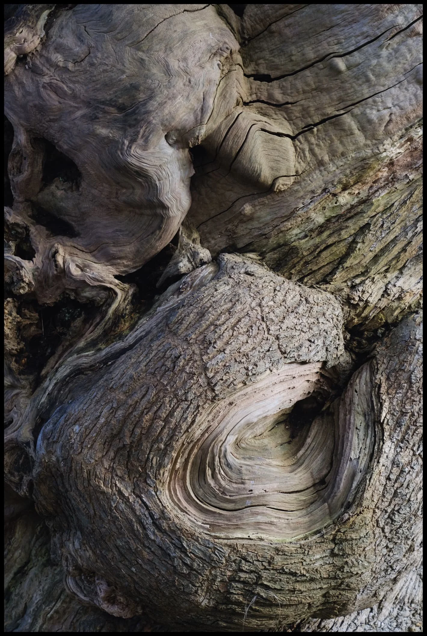
I mean, just check out those textures…
After capturing some close-up compositions on my 23mm and 55mm, it was time to whack on the ultra-wide 9mm to really play with those textures, light, and angles.
I really dig this composition, I must say.
Some of the twists and knots in these trees were almost impossibly otherworldly and magical..
It’s not often I do close-up compositions using my ultra-wide lens, but the texture on this tree just called for it.
Anyone else see something of H. R. Giger’s work or style in this tree?
Onwards through the Oak Avenue, with a Storm Arwen casualty lying across. Can’t imagine how old that tree was…
I love the combination of textures here, from whirling and smooth to stubbly and geometric.
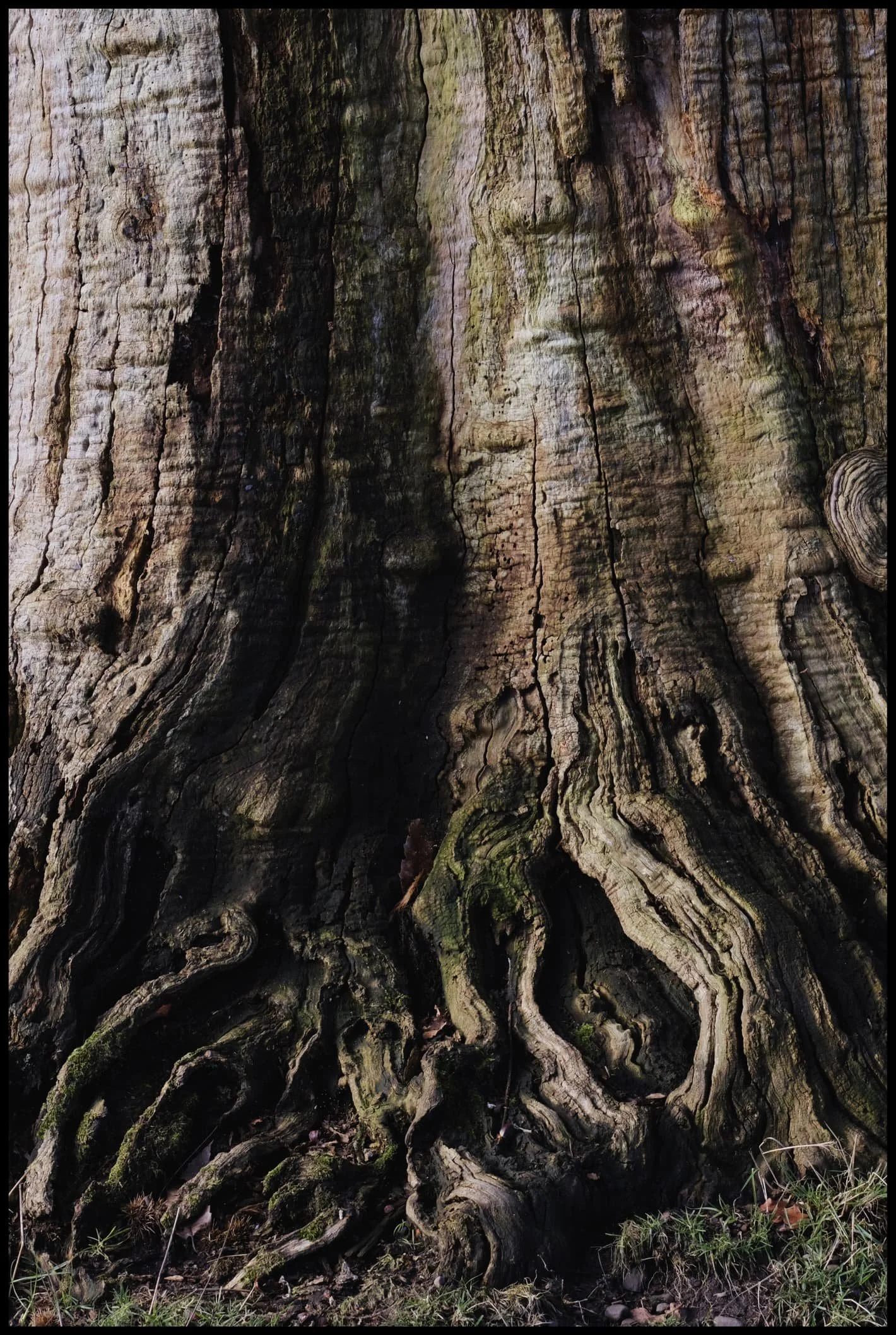
The base and roots of another tree gave me Sleepy Hollow vibes.
My lovely Lisabet, being the Wood Elf that she is, inside a hollow tree.
Looking back down the Oak Avenue we sauntered up, past another destroyed tree.
Nearing the end of our walk, this cluster of trees—all seemingly “looking” in the same direction—caught my eye.

Sometimes you just have to shoot chaos, and let someone else’s brain find something they can point to.

The day was a joy of wonderful soft light and glorious eldritch textures.
More days like this, please.
Crina Bottom, Yorkshire Dales, Winter
Temperatures are still down but conditions are rather contentious at the moment.
Temperatures are still down but conditions are rather contentious at the moment.
That didn’t stop us from throwing caution to the bitterly cold wind! After examining my 90 million weather apps plus satellite radars, it looked to me that the further east we went, the better our chances for drier conditions.
To the Yorkshire Dales!
We settled on a hike up to Crina Bottom from Ingleton. We did plan on an additional hike from Horton-in-Ribblesdale to Hull Pot, but we unfortunately ran out of time. Nevertheless, Crina Bottom is lovely. It’s famed for its wonderful view of Ingleborough right above the farmstead (a shot of which you can see here). Unfortunately for us on this day, the cloud base level wasn’t due to lift anywhere above 500–600m, and Ingleborough is 726 m high.
Nevertheless, the low winter light was beautiful, casting isolated golden light across the landscape, drawing long shadows, and the low cloud level made for more minimalist landscape compositions.
All photos shot on my Fujifilm X-T2 using my Fujinon 23mm f/2.0 prime lens. Images were made 95% in-camera, with a final curve adjustment in Pixelmator Photo and framing in Darkroom.
We found a spare lay-by off the Ingleton–Hawes road, and already the light was looking gorgeous.
There’s a sparseness to a winter landscape that’s dramatic and beautiful.
It’s only 2.5 miles from the start of this track, known as Fell Lane, to the mountain that is Ingleborough. As such, it’s rather steep in places.
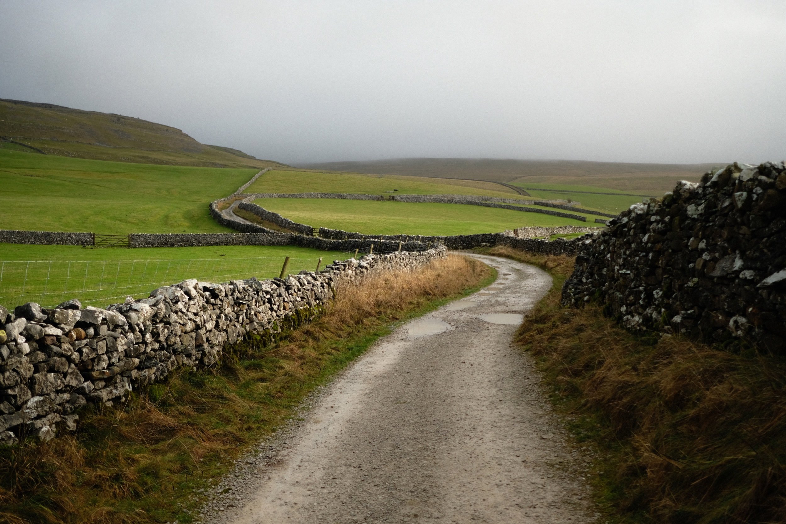
Beautiful golden light greets us as we enter the high-walled portion of Fell Lane.
Across the valley, Twistleton Scar gets drenched in light. Chunks of the drystone wall are still collapsed after Storm Arwen.
Around this part of the track you’d normally expect to see the shoulders of Ingleborough. Not today.
Looking across the fields to the winding walls that guide Fell Lane.
Over the fields towards the Aire Gap and beyond to the Forest of Bowland, the clouds race across the sky and the sun punches through where it can.
Crina Bottom, a remote farmstead that was fairly recently on sale. I think it’s been purchased now. No doubt it will see lots of hikers who use this bridleway to ascend Ingleborough.
Just imagine a giant flat-topped mountain framed in between those trees…
The last time we hiked up to Crina Bottom was August 2017, when I was shooting with my Sigma dp0. Definitely a different world in the winter.
We decided there wasn’t really any point attempting an impromptu hike up to Ingleborough, given that it was completely engulfed in clouds, so we made our merry way back down Fell Lane.
Random bit of fleece, probably from a Swaledale sheep, snagged in the barbed wire.
The long lonnin (lane) back down to Ingleton.
The shadow of Twistleton Scar makes an appearance as storm approaches us from across the Forest of Bowland.
Beautiful Ingleton lay before us near the bottom of Fell Lane. Hmm… a flapjack sounds good about now…
We decided on a wee extra wander into Ingleton town proper to procure a few groceries from the Co-op before hiking back up to the Ingleton–Hawes Road. Ingleton is in a wonderful setting.
Morecambe, Lancashire, Winter
We felt the coast calling us.
We felt the coast calling us.
After an epic hike around Malhamdale in the Yorkshire Dales, followed by a beautiful walk along the Keswick–Threlkeld Railway trail, it was time for something a little more… pedestrian.
The coastline was calling us, and we heeded its call. But where to go? We decided, ultimately, on Morecambe.
Morecambe has a special place in the hearts and minds of the Lisabet family. To start, it’s a favourite destination of her brother, Dwight. Additionally, Lisabet has fond memories of visiting Morecambe with her grandparents for a stroll along the promenade, perhaps with a pit stop for some tea and a slice of cake for good measure.
Morecambe was set up by the Morecambe Harbour and Railway Company to connect the nearby fishing village of Poulton-le-Sands with a railway line. The Company expanded the railway line further. In the 1850s Morecambe was connected to Skipton, Keighley, and Bradford in the West Riding of Yorkshire, and a settlement began to grow around the harbour and railway to service the port and as a seaside resort.
In time, Morecambe became known as the UK seaside resort, which peaked in the middle of the 20th century. In fact, Coco Chanel was known to fly directly to Morecambe from the South of France for weekends at the town, staying at the Midland Hotel.
Like most UK seaside resorts, Morecambe experienced a decline from the 1970s onwards. Even the jewel of the Morecambe promenade, the Midland Hotel, fell into disrepair until its resurrection in 2008.
Plans are afoot, though, to continue the rejuvenation of Morecambe, including the ambitious Eden Project North, no doubt following on from the success of the first Eden Project in Cornwall.
On this day, weather and light conditions were very generous, and Lisabet and I enjoyed several hours along the promenade, soaking in the massive scenes across Morecambe Bay towards the Lakeland fells.
All photos shot on my Fujifilm X-T2 using two of my prime lenses: a Fujinon 23mm f/2.0, and a Laowa 9mm f/2.8. All images made in-camera using Øyvind Nordhagen’s Daylight Fujifilm recipe.
My lovely Lisabet, she who is skilled in the arts of being super cosy.
There appears to be a lot of new signage around Morecambe now. I like the way the design and typography reflects the early 20th century Art Deco style when Morecambe was at its peak.
Aye. Have some respect, people.
On this occasion, the tide was out as evidenced the large and seemingly endless expanse of sand and mudflats (one of the largest in Europe).
Soon we came across this fantastic sculpture, known as the Venus and Cupid (subtitled “Love, The Most Beautiful Of Absolute Disasters”). It was designed by Shane A. Johnstone in 2005.
Views for miles and miles, with some epic clouds to boot.
The people who live in these flats must enjoy some incredible Morecambe Bay sunsets.
A family carefully navigating around Morecambe’s beach pool. No doubt it will be frightfully cold.
Some braver souls than I ventured further out onto the sands. Just be careful of the quicksand…
Lone fishing boats rest lopsidedly in the sands, waiting for the tide to inevitably return.
Plenty of memorials can be found along the promenade in one form or another. Clearly a special place for many people.
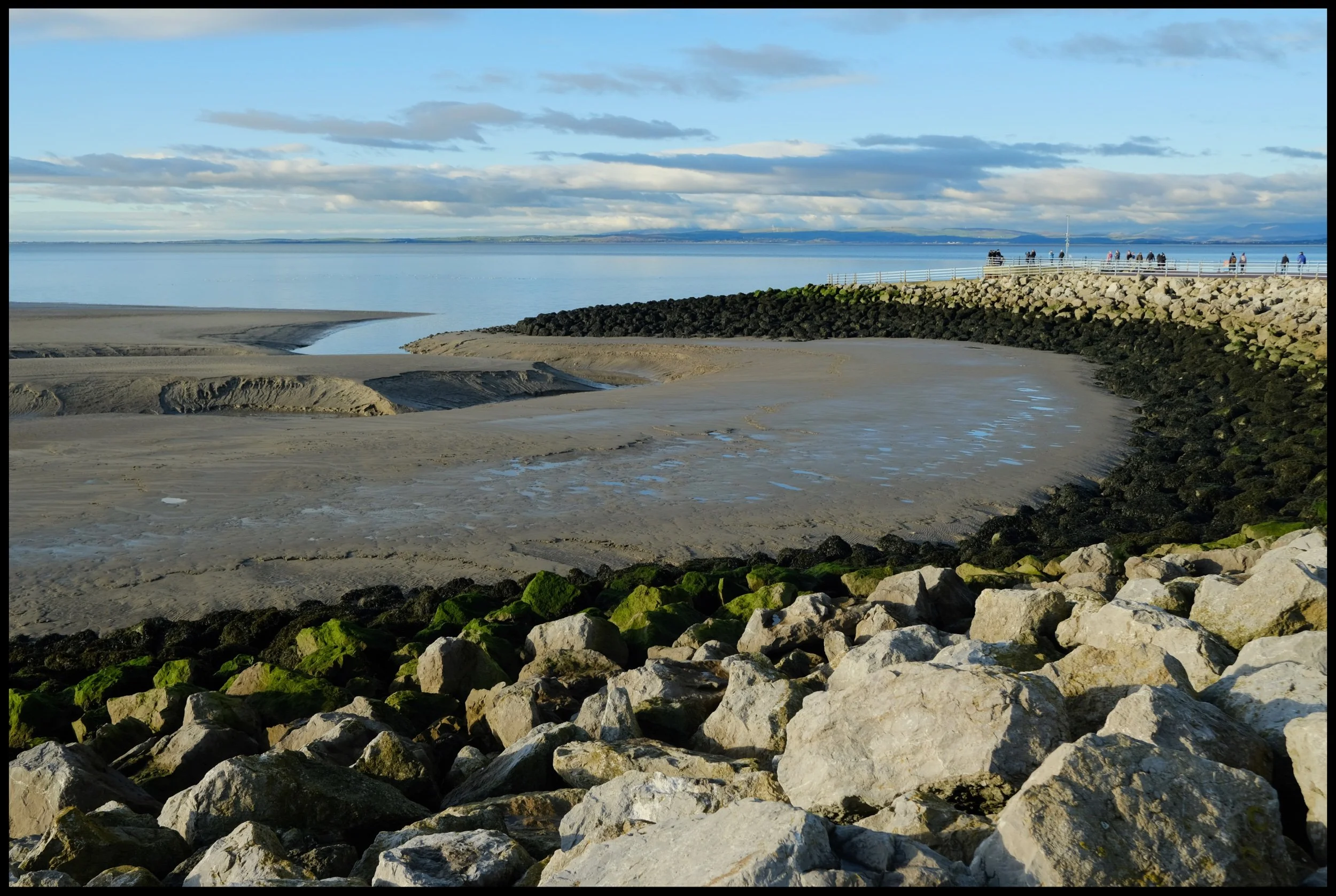
Had to use some of these tide breakers as a leading line across the bay towards the Lake District fells.
We soon reach the more “touristy” part of Morecambe’s promenade. Kids playgrounds and B&Bs ahoy.
Near the clock tower one can find this metallic sculpture depicting the Lakeland fells across Morecambe Bay.
You can find some rather colourful and unusually shaped seafront buildings when strolling along the promenade.
Of course, no walk of Morecambe is complete without visiting the Eric Morecambe stature, now seasonally adorned with a Christmas hat and fluffy white beard.
Bringing sunshine to millions of people.
The clouds were looking a little dark, looking back towards Cumbria and North Yorkshire.
I love that some of the buildings in Morecambe still have their original signage.
More new signage that reflects Morecambe’s Art Deco past, complete with palm trees.
It’s rather beautifully done.
Near the Stone Jetty, I wandered around the front of the Midland Hotel to capture some ultra-wide compositions of the buildings curvature.
It’s a cracking building. Glad to see it restored to its former glory.
Around the other side of the hotel, I decided to shoot right into the sun and fully accept whatever weird and wonderful lens flares I got. In the end, not bad at all!
There are bird sculptures aplenty when you follow the Stone Jetty, such as these cool seagulls.
Love the design and layout of the Stone Jetty.
The sun was really starting to break out from the heavy winter clouds, casting long shadows that I couldn’t resist playing with.
One of my favourite bird sculptures found on the Stone Jetty, a rather depressed looking bird.
Near the terminus of the Stone Jetty, Lisabet and I spotted these mudbanks and their curves alongside the boulders. Had to line up a composition.
She’s a beaut.
Lunch was beckoning, but not before I nabbed a few more scenes along the Stone Jetty.
Remember what I said earlier about strange and unusual Morecambe buildings?
This is one of Morecambe’s prettier buildings, though; the Winter Gardens, originally built as the Victoria Pavilion Theatre in 1897.
Pre-sunset, some beautiful golden sunlight was casting beams across various buildings along Morecambe’s seafront. As well as documenting the weird and wonderful, I also wanted to capture the “other” side of Morecambe too.
Some places have existed along the Morecambe seafront for so long they’re practically institutions in their own right, such as the Old Pier Bookshop.
The light just got better and better, and we weren’t the only ones enjoying the scenes.
Another fantastic day.
Keswick–Threlkeld Railway, Lake District, Winter
And now for something completely different.
And now for something completely different.
After yesterday’s thrilling circular hike around the gorgeous and epic Malhamdale, today we embarked on something a little more tourist-friendly and flat: the Keswick–Threlkeld Railway walk.
The 5km walk follows the route of the old Cockermouth, Keswick and Penrith Railway from Keswick to Threlkeld. It was constructed in 1864 with the goal of connecting the town of Cockermouth with the London and North Western Railway (LNWR) West Coast Main Line at Penrith. It closed to passengers and business in the 1960s and 1970s.
Much of the trail was badly damaged or totally destroyed by Storm Desmond in December 2015. Major restoration work was undertaken and the trail was upgraded and reopened in December 2020.
Lisabet and I met met up with me Dad near the start of the trail at Keswick, and followed the route all the way to Threlkeld and back, a good 6.2 miles and 17,000 steps later.
We were blessed with lifting hill fog, resulting in some incredible scenes of clouds whipping around the shoulders of nearby fells Lonscale Fell, Blencathra, and even some of the Helvellyn fells.
This route will definitely be one to revisit in Spring and Summer.
All photos taken on my Fujifilm X-T2 using my three prime lenses: a Fujinon 23mm f/2.0, a Laowa 9mm f/2.8, and an adapted Pentax SMC 55mm f/2.0. Images made in-camera, with no additional editing, using Øyvind Nordhagen‘s Overcast Fujifilm recipe.
The Keswick Hotel, which also seems to come with its own garage. At least, it used to.
The aforementioned Keswick Hotel Garage.

The Keswick–Threlkeld Railway trail starts near Keswick Leisure Centre, alongside the old station. I nabbed a sneaky shot of me Dad.
It wasn’t long before the trail started offering some lovely views along the River Greta towards the fells above Keswick. The main fell pictured here is a favourite of ours, Latrigg.
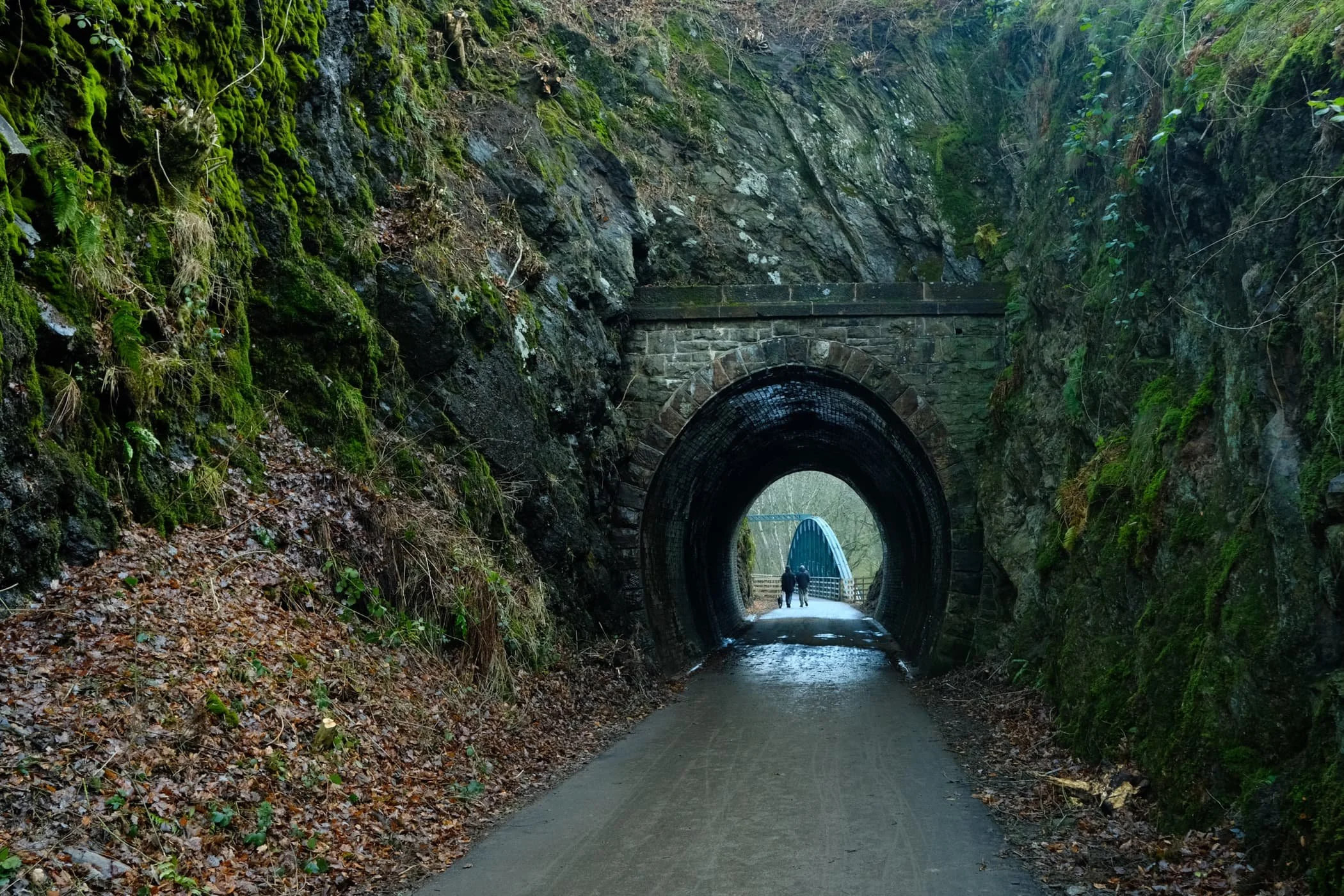
Where possible the Lake District National Park have tried to save and restore as many of the old Victorian bridges and tunnels as possible.
Near the “big” tunnel there’s a little commemorative sculpture, erected to celebrate the National Cycle Route and the Coast to Coast trail.
Into the “big” tunnel we go…
Again, beautifully preserved Victorian engineering, now with the added convenience of modern lighting and smooth, durable tarmac.
On the other side of the tunnel, panoramic views of the River Greta and Latrigg open up.
Despite being in winter, it was lovely to still see some colour about.

One of many of the newer bridges that criss-cross the winding River Greta.
Evidence of Storm Desmond, which scoured the river banks clean. You can still the level that river came up to during the storm. Land slips ahoy.
A nice little holiday village, Low Briery, alongside the River Greta.
The trees now denuded of their leafy vegetation, line the river and serve as a leading line towards Latrigg.
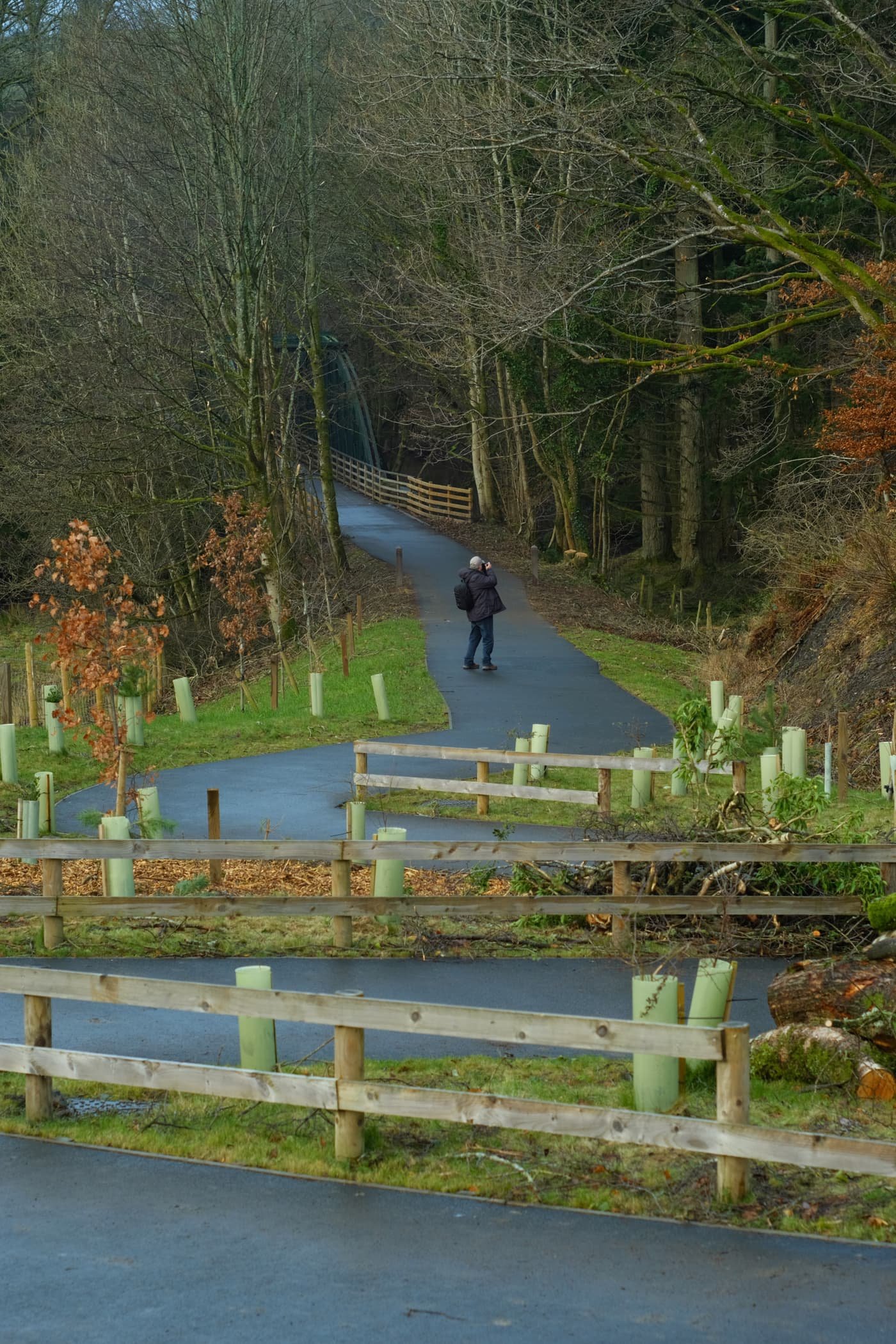
Onwards to the next bridge. There were plenty of other people around enjoying this trail. It was a good job we got started nice and early.
The next bridge to cross the River Greta. The Greta Gorge flattens out at this point, providing “in-bye” land for nearby hill farmers to use for their grazing flocks of sheep.

I wanted to play with lines and angles provided by this bridge, so I snapped on my ultra-wide 9mm lens for some fun compositions.
Not a bad spot for a bit of lunch.
The gorge created of the River Greta flattens out here, opening more perspectives of the Latrigg fells above.
To the north, the clouds were starting to lift from mighty Blencathra.
A solitary tree has survived erosion and storms against all the odds, and stands proudly in the middle of the river.
The excitement levels rise as we catch our first glimpse of Blencathra’s jagged peaks.
Additionally, to the east, the morning hill fog was wrestling with the crags of Clough Head, part of the Helvellyn range.
Beyond Latrigg, the crags of Lonscale, too, were freeing themselves of the morning’s mist.

The shoulder of Lonscale Fell high above the Greta Gorge.
Another relic of Victorian engineering, a small tunnel blasted through the crag leading to Rawsome’s Bridge.
Near Threlkeld, lots of trees were covered in beautiful and vibrant moss as the gorge walls closed in.
The end of the trail. Beyond the A66, Clough Head provides a dramatic backdrop as it tussles with the clearing fog and mist.
Blencathra’s craggy and jagged peaks, now nearly clear of morning mist.
Dad leads the way back to Keswick, happily snapping away.
There’s something wonderfully eldritch about wintery trees covered in moss.
Quite happy with this candid snap of me Dad.
Lonscale Fell again, now apparently losing its battle against the sky.
Blease Fell below Blencathra, and a band of mist clinging to its shoulder.
At around lunchtime, the sun finally broke through the thick cloud cover and illuminated these trees in golden light.
Overall, I can heartily recommend this trail. I look forward to returning in the spring and summer, when there’s more wildlife and flora about.
Beckmickle Ing, Staveley, Lake District, Spring
It’s taken a little longer, but the bluebells have finally arrived.
It’s taken a little longer, but the bluebells have finally arrived.
After work recently, Lisabet and I hopped into the car and drove just a few miles up the A591 to Staveley, a Lake District village near Kendal. We had been recommended a walk near the village from my boss, due to the woodlands of bluebells in the area.
It did not disappoint.
The trail starts near the junction with the A591, a wooden sign points the way off the road towards the Dales Way. Just a few hundred metres down the path you enter a beautiful country lane, flanked either side by moss-covered drystone walls, with old trees providing shade to a beautiful carpet of bluebells.
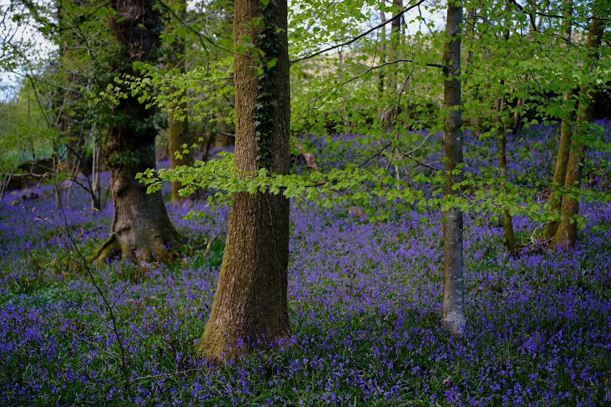
Further around the hike, after crossing the footbridge near Cowan Head, you can explore arguably the showstopper of the walk: Beckmickle Ing woods (great name, btw). This wood provided Lisabet and I with one of the greatest displays of bluebells I’ve ever seen, never mind all the additional flowers such as the Wood Anemone (Anemonoides nemorosa) and finally some Wild Garlic (Allium ursinum).
For a quieter, away-from-the-crowds walk (especially in the spring), I can heartily recommend this one.
All photos shot on my Fujifilm X-T2 using a Samyang 35mm f/1.2 lens. The images are 85% SOOC (straight out of camera) using a customised Velvia film simulation, with some minor curve and saturation finishes in Lightroom and Affinity Photo.
The start of the trail, and a crackin’ evening to look forward.
Wonderful scenes across the valley.
Into this beautiful country lane we go, the small patch of bluebells below a signifier of things to come.
Towards the exit of this lane you’re greeted with a shock of purple below the trees. Bluebells everywhere.
Approaching Cowan Head, the light really starts to get golden.
A true spring Lakeland scene: this year’s lambs grazing underneath some crags on a hill.
After following the River Kent upstream and crossing the footbridge at Hagg Foot, we enter Beckmickle Ing woods. Already, the colours are getting considerably more verdant.
You’re always bound to fine at least one oddity in a British woodland.
A jaw-dropping scene, and Velvia did a wonderful job capturing all of colours and tones. One of the finest displays of bluebells I’ve ever seen.
Just stupendous. A veritable carpet or sea of bluebells.
After popping out of Beckmickle Ing woods we followed this minor road back towards the general direction of Staveley.
Another nearby woodland showed that, finally, wild garlic and its delicate white flowers were starting to bloom.
A much older tree, catching some sunset side light.
I loved how intense the sunset glow was on these leaves.
Back on the footpath to Staveley, a fleeting moment of strong golden light illuminates some distant trees and a barn.
Ashgill Force, North Pennines, Summer
With the easing of lockdown restrictions in the UK, it’s my experience that tourism in the UK has never been busier.
With the easing of lockdown restrictions in the UK, it’s my experience that tourism in the UK has never been busier. It’s likely a result of a declining aviation industry and the extra hassle involved in holidaying abroad.
This means that Lisabet and I have been actively looking for alternative locations for hikes, photography, and exercise, as the Lake District and the Yorkshire Dales—the two National Parks we are sandwiched between—are absolutely chock full.
That’s no bad thing, though. A cursory look through Instagram’s #HiddenCumbria hashtag alerted us to a waterfall that we’d never heard of before: Ashgill Force.
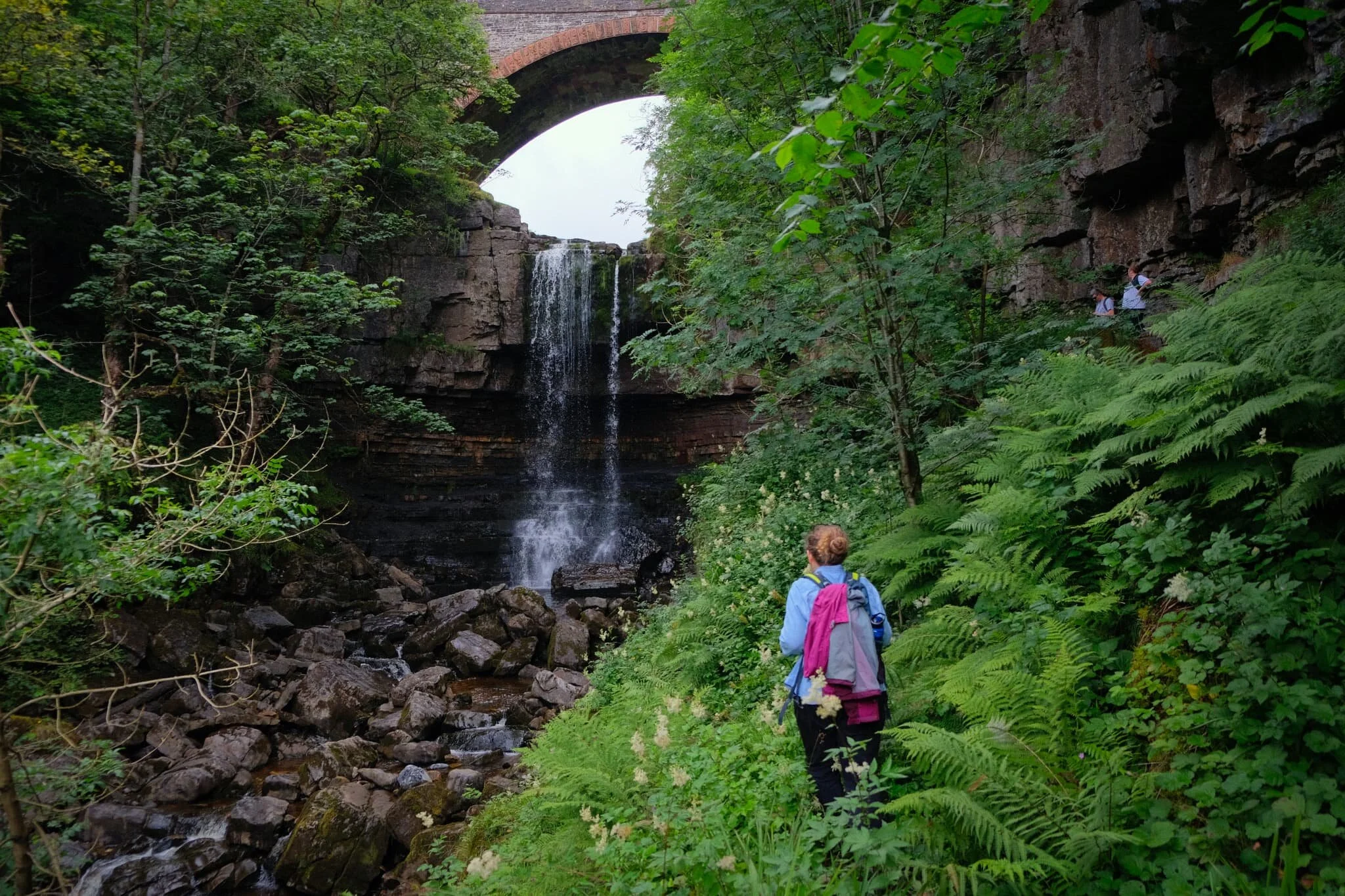
This waterfall, just south of Garrigill in the North Pennines, is mightily impressive even when fairly dry. The waterfall crashes 55 ft over a rocky shelf, set in a deep gorge, and framed by Ashgill Bridge that carries the B6277 over it. There’s plenty to see even before you get to the falls too.
All photos shot on a Fujifilm X-T2 with a Fujinon XF 18–55mm f/2.8–4.0 lens using a customised Provia film profile. All these photos are 95% SOOC (straight out of camera).
The day started off pretty wet, but I could see the cloud cover was lifting and breaking.
Just outside Garrigill village the views soon started to open up.
Heading down to the South Tyne Trail, which we’ll follow alongside all the way to Ashgill Force.
This was a rather pleasant discovery! Just below Windshaw Bridge the South Tyne river has cut a fine gorge out.

Fascinating rock formations formed by the South Tyne river.
Further up the river a series of small cascades can be found, each more delightful than the next.
Gorgeous light play around these little cascades as the peeped in and out of the clouds.
A proper lovely scene.
Could do with more water though.
The waterfall is beautifully framed by the gorge it’s set in and the bridge above it.
Ashgill Force, though relatively dry, is still a sight to behold. The waterfall is one of the bigger ones I’ve seen in England, dropping 55 ft (not quite as big as nearby High Force in Country Durham, which drops 70 ft).
Above and beyond the waterfall, Ash Gill is calm and serene.
The B6277, which we followed all the way back to Garrigill. A scene of big sky and expansive landscape.
This part of the North Pennines feels very similar to Swaledale, for me.
Heading down Loaning Head lane, down the valley back to Garrigill.
Back at Garrigill village, now beautifully drenched in sun.
On the way back home, we stopped at the summit of Hartside Pass (1,903 ft) for a bite to eat and to enjoy the massive views back towards the Lakeland Fells.